MyTopo
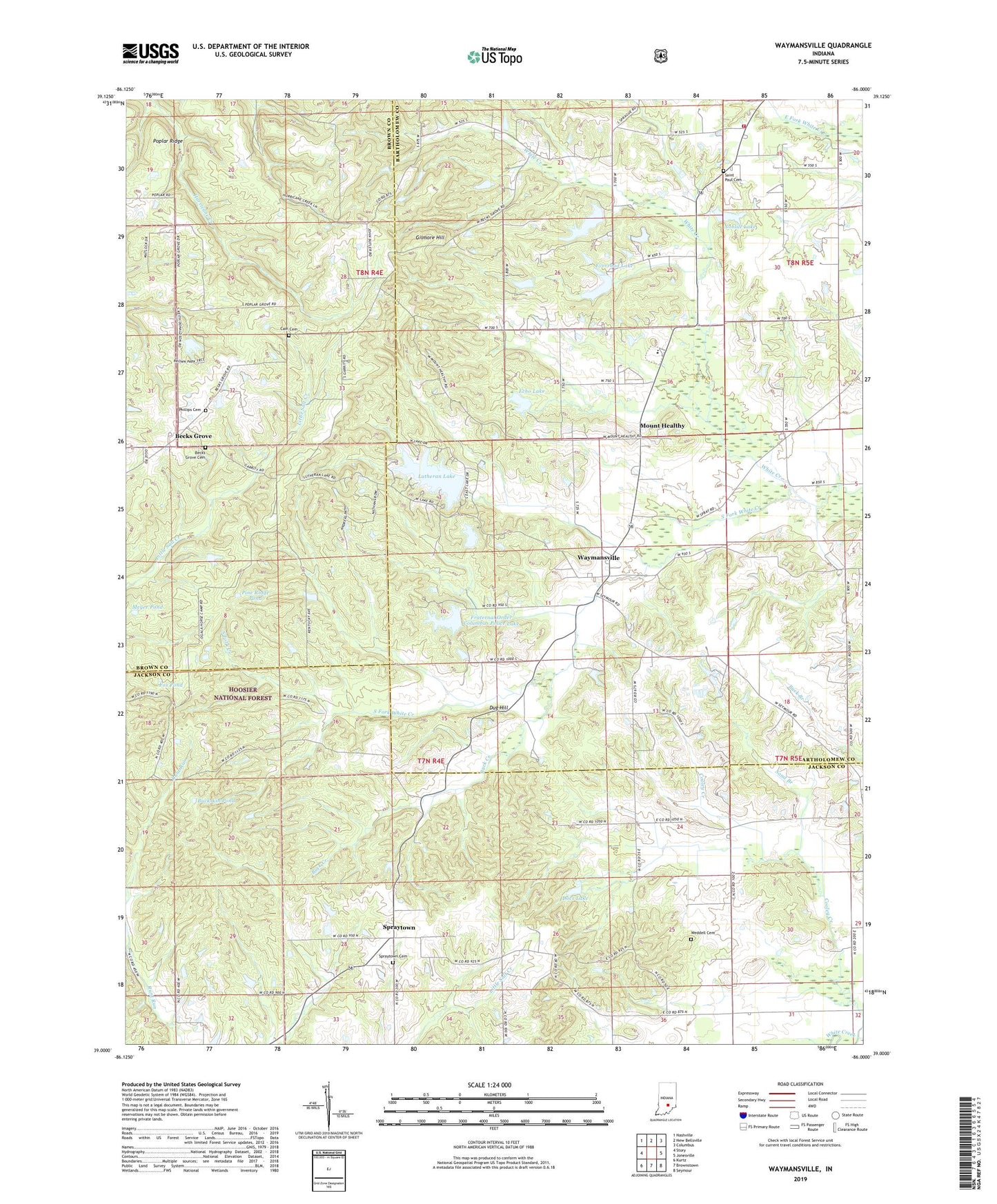
Waymansville Indiana US Topo Map
Couldn't load pickup availability
Also explore the Waymansville Forest Service Topo of this same quad for updated USFS data
2022 topographic map quadrangle Waymansville in the state of Indiana. Scale: 1:24000. Based on the newly updated USGS 7.5' US Topo map series, this map is in the following counties: Bartholomew, Jackson, Brown. The map contains contour data, water features, and other items you are used to seeing on USGS maps, but also has updated roads and other features. This is the next generation of topographic maps. Printed on high-quality waterproof paper with UV fade-resistant inks.
Quads adjacent to this one:
West: Story
Northwest: Nashville
North: New Bellsville
Northeast: Columbus
East: Jonesville
Southeast: Seymour
South: Brownstown
Southwest: Kurtz
This map covers the same area as the classic USGS quad with code o39086a1.
Contains the following named places: Becks Grove, Becks Grove Cemetery, Black Oak Pond, Buck Creek, Buck Creek Pond, Buckskin Pond, Cain Cemetery, Docs Lake, Dug Hill, Echo Lake, Echo Lake Dam, Everroad Lake, Fox Pond, Fraternal Order Columbus Police Lake, Fred C Owen Lodge Lake Dam, Gilmore Hill, Grandview Church, Grouse Ridge Lake, Grouse Ridge Lake Dam, Grouse Ridge Public Fishing Area, Indian Lake Dam, Lutheran Lake, Meyer Pond, Mount Healthy, Mount Healthy Church, Noblitt Lake, Ogilville Church, Ogilville School, Ohio Chapel, Phillips Cemetery, Pine Ridge Pond, Poplar Ridge, Saint Paul Cemetery, Saint Pauls Church, Saint Peters Church, Sand Branch, South Fork Creek, South Fork White Creek, Southwest Bartholomew County Volunteer Fire Company, Spraytown, Spraytown Cemetery, Township of Jackson, Township of Ohio, Township of Pershing, Waymansville, Weddell Cemetery, White Chapel