MyTopo
Lebanon Indiana US Topo Map
Couldn't load pickup availability
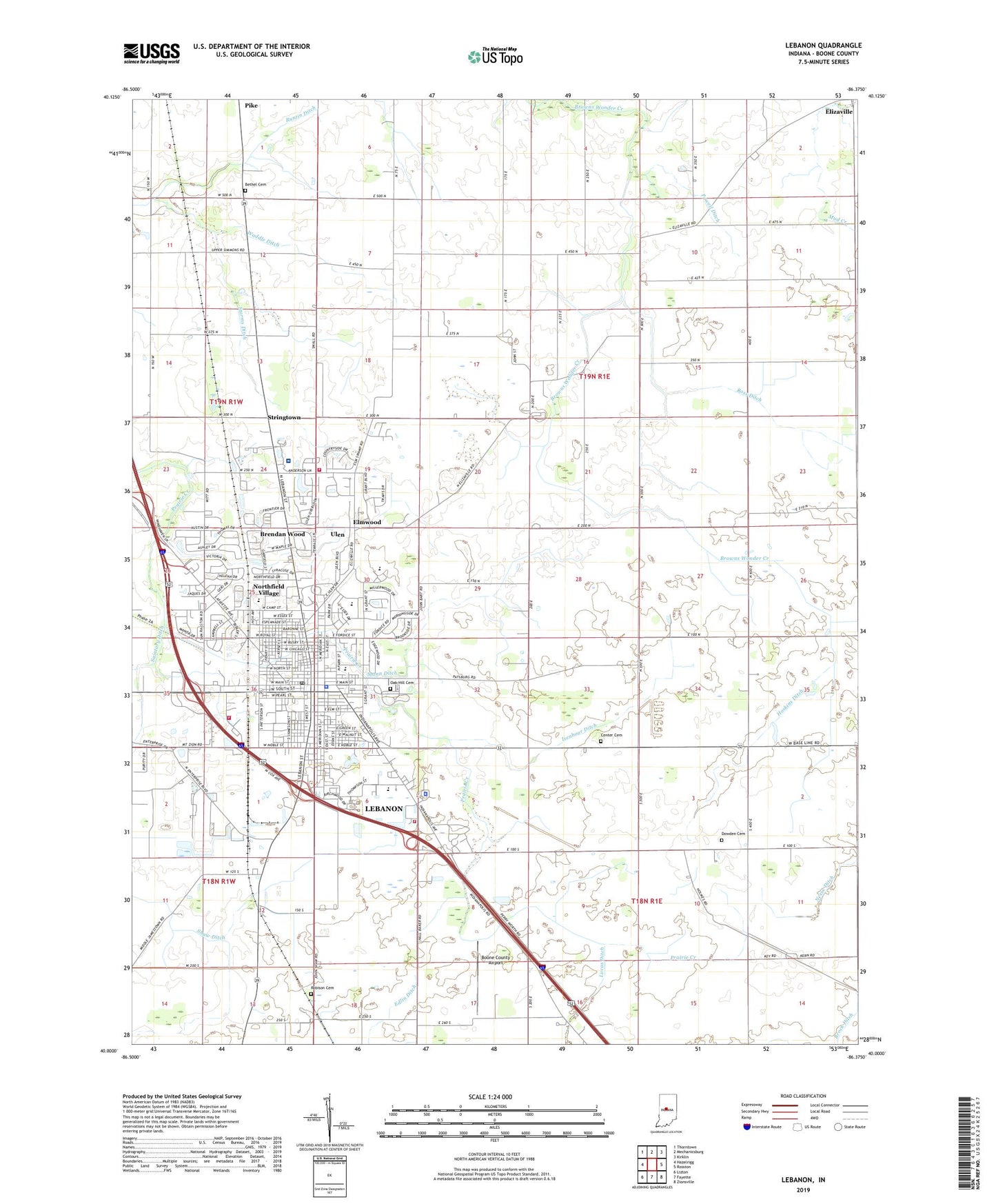
2022 topographic map quadrangle Lebanon in the state of Indiana. Scale: 1:24000. Based on the newly updated USGS 7.5' US Topo map series, this map is in the following counties: Boone. The map contains contour data, water features, and other items you are used to seeing on USGS maps, but also has updated roads and other features. This is the next generation of topographic maps. Printed on high-quality waterproof paper with UV fade-resistant inks.
Quads adjacent to this one:
West: Hazelrigg
Northwest: Thorntown
North: Mechanicsburg
Northeast: Kirklin
East: Rosston
Southeast: Zionsville
South: Fayette
Southwest: Lizton
This map covers the same area as the classic USGS quad with code o40086a4.
Contains the following named places: Bethel Cemetery, Bethel Church, Boone County, Boone County Airport, Boone County Sheriff's Office, Brendan Wood, Browns Wonder Church, Buntin Ditch, Center Cemetery, Center Township Fire Department, Central Elementary School, City of Lebanon, Dale, Dowden Cemetery, Elmwood, Harney Elementary School, Hoskins Ditch, Isenhour Ditch, Lebanon, Lebanon Fire Department, Lebanon Fire Department Station 2, Lebanon Middle School, Lebanon Police Department, Lebanon Post Office, Lebanon Senior High School, Lindbergh School, Lucas Ditch, Mann Ditch, Municipal Park, Northfield Village, Oak Hill Cemetery, Pike, Powell Ditch, Robison Cemetery, Saint Josephs School, Saintary Ditch, Shaw Ditch, South Side Park, Stokes Elementary School, Storms Ditch, Stringtown, Town of Ulen, Township of Center, Ulen, Waddle Ditch, Witham Memorial Hospital, ZIP Code: 46052