MyTopo
Rosston Indiana US Topo Map
Couldn't load pickup availability
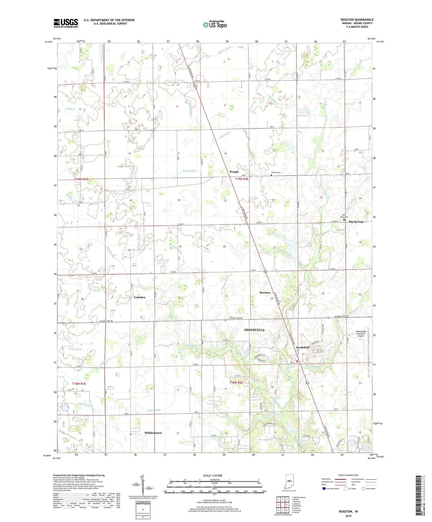
2022 topographic map quadrangle Rosston in the state of Indiana. Scale: 1:24000. Based on the newly updated USGS 7.5' US Topo map series, this map is in the following counties: Boone. The map contains contour data, water features, and other items you are used to seeing on USGS maps, but also has updated roads and other features. This is the next generation of topographic maps. Printed on high-quality waterproof paper with UV fade-resistant inks.
Quads adjacent to this one:
West: Lebanon
Northwest: Mechanicsburg
North: Kirklin
Northeast: Sheridan
East: Westfield
Southeast: Carmel
South: Zionsville
Southwest: Fayette
This map covers the same area as the classic USGS quad with code o40086a3.
Contains the following named places: Antioch Church, Artman Ditch, Bethel Cemetery, Big Springs, Campbell Ditch, Cobb Ditch, Davis Ditch, Dixon Branch, Fairview Church, Finley Creek, Gadsden, Hickson Ditch, Indianapolis Executive Airport, Jones Greenhouse, Kemper Ditch, Kreager Ditch, Lane Ditch, Lanes Chapel, Laughner Ditch, Lenox Ditch, McCoy Ditch, Mounts Run, Mounts Run Church, Neese Ditch, Northfield, Northfield Community Church, Padgett Ditch, Parr-Jones Cemetery, Rosston, Township of Marion, Township of Union, Township of Worth, Waugh, Wurster Lake, Wurster Lake Dam, Yates Ditch, Zionsville Fire Department Station 92, ZIP Code: 46075