MyTopo
Kirklin Indiana US Topo Map
Couldn't load pickup availability
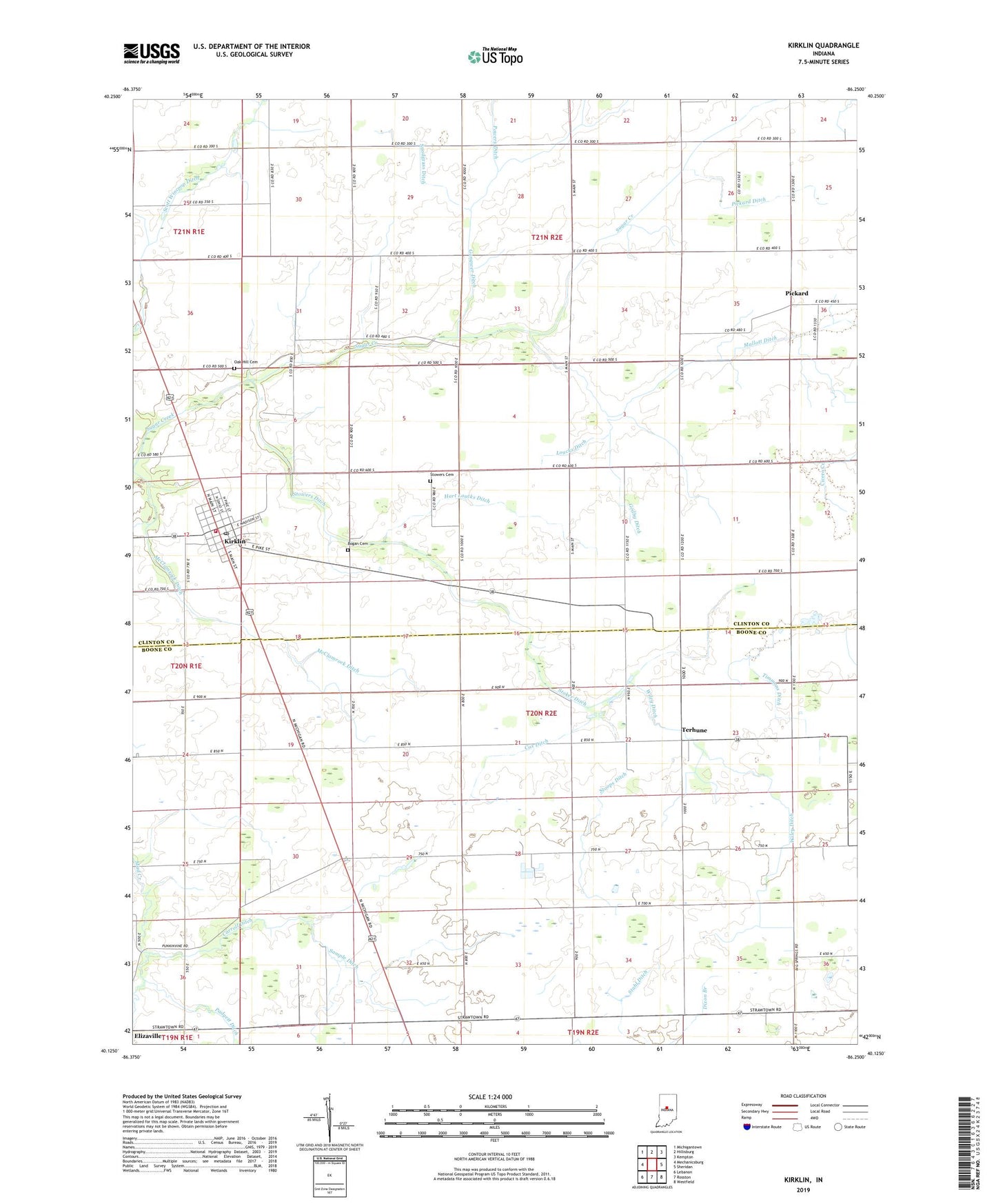
2022 topographic map quadrangle Kirklin in the state of Indiana. Scale: 1:24000. Based on the newly updated USGS 7.5' US Topo map series, this map is in the following counties: Clinton, Boone. The map contains contour data, water features, and other items you are used to seeing on USGS maps, but also has updated roads and other features. This is the next generation of topographic maps. Printed on high-quality waterproof paper with UV fade-resistant inks.
Quads adjacent to this one:
West: Mechanicsburg
Northwest: Michigantown
North: Hillisburg
Northeast: Kempton
East: Sheridan
Southeast: Westfield
South: Rosston
Southwest: Lebanon
This map covers the same area as the classic USGS quad with code o40086b3.
Contains the following named places: Bogan Cemetery, Carroll Ditch, Christian Chapel, Gangwer Ditch, Godby Ditch, Hart Loucks Ditch, Kingsoliver Ditch, Kirklin, Kirklin Post Office, Kirklin Township Volunteer Fire Department, Liberty Church, Loucks Ditch, Mallott Ditch, Martin Ditch, Matthews Ditch, McClamrock Ditch, Oak Hill Cemetery, Pickard, Pickard Ditch, Powers Ditch, Sample Ditch, Sedwick Chapel, Stahl Ditch, Stoker Ditch, Stoops Ditch, Stowers Cemetery, Stowers Ditch, Sugar Creek Church, Terhune, Timmons Ditch, Town of Kirklin, Township of Kirklin, Township of Sugar Creek, Wiley Ditch, ZIP Code: 46050