MyTopo
Pierceton Indiana US Topo Map
Couldn't load pickup availability
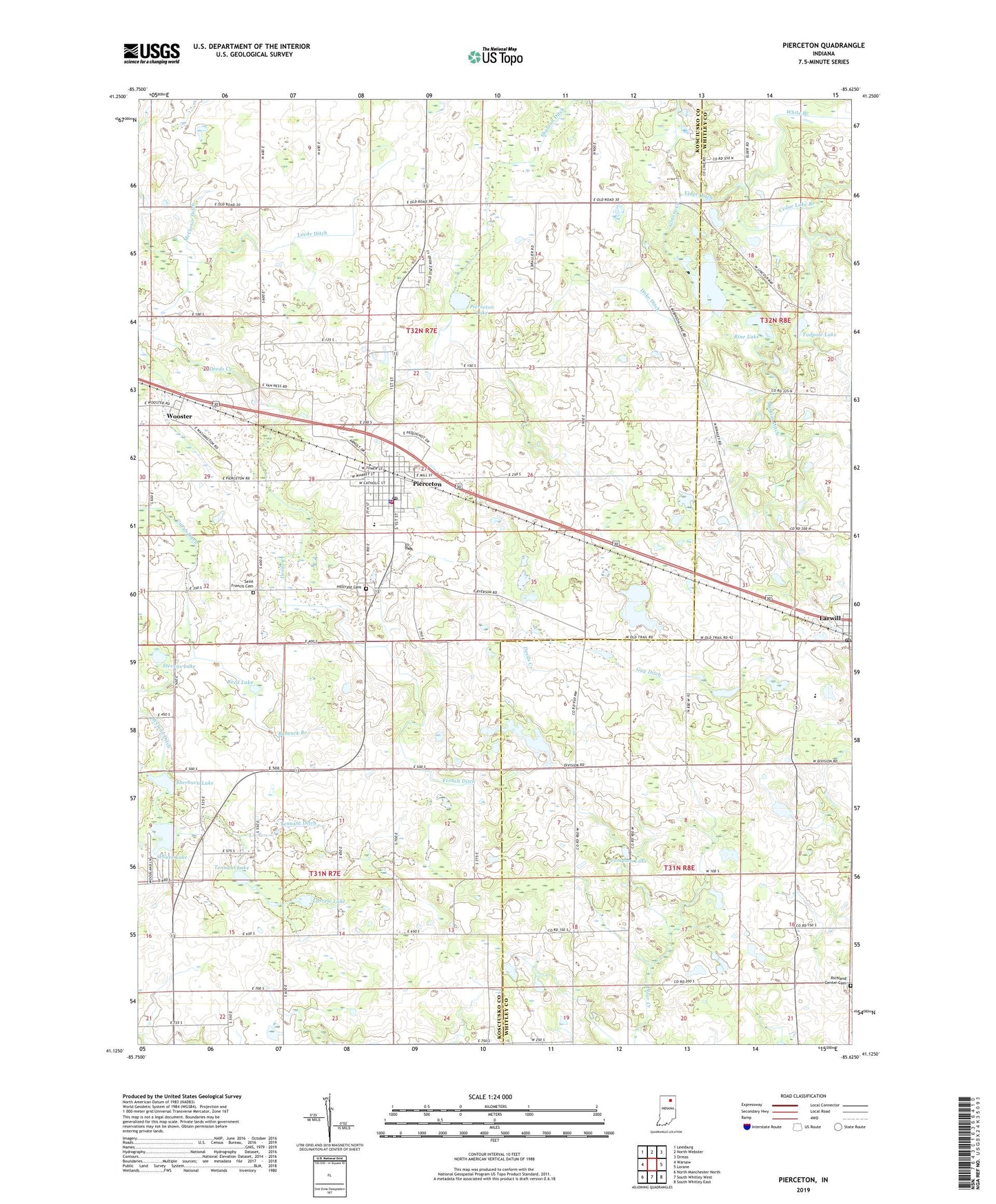
2022 topographic map quadrangle Pierceton in the state of Indiana. Scale: 1:24000. Based on the newly updated USGS 7.5' US Topo map series, this map is in the following counties: Kosciusko, Whitley. The map contains contour data, water features, and other items you are used to seeing on USGS maps, but also has updated roads and other features. This is the next generation of topographic maps. Printed on high-quality waterproof paper with UV fade-resistant inks.
Quads adjacent to this one:
West: Warsaw
Northwest: Leesburg
North: North Webster
Northeast: Ormas
East: Lorane
Southeast: South Whitley East
South: South Whitley West
Southwest: North Manchester North
This map covers the same area as the classic USGS quad with code o41085b6.
Contains the following named places: Boonesville Church, Cedar Lake Branch, Compton Lake, Doke Ditch, Eel River Church, Elder Ditch, French Ditch, Guy Ditch, Hillcrest Cemetery, Larrew Lake, Larwill, Larwill Post Office, Leedy Ditch, Mathias Ditch, McCarter Ditch, Pierceton, Pierceton Elementary School, Pierceton Fire Department, Pierceton Lake, Pierceton Police Department, Pierceton Post Office, Pierceton United Methodist Church, Reed Lake, Richland Center Cemetery, Rine Lake, Robinson Lake, Saint Francis Cemetery, Sellers Lake, Shanton Ditch, Sherburn Lake, Stevens Lake, Tadpole Lake, Tennant Ditch, Tennant Lake, Town of Pierceton, Township of Monroe, Township of Washington, Unrah Ditch, White Branch, Whitko Middle School, Wooster, ZIP Code: 46562