MyTopo
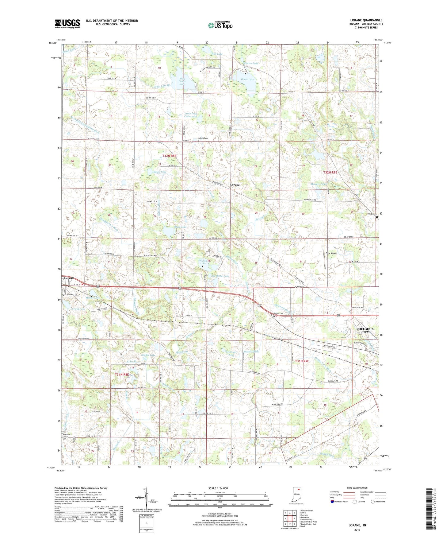
Lorane Indiana US Topo Map
Couldn't load pickup availability
2023 topographic map quadrangle Lorane in the state of Indiana. Scale: 1:24000. Based on the newly updated USGS 7.5' US Topo map series, this map is in the following counties: Whitley. The map contains contour data, water features, and other items you are used to seeing on USGS maps, but also has updated roads and other features. This is the next generation of topographic maps. Printed on high-quality waterproof paper with UV fade-resistant inks.
Quads adjacent to this one:
West: Pierceton
Northwest: North Webster
North: Ormas
Northeast: Merriam
East: Columbia City
Southeast: Laud
South: South Whitley East
Southwest: South Whitley West
This map covers the same area as the classic USGS quad with code o41085b5.
Contains the following named places: Adams Cemetery, Bethel Cemetery, Betzner Branch, Black Lake, Brown Ditch, Camp Whitley, Compton Ditch, County Farm Ditch, Dowell Ditch, Elon Maynard Ditch, Etna-Troy School, Ford Branch, Goose Lake, Ice House Lake, Indian Lake, Jones Branch, Kaler Branch, King Branch, Knisely Ditch, Lakeview Cemetery, Larwill Lake, Leininger Lake, Linvill Ditch, Little Troy Cedar Lake, Little Wilson Lake, Lorane, Maynard Ditch, McDonald Cunningham Ditch, Menzie Lake, Metzger Pond, Mud Lake, Oak Grove Church, Phillips Ditch, Plew Airport, Richland Township Fire and Rescue, Sattison Ditch, Schuman Ditch, Souder Lake, Stough Cemetery, Thorn Creek Church, Town of Larwill, Township of Columbia, Township of Richland, Troy Cedar Lake, Troy Church, West Point Church, Whitley County, Wilson Lake, Winters Lake, ZIP Code: 46764