MyTopo
South Whitley West Indiana US Topo Map
Couldn't load pickup availability
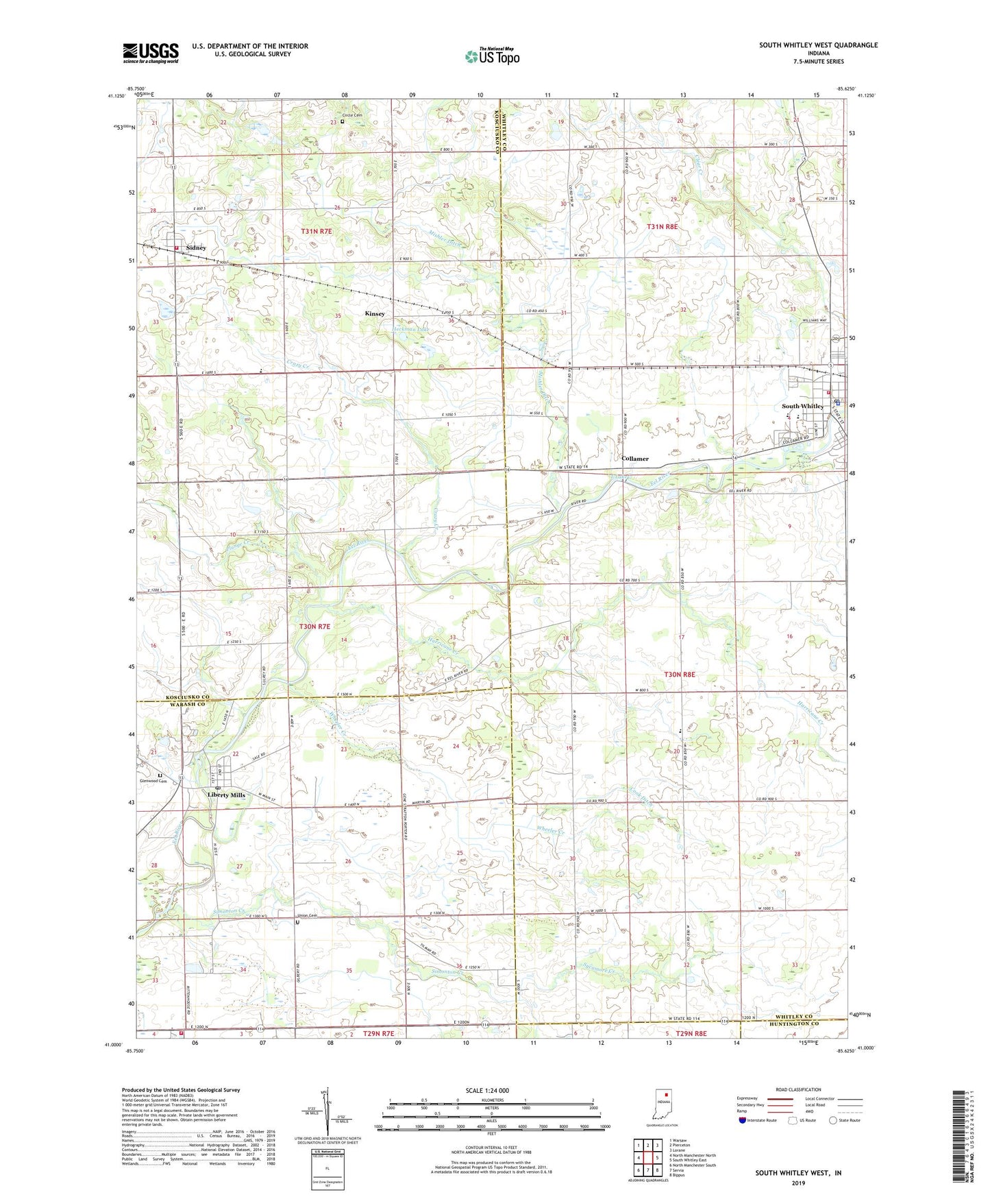
2022 topographic map quadrangle South Whitley West in the state of Indiana. Scale: 1:24000. Based on the newly updated USGS 7.5' US Topo map series, this map is in the following counties: Whitley, Kosciusko, Wabash, Huntington. The map contains contour data, water features, and other items you are used to seeing on USGS maps, but also has updated roads and other features. This is the next generation of topographic maps. Printed on high-quality waterproof paper with UV fade-resistant inks.
Quads adjacent to this one:
West: North Manchester North
Northwest: Warsaw
North: Pierceton
Northeast: Lorane
East: South Whitley East
Southeast: Bippus
South: Servia
Southwest: North Manchester South
This map covers the same area as the classic USGS quad with code o41085a6.
Contains the following named places: Chester Township Fire Department, Circle Cemetery, Cleveland Township Volunteer Fire Department, Collamer, Cook Ditch, Crazy Creek, Glenwood Cemetery, Heckman Lake, Hurricane Creek, Kinsey, Koontz Ditch, Liberty Mills, Liberty Mills Post Office, Mishler Ditch, Mishler Landing Strip, Pleasant View Church, Plunge Creek, Sidney, Sidney - Jackson Township Volunteer Fire Department, Sidney Elementary School, Simonton Creek, South Whitley, South Whitley Elementary School, South Whitley Middle School, South Whitley Police Department, South Whitley Post Office, South Whitley Wastewater Plant, Sycamore Creek, T Lake, Town of Sidney, Town of South Whitley, Township of Cleveland, Township of Jackson, Union Cemetery, Westrick Airport, Wheeler Creek, ZIP Code: 46946