MyTopo
Monon Indiana US Topo Map
Couldn't load pickup availability
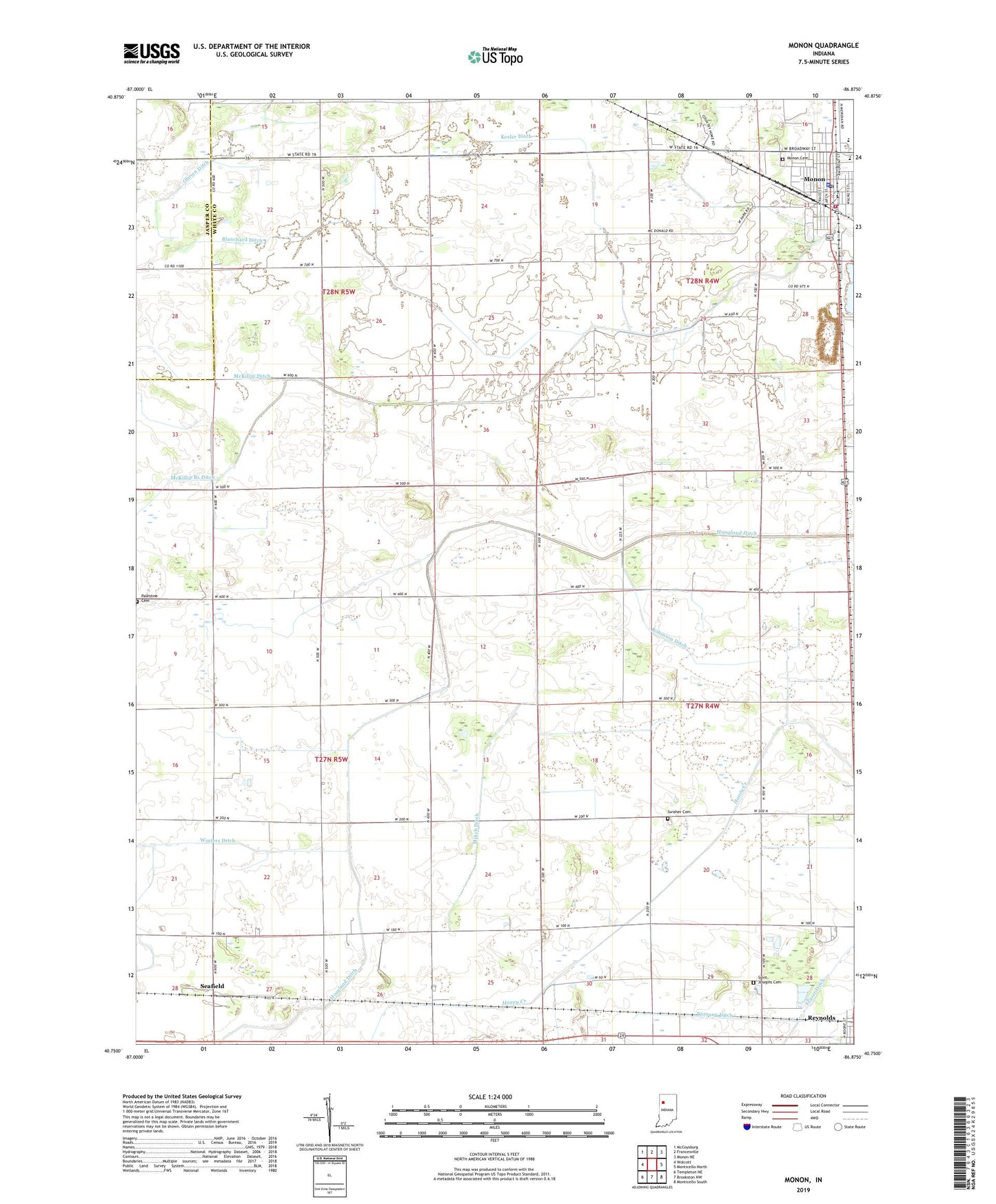
2022 topographic map quadrangle Monon in the state of Indiana. Scale: 1:24000. Based on the newly updated USGS 7.5' US Topo map series, this map is in the following counties: White, Jasper. The map contains contour data, water features, and other items you are used to seeing on USGS maps, but also has updated roads and other features. This is the next generation of topographic maps. Printed on high-quality waterproof paper with UV fade-resistant inks.
Quads adjacent to this one:
West: Wolcott
Northwest: McCoysburg
North: Francesville
Northeast: Monon NE
East: Monticello North
Southeast: Monticello South
South: Brookston NW
Southwest: Templeton NE
This map covers the same area as the classic USGS quad with code o40086g8.
Contains the following named places: Blanchard Ditch, Bossung Ditch, Box Ditch, Hoagland Ditch, Kesler Ditch, Klopfenstein Airport, McKillip Ditch, Minch Ditch, Monon, Monon Cemetery, Monon Fire Department, Monon Police Department, Monon Post Office, Monon Quarry, North White High School, Obrien Ditch, Palestine Cemetery, Robinson Ditch, Saint Josephs Cemetery, Seafield, Swisher Cemetery, Town of Monon, Township of Monon, Walker Ditch, White County Pullet Farm, Winters Ditch, ZIP Codes: 47959, 47980