MyTopo
Nashville Indiana US Topo Map
Couldn't load pickup availability
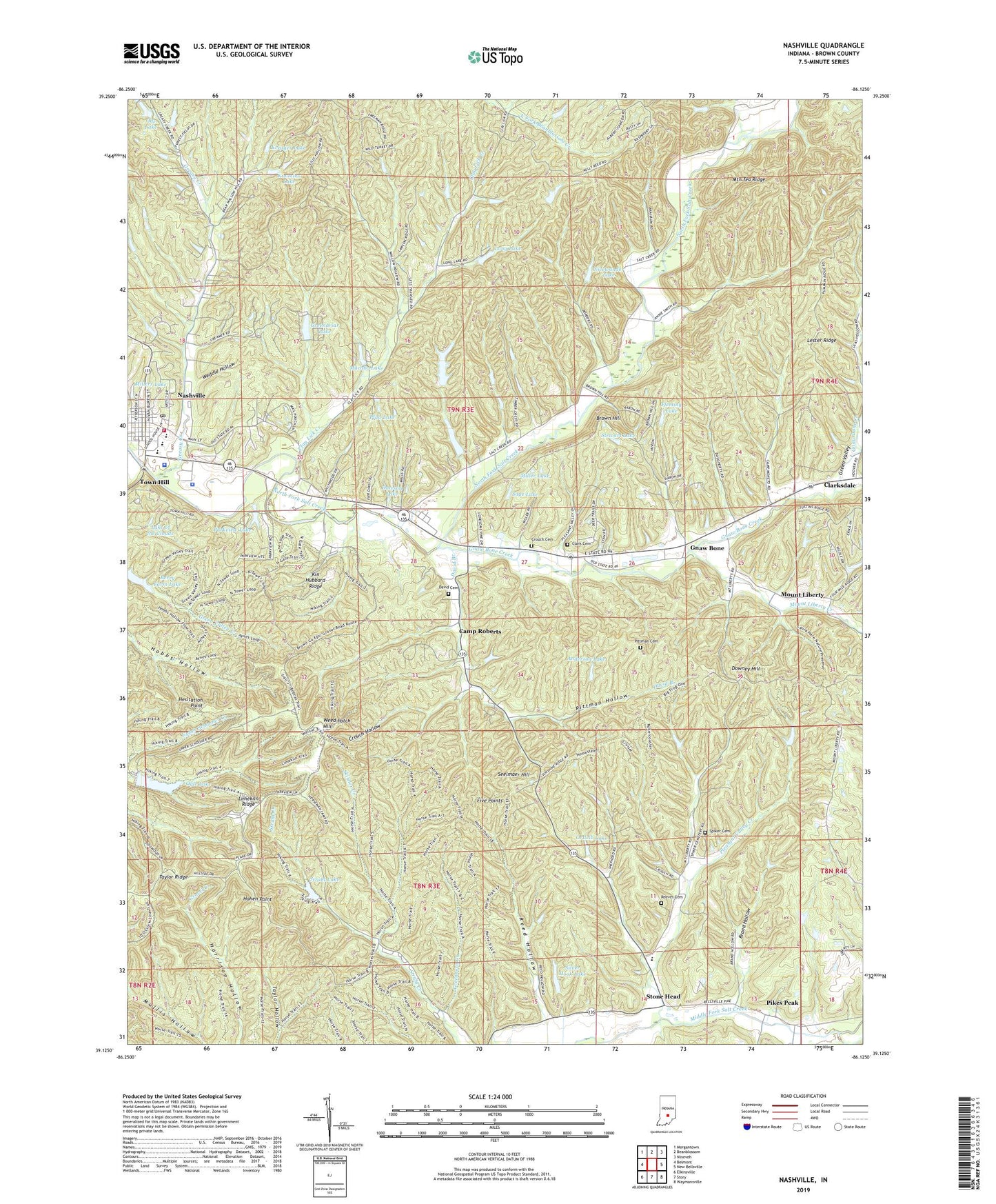
2022 topographic map quadrangle Nashville in the state of Indiana. Scale: 1:24000. Based on the newly updated USGS 7.5' US Topo map series, this map is in the following counties: Brown. The map contains contour data, water features, and other items you are used to seeing on USGS maps, but also has updated roads and other features. This is the next generation of topographic maps. Printed on high-quality waterproof paper with UV fade-resistant inks.
Quads adjacent to this one:
West: Belmont
Northwest: Morgantown
North: Beanblossom
Northeast: Nineveh
East: New Bellsville
Southeast: Waymansville
South: Story
Southwest: Elkinsville
This map covers the same area as the classic USGS quad with code o39086b2.
Contains the following named places: Abe Martin Lodge, Anderson Lake, Berry Farm Lake, Brand Hollow, Brown County, Brown County High School, Brown County Sheriff's Office, Brown County Volunteer Fire Department, Brown Hill, Camp Rancho Framasa, Camp Roberts, Clark Cemetery, Clarksdale, Clay Lick Creek, Crouch Cemetery, Crouch Hollow, David Branch, David Cemetery, Dawson Lake, Downey Hill, Five Points, Fleming Lake, Fleming Lake Dam, Gnaw Bone, Gnaw Bone Camp, Gnaw Bone Creek, Greasy Creek, Greasy Creek Church, Green Valley, Greenbriar Lake, Greenbriar Lake Estates Dam, Greenhorn Creek, Henderson Creek, Hesitation Point, Hohen Point, Kahn Lake, Kahn Lake Dam, Kimmins Lake, Kin Hubbard Ridge, Kreuger Lake, Lake of the Clouds, Lester Ridge, Lilly Lookout Tower, Limekiln Ridge, Long Lake, Macabo Lake, Miller Lake, Millers Lake, Millers Lake Dam, Mount Liberty, Mount Liberty Creek, Mountain Tea Ridge, Nashville Police Department, Nashville Post Office, Nicewander Lake, Nicewander Lake Dam, Ode Lake, Ogle Lake, Ogle Lake Dam, Ortleib Lake, Parkview Lake, Parkview Lake Dam, Pfau Lake, Pfau Lake Dam, Pikes Peak, Pittman Cemetery, Pittman Hollow, Pleasant Valley Church, Pleasant Valley Creek, Reed Hollow, Reeves Cemetery, Rising Hope Baptist Church, Sage Lake, Sage Lake Dam, Saint Agnes Church, Seelmaer Hill, Silver Hook Lake, Silver Hook Lake Dam, Skinner Creek, Spiker Cemetery, Stewart Lake, Stewart Lake Dam, Stone Head, Strahl Lake, Strahl Lake Dam, Taylor Ridge, Town Hill, Town of Nashville, Weddle Hollow, Weed Patch Hill, Willcraft Lake Lower Dam, ZIP Code: 47448