MyTopo
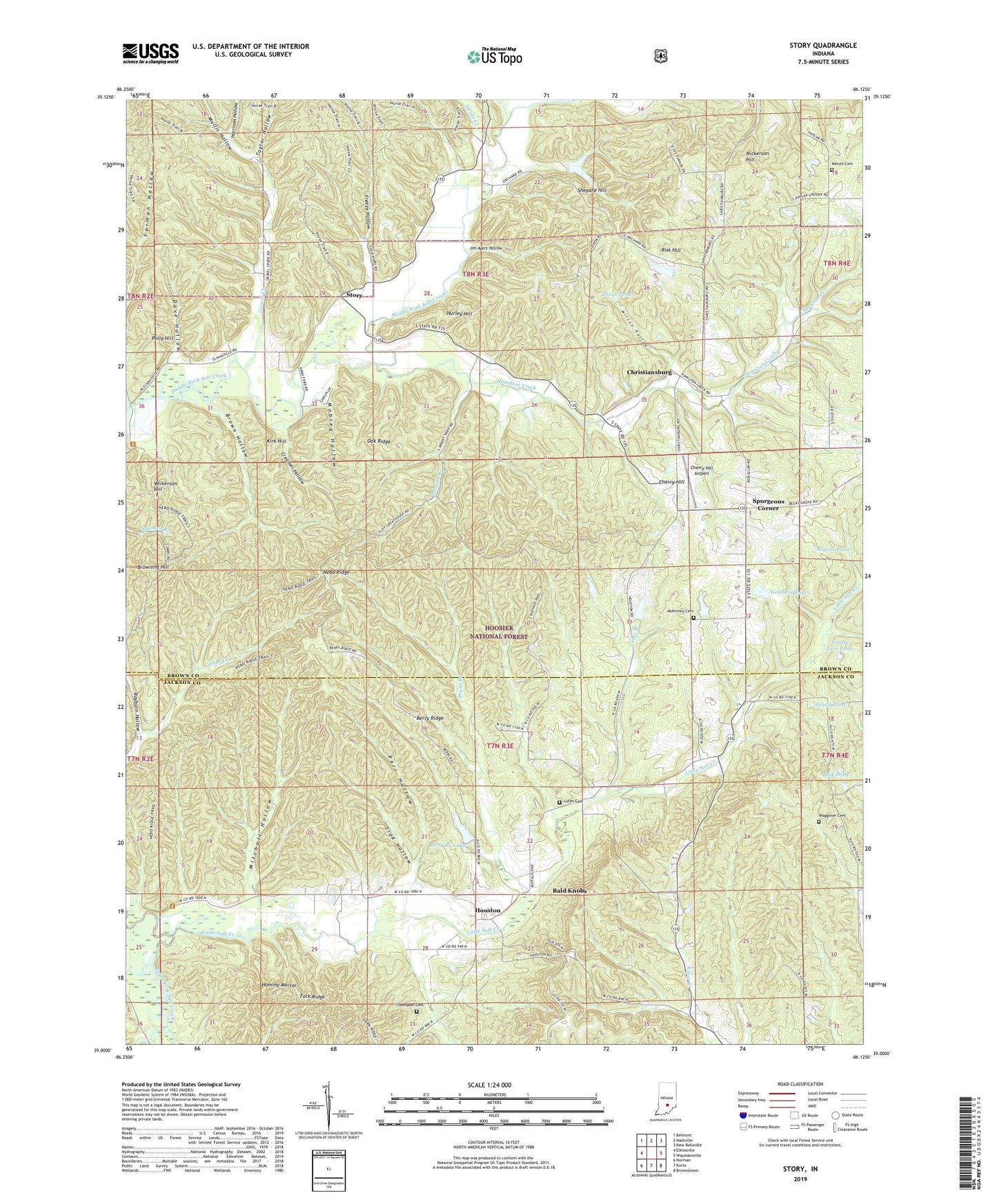
Story Indiana US Topo Map
Couldn't load pickup availability
Also explore the Story Forest Service Topo of this same quad for updated USFS data
2022 topographic map quadrangle Story in the state of Indiana. Scale: 1:24000. Based on the newly updated USGS 7.5' US Topo map series, this map is in the following counties: Brown, Jackson. The map contains contour data, water features, and other items you are used to seeing on USGS maps, but also has updated roads and other features. This is the next generation of topographic maps. Printed on high-quality waterproof paper with UV fade-resistant inks.
Quads adjacent to this one:
West: Elkinsville
Northwest: Belmont
North: Nashville
Northeast: New Bellsville
East: Waymansville
Southeast: Brownstown
South: Kurtz
Southwest: Norman
This map covers the same area as the classic USGS quad with code o39086a2.
Contains the following named places: Bald Knobs, Beck Pond, Berry Branch Lake, Berry Branch Lake Dam, Berry Ridge, Brown Hollow, Buffalo, Cherry Hill, Cherry Hill Airport, Christiansburg, Creamer Hollow, Cross Branch, Dave Hollow, Dixon Pond, Fork Ridge, Freeze Hollow, Goodwin Lake, Goodwin Lake Dam, Gravel Creek, Hamilton Creek, Harris Pond, Harrison Hollow, Hilltop Camp, Hominy Mortar, Houston, Hurley Hill, Jim Ayers Hollow, Kirk Hill, Little Salt Creek, Lutes Cemetery, McKinney Cemetery, Melott Cemetery, Mitchell Hollow, Mobley Hollow, Mount Nebo Church, Mount Zion Church, Mullis Hollow, Nebo Ridge, Nickerson Hill, Oak Ridge, Parr Hollow, Pension Branch, Polly Hill, Pruitt Branch, Rayburn Hollow, Risk Hill, Runt Run, Scholl Pond, Shepard Hill, Spurgeons Corner, Story, Strahl Creek, Taylor Hollow, Thompson Cemetery, Tidd Hollow, Township of Salt Creek, Township of Van Buren, Treaty Line Pond, Waggoner Cemetery, Wilkerson Hill, Wilson Hollow