MyTopo
New Albany Indiana US Topo Map
Couldn't load pickup availability
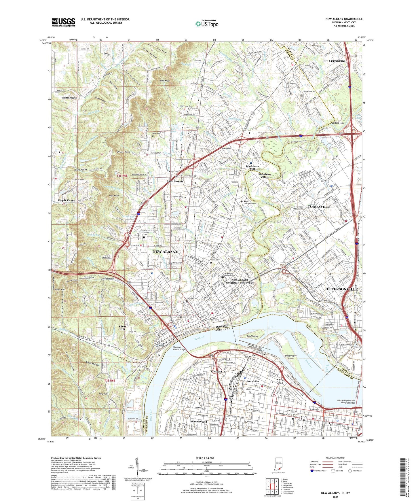
2023 topographic map quadrangle New Albany in the states of Indiana, Kentucky. Scale: 1:24000. Based on the newly updated USGS 7.5' US Topo map series, this map is in the following counties: Floyd, Clark, Jefferson. The map contains contour data, water features, and other items you are used to seeing on USGS maps, but also has updated roads and other features. This is the next generation of topographic maps. Printed on high-quality waterproof paper with UV fade-resistant inks.
Quads adjacent to this one:
West: Georgetown
Northwest: Borden
North: Speed
Northeast: Charlestown
East: Jeffersonville
Southeast: Louisville East
South: Louisville West
Southwest: Lanesville
Contains the following named places: Alsac-Saint Jude Childrens Research Hospital, Anderson Park, Arrow Run, Atkins Run, Atkinson School, Atlantis Water Park, Bald Knob, Bald Knob Creek, Bank of Louisville Historical Marker, Baptist Health Floyd Hospital, Baxter Park, Beecher Playground, Bicknell Park Playground, Bills Lakes, Binford Park, Blackiston Mill, Blackiston Run, Blackiston Village, Blooms Eddy, Boone Square Park, Bow Run, Brave Hollow, Brown-Forman Corporation Historical Marker, Cane Run, Carters Hole, Carters Run, Cathedral of the Assumption Historical Marker, Central High School, Chapel Branch, Charles Allen Prosser Vocational Center, Charles W Anderson Junior Historical Marker, Church Run, City of New Albany, Clarksville, Clarksville Middle School, Clarksville Senior High School, Clear Fork, Colgate Park, Colgate School, Colonial Manor Shopping Center, Copperas Banks, Coryden Run, Corydon Pike School, County Memorial Hospital, County Run, Creek Hollow, Crooked Run, Cross Branch, Cross Brook, Dolfinger School, Duck Hollow, E. Leland Taylor Park, Early Forth Street Historical Marker, East Spring Street School, Elliott Square Playground, Fairmont Elementary School, Fairview Cemetery, Fall Run, Falling Run, Falling Run Park, Falls of the Ohio, Falls of the Ohio State Park, Flaget High School, Flat Run, Floyds Creek, Floyds Knobs, Floyds Knobs Water Company Dam, Fontaine Ferry Park, Fork Run, Fourth Street Historical Marker, Fourth Street Live Shopping Center, Friendship Run, George Rogers Clark Elementary School, George Rogers Clark Memorial Bridge, Grace Run, Grant Line School, Graysville, Green Run, Green Tree Mall, Green Valley Elementary School, Greenacres Elementary School, Greentree Mall Shopping Center, Griffin School, Haps Airport, Henry Clay School, Hill Brook, Holy Family School, Holy Trinity Cemetery, Home of I Willis Cole Historical Marker, Horse Hollow, Indiana University Southeast Campus, Irene Dunne Historical Marker, Jacobs Creek, James Guthrie Historical Marker, Jay Run, Jefferson County Courthouse Historical Marker, Jefferson County Historical Marker, Jewish Hospital Heliport, Kraft - Graceland Cemetery, Lafayette Elementary School, Lamb Run, Land Run, Lannan Memorial Park, Lapping Memorial Park, Lawrence Park, Lewis and Clark Expedition Historical Marker, Lewis Branch, Lillian Emery Elementary School, Lost Knob, Lost Knob Brook, Louisville, Louisville and Portland Canal, Louisville Bar Association Historical Marker, Louisville City Hall Historical Marker, Louisville Convention Historical Marker, Louisville Galleria Shopping Center, Louisville Slave Trading Historical Marker, Louisville Steamboat Era Historical Marker, Louisville West Division, Lowell School, Madison Street School, Mayhurst School, McAlpine Dam, McAlpine Locks, McCulloch Elementary School, Middle Creek, Mill Creek, Mount Tabor School, Nathaniel Scribner Junior High School, Neighborhood House Historical Marker, New Albany, New Albany Country Club, New Albany Mall, New Albany National Cemetery, New Albany Senior High School, Old Catholic High School Historical Marker, Our Lady Church Historical Marker, Our Lady of Perpetual Help School, Our Lady of Providence High School, Our Lady School, Parkwood Elementary School, Pieiss Hollow, Pine Hill, Pine View Elementary School, Plum Run, Portland, Portland Cemetery, Portland Park, Portland School, Prentice School Historical Marker, Rail Run, Renaissance Business Centers at the Normandy Building, River Falls Mall, River Falls Mall Shopping Center, Road Hollow, Roosevelt School, Russell Neighborhood Historical Marker, S Ellen Jones Elementary School, Saint Anthony School, Saint Cecilias School, Saint Charles Borromeos School, Saint Columba School, Saint Edwards Hospital, Saint John Cemetery, Saint Marys, Saint Mary's Cemetery, Saint Marys Run, Saint Marys School, Sand Island, Scott Cemetery, Scribner Junior High School, Second African Baptist Church Historical Marker, Shawnee Park, Shawneeland, Sherman Minton Bridge, Shippingport Island, Silver Creek, Silver Hills, Silver Street Elementary School, Silvercrest Run, Silvercrest State Hospital, Slate Run, Slate Run Elementary School, Slavery Laws in Old Kentucky Historical Marker, South Hollow, Southern Indiana Rehab Hospital, Spickert Knob, Squaw Hollow, Starks Court Shopping Center, State Run, Steamboat Captain Mary M Millers Grave Historical Marker, Surgical Center of New Albany, Tabor Run, The Childrens Academy of New Albany, The Discovery of the Ohio River Historical Marker, The Galt House Historical Marker, Thomas Merton Historical Marker, Thornton and Lucie Blackburn Historical Marker, Town of Clarksville, Town Run, Township of New Albany, Trinity Run, Truth in Advertising Historical Marker, University Plaza, Uphill Run, Vincennes Run, W C Culbertson Mansion, War Run, WAVE-TV (Louisville), WDJX-AM (Louisville), WDJX-FM (Louisville), WDRB-TV (Louisville), West Haven Cemetery, West Spring Street School, Western Cemetery, Westonia Playground, WHAS-TV (Louisville), WKMJ-TV (Louisville), WKPC-TV (Louisville), WLKY-TV (Louisville), WNAS-FM (New Albany), WOBS-AM (New Albany), Wooded View Country Club, WUOL-FM (Louisville), WVEZ-FM (Louisville), WZKS-FM (Louisville), York Historical Marker, Youngstown Shopping Center, Youngtown Yards, Zion Baptist Church Historical Marker, ZIP Codes: 40202, 40203, 40212, 47129, 47150


