MyTopo
Charlestown Indiana US Topo Map
Couldn't load pickup availability
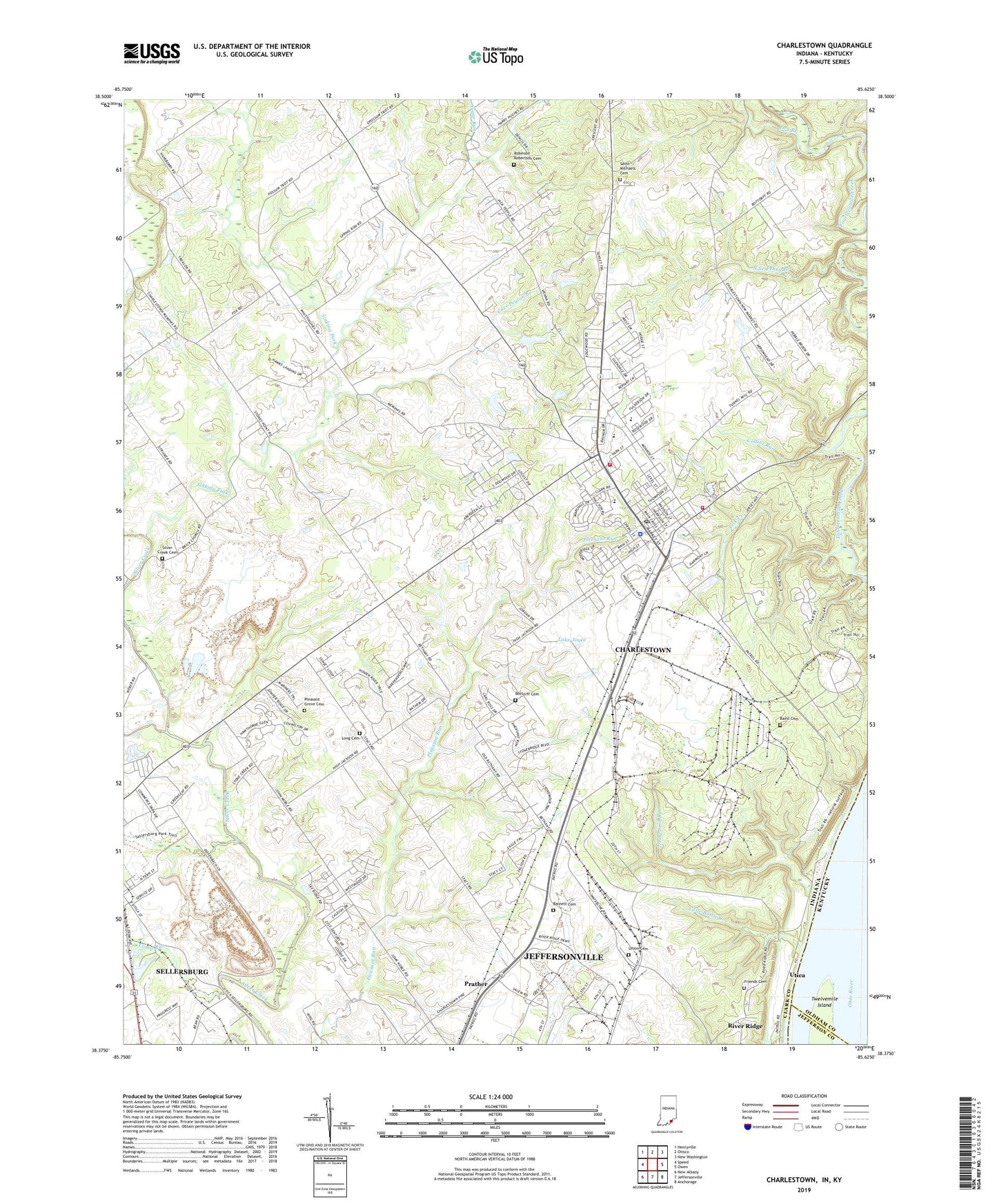
2022 topographic map quadrangle Charlestown in the states of Indiana, Kentucky. Scale: 1:24000. Based on the newly updated USGS 7.5' US Topo map series, this map is in the following counties: Clark, Oldham, Jefferson. The map contains contour data, water features, and other items you are used to seeing on USGS maps, but also has updated roads and other features. This is the next generation of topographic maps. Printed on high-quality waterproof paper with UV fade-resistant inks.
Quads adjacent to this one:
West: Speed
Northwest: Henryville
North: Otisco
Northeast: New Washington
East: Owen
Southeast: Anchorage
South: Jeffersonville
Southwest: New Albany
Contains the following named places: Baird Cemetery, Barnett Cemetery, Bethany Church, Bottorff Cemetery, Camp Chelan, Camp Run, Carr Peyton Branch, Charlestown, Charlestown Landing, Charlestown Police Department, Charlestown Post Office, Charlestown Senior High School, Charlestown Volunteer Fire Department Station 91, Charlestown Volunteer Fire Department Station 93, City of Charlestown, Clark County, Clark Siding, Collins Run, Dry Branch, Friends Cemetery, Jay C Shopping Center, Jenny Lind Run, Lake Joyce, Lick Creek, Little Battle Creek, Long Cemetery, Muddy Fork, Nine Penny Branch, Pleasant Grove Cemetery, Pleasant Grove Church, Pleasant Ridge Elementary School, Prather, River Ridge, Robinson Robertson Cemetery, Saint Catherine Regional Hospital, Saint Michael School, Saint Michaels Cemetery, Sellersburg Stone Quarry, Silver Creek Cemetery, Silver Creek Church, Sinking Fork, Speed Quarry, Springville, Stony Point Church, Sugar Run, Sylvan Grove, Township of Charlestown, Tunnel Mill Boy Scout Camp, Twelvemile Island, Union Cemetery, Utica School, Worrell Cemetery, ZIP Code: 47111