MyTopo
Sulphur Springs Indiana US Topo Map
Couldn't load pickup availability
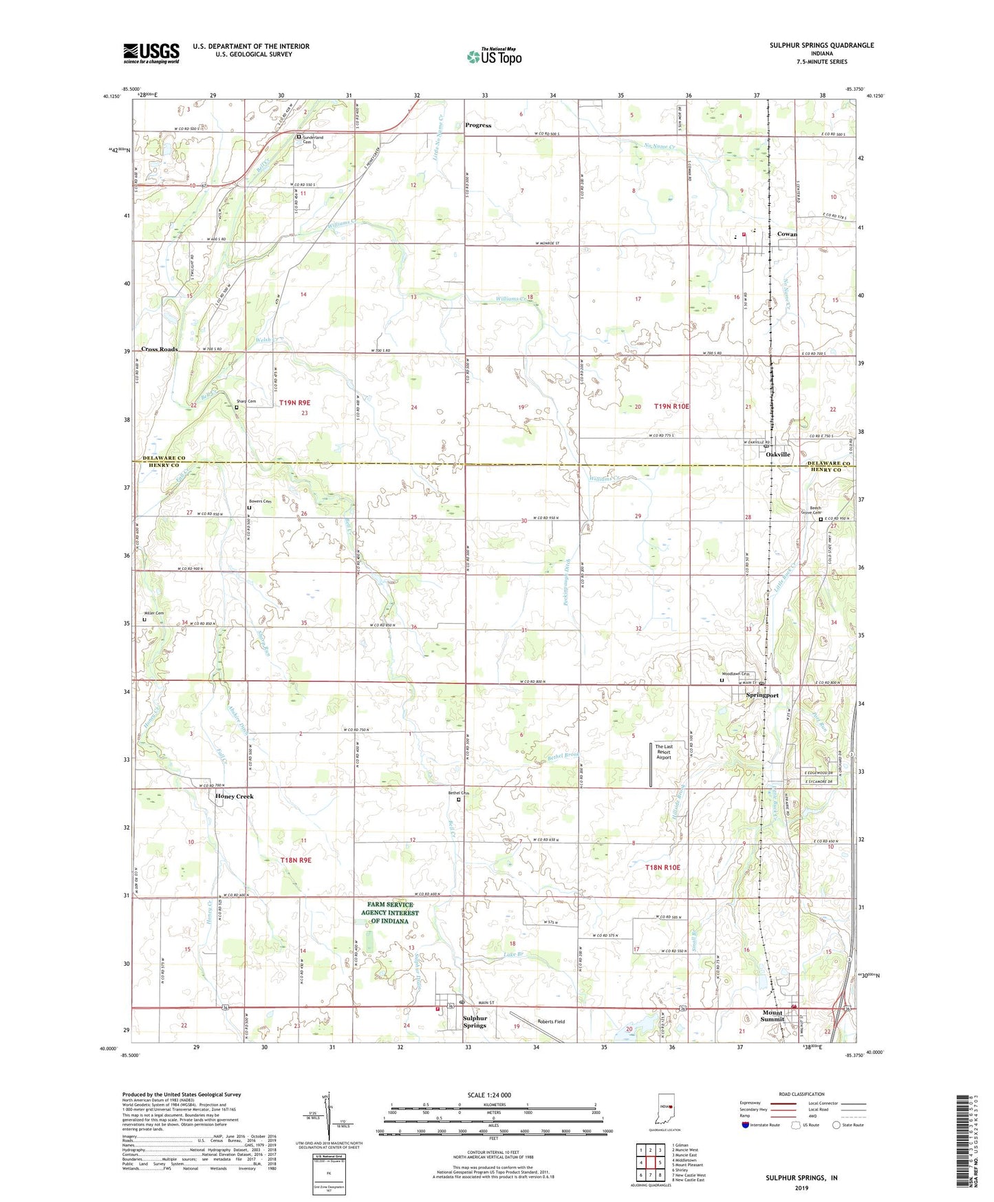
2022 topographic map quadrangle Sulphur Springs in the state of Indiana. Scale: 1:24000. Based on the newly updated USGS 7.5' US Topo map series, this map is in the following counties: Henry, Delaware. The map contains contour data, water features, and other items you are used to seeing on USGS maps, but also has updated roads and other features. This is the next generation of topographic maps. Printed on high-quality waterproof paper with UV fade-resistant inks.
Quads adjacent to this one:
West: Middletown
Northwest: Gilman
North: Muncie West
Northeast: Muncie East
East: Mount Pleasant
Southeast: New Castle East
South: New Castle West
Southwest: Shirley
This map covers the same area as the classic USGS quad with code o40085a4.
Contains the following named places: Abshire Ditch, Beech Grove Cemetery, Bethel Brook, Bethel Cemetery, Bowers Cemetery, Cowan, Cross Roads, Hillside Brook, Honey Creek, Jefferson Township Fire Department, Lake Branch, Miller Cemetery, Monroe Township Cowan Volunteer Fire Department, Mount Run, Mount Summit, Mount Summit Post Office, Oakville, Oakville Post Office, Peckinpaugh Ditch, Port Run, Prairie Township Volunteer Fire Department, Progress, Roberts Field, Sharp Cemetery, Sharp Run, Small Branch, Spring Run, Springport, Springport Post Office, Sulphur Drain, Sulphur Springs, Sulphur Springs Elementary School, Sulphur Springs Post Office, Summit Brook, Sunderland Cemetery, Tabor Church, The Last Resort Airport, Town of Mount Summit, Town of Springport, Township of Jefferson, Township of Monroe, Welsh Creek, White Church, Williams Creek, WMDH-FM (New Castle), Woodlawn Cemetery, ZIP Codes: 47361, 47367, 47386, 47388