MyTopo
New Corydon Indiana US Topo Map
Couldn't load pickup availability
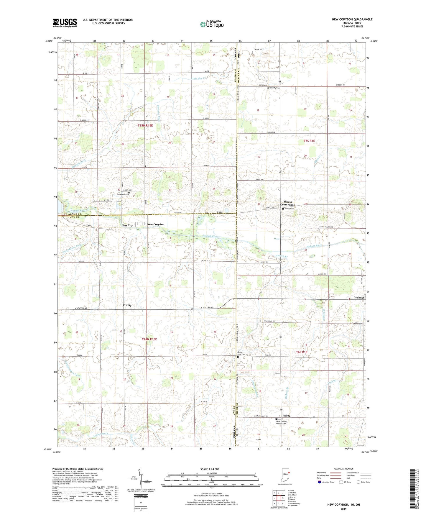
2022 topographic map quadrangle New Corydon in the states of Indiana, Ohio. Scale: 1:24000. Based on the newly updated USGS 7.5' US Topo map series, this map is in the following counties: Jay, Mercer, Adams. The map contains contour data, water features, and other items you are used to seeing on USGS maps, but also has updated roads and other features. This is the next generation of topographic maps. Printed on high-quality waterproof paper with UV fade-resistant inks.
Quads adjacent to this one:
West: Geneva
Northwest: Berne
North: Willshire
Northeast: Rockford
East: Erastus
Southeast: Coldwater
South: Fort Recovery
Southwest: Portland
Contains the following named places: Alig Farms, Beaver Creek, Forest Hill School, Franks Drain, Hickory Branch, Jay City, Jefferson School, Liberty Cemetery, Lufborrow Cemetery, Lutheran Cemetery, Mount Carmel Church, Muhlenkamp Farms, New Corydon, Padua, Padua Post Office, R and H Farms, Saint Anthony Catholic Cemetery, Saint Anthony Catholic Church, Saint Marys Church, Scherman Ditch, School Number 3, School Number 9, Skeels Cemetery, Skeels Crossroads, Skeels Crossroads Post Office, State Line Cemetery, Stolz Field, Sudhoff Tree Farm, Township of Jefferson, Township of Wabash, Trinity, Wabash Post Office, Wilson Creek