MyTopo
Portland Indiana US Topo Map
Couldn't load pickup availability
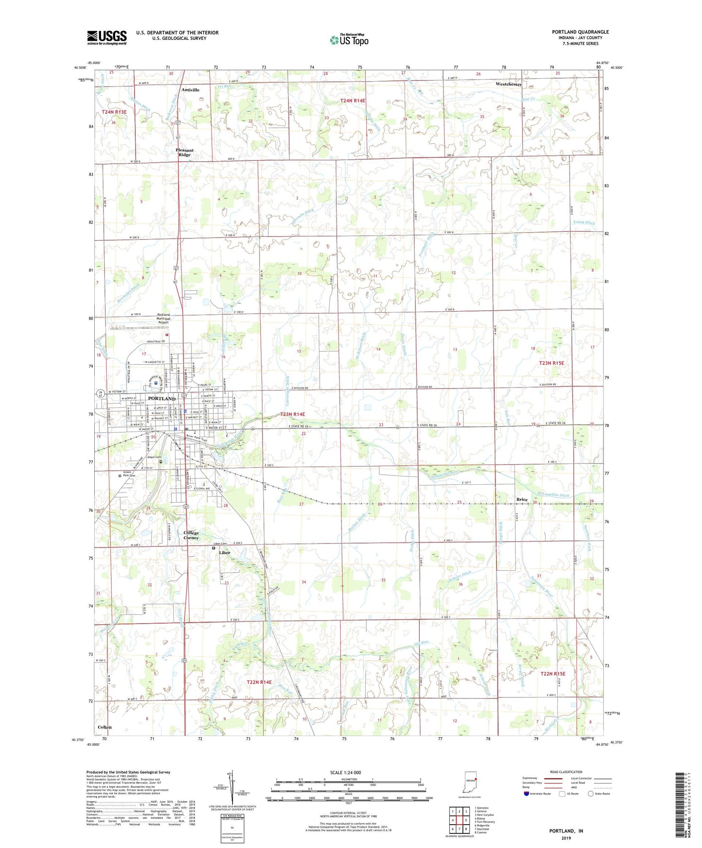
2022 topographic map quadrangle Portland in the state of Indiana. Scale: 1:24000. Based on the newly updated USGS 7.5' US Topo map series, this map is in the following counties: Jay. The map contains contour data, water features, and other items you are used to seeing on USGS maps, but also has updated roads and other features. This is the next generation of topographic maps. Printed on high-quality waterproof paper with UV fade-resistant inks.
Quads adjacent to this one:
West: Blaine
Northwest: Domestic
North: Geneva
Northeast: New Corydon
East: Fort Recovery
Southeast: Cosmos
South: Deerfield
Southwest: Ridgeville
This map covers the same area as the classic USGS quad with code o40084d8.
Contains the following named places: Alexander Ditch, Antiville, Antiville Ditch, Ashley Ditch, Berger Ditch, Bockoven Ditch, Brice, Buckeye Creek, Burkey Ditch, City of Portland, College Corner, Fairview Church, Freemyer Ditch, Garfield School, General Shanks Elementary School, Golf Brook, Green Park Cemetery, Haynes Park, Hodge Ditch, Houte Ditch, IU Health Jay Hospital, Jaque Cemetery, Jay County Emergency Medical Services - Portland, Jay County High School, Jay County Sheriff's Office, John Cring Memorial Forest, Judge Haynes Elementary School, Karnes Ditch, Kerns Ditch, Liber, Liber Cemetery, Lincoln School, Little Salamonie Church, Little Salamonie River, McKinsey Ditch, Miller School, Millers Branch, Old Run, Osterholt Farms, Pleasant Hill Church, Pleasant Ridge, Portland, Portland Fire Department, Portland Municipal Airport, Portland Police Department, Portland Post Office, Race Run, Rest Run, Sale Run, Saw Run, Scholer Ditch, Sycamore Fork, Township of Wayne, Walnut Creek, Westchester, Young Ditch, ZIP Code: 47371