MyTopo
Berne Indiana US Topo Map
Couldn't load pickup availability
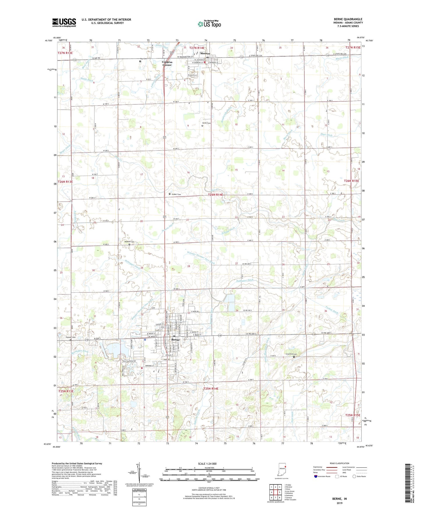
2022 topographic map quadrangle Berne in the state of Indiana. Scale: 1:24000. Based on the newly updated USGS 7.5' US Topo map series, this map is in the following counties: Adams. The map contains contour data, water features, and other items you are used to seeing on USGS maps, but also has updated roads and other features. This is the next generation of topographic maps. Printed on high-quality waterproof paper with UV fade-resistant inks.
Quads adjacent to this one:
West: Linn Grove
Northwest: Preble
North: Decatur
Northeast: Wren
East: Willshire
Southeast: New Corydon
South: Geneva
Southwest: Domestic
This map covers the same area as the classic USGS quad with code o40084f8.
Contains the following named places: Adams Central Elementary School, Adams Central High School, Adams Central Middle School, Adams County, Bella Vista Farms, Berne, Berne Elementary School, Berne Fire Department, Berne Police Department, Berne Post Office, Christian Mission Church, City of Berne, Coppess Corner, Crawford Cemetery, Duer Ditch, Farlow Ditch, First Missionary Church, Four-H Park, Friends Meetinghouse, Fuch Ditch, Gates Ditch, Graber Cemetery, Habegger Ditch, Hendericks Ditch, Hoosier Cemetery, Irish Acres Dairy, Jamstutz Ditch, Johnson Ditch, Lehman Park, Lotter Farms, Maple Grove Church, Martz Ditch, Mazelin Cemetery, Monroe, Monroe Post Office, Monroe Volunteer Fire Department, Peel Ditch, Pleasant Valley Church, Ray Cemetery, Schugg Ditch, Smith Cemetery, Smith Ditch, Smith Shoemaker Ditch, Sommer Farm, Spring Hill Church, Sprunger Ditch, Sprungers South Adams County Airstrip, Swartz Ditch, Town of Monroe, Township of Monroe, Winchester Church, Wittmer Number One Ditch, Wittmer Number Two Ditch, ZIP Codes: 46711, 46772