MyTopo
Gosport Indiana US Topo Map
Couldn't load pickup availability
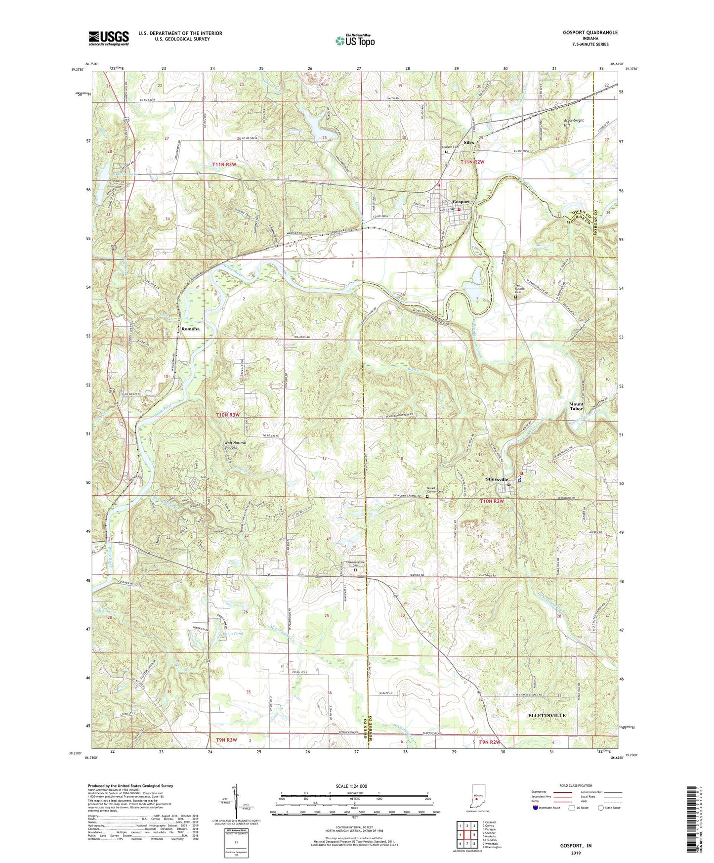
2022 topographic map quadrangle Gosport in the state of Indiana. Scale: 1:24000. Based on the newly updated USGS 7.5' US Topo map series, this map is in the following counties: Owen, Monroe, Morgan. The map contains contour data, water features, and other items you are used to seeing on USGS maps, but also has updated roads and other features. This is the next generation of topographic maps. Printed on high-quality waterproof paper with UV fade-resistant inks.
Quads adjacent to this one:
West: Spencer
Northwest: Cataract
North: Quincy
Northeast: Paragon
East: Modesto
Southeast: Bloomington
South: Whitehall
Southwest: Freedom
This map covers the same area as the classic USGS quad with code o39086c6.
Contains the following named places: Amazon Lake, Amazon Lake Dam, Arganbright Hill, Bean Blossom - Stinesville Fire Department, Bean Blossom Township - Stinesville Fire Department, Beanblossom Creek, Big Creek, Camp Romona, Chafin Memorial Church, Chambersville Cemetery, Fall Creek, Farm Pond, Farm Pond Dam, Gosport, Gosport Cemetery, Gosport Elementary School, Gosport Fire Department Station 2, Gosport Police Department, Gosport Post Office, Gosport Quarry, Gosport Volunteer Fire Department, Highets Corner, Hollybrook Lake, Indian Creek, Jacks Defeat Creek, Laymon Church, Limestone Creek, Littens Branch, Little Mill Creek, McCormicks Creek, McCormicks Creek Church, McCormicks Creek State Park, Mill Creek, Mount Carmel Cemetery, Mount Olive Church, Mount Tabor, Murdy Station, Old Dutch Church, Romona, Shiloh Church, Silex, Stinesville, Stinesville Elementary School, Stinesville Police Department, Stinesville Post Office, Town of Gosport, Town of Stinesville, Township of Bean Blossom, Township of Wayne, Van Buskirk Cemetery, Wolf Natural Bridges, ZIP Codes: 47433, 47464