MyTopo
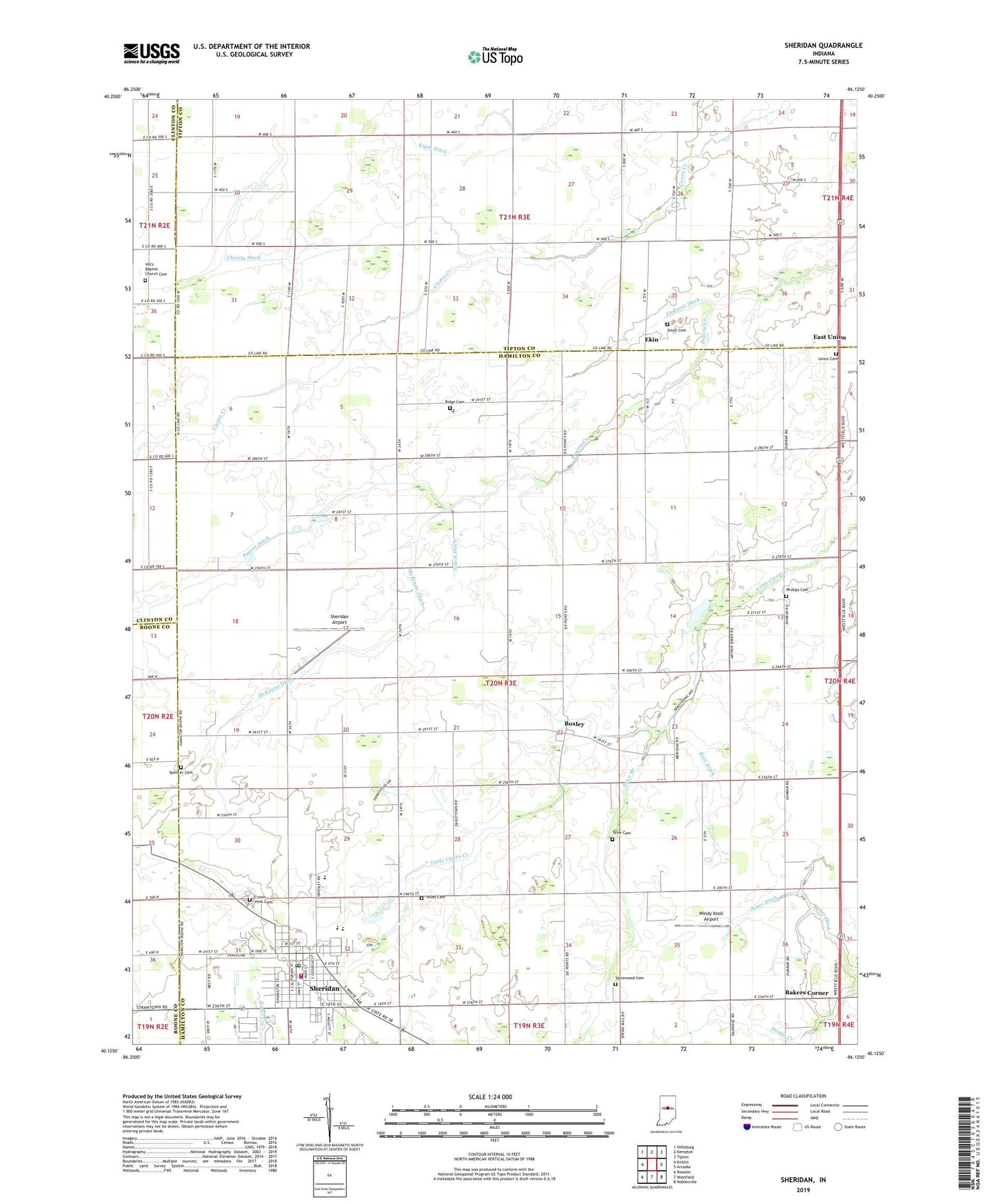
Sheridan Indiana US Topo Map
Couldn't load pickup availability
2022 topographic map quadrangle Sheridan in the state of Indiana. Scale: 1:24000. Based on the newly updated USGS 7.5' US Topo map series, this map is in the following counties: Hamilton, Tipton, Clinton, Boone. The map contains contour data, water features, and other items you are used to seeing on USGS maps, but also has updated roads and other features. This is the next generation of topographic maps. Printed on high-quality waterproof paper with UV fade-resistant inks.
Quads adjacent to this one:
West: Kirklin
Northwest: Hillisburg
North: Kempton
Northeast: Tipton
East: Arcadia
Southeast: Noblesville
South: Westfield
Southwest: Rosston
This map covers the same area as the classic USGS quad with code o40086b2.
Contains the following named places: Adams Elementary School, Baker Ditch, Bakers Corner, Black Hawk Airport, Boxley, Christy Ditch, Cox Ditch, Crown View Cemetery, East Union, Ekin, Endicott Ditch, Fouch Ditch, Hill's Baptist Church Cemetery, Hills Church, Jay Ditch, Jones Ditch, K and S Farms, Leander Boyer Ditch, Legion Park, Marion-Adams High School, McKinzie Ditch, Pearce Ditch, Phillips Cemetery, Ridge Cemetery, Ross Ditch, Sheridan, Sheridan Airport, Sheridan Fire Department, Sheridan Police Department, Sheridan Post Office, Small Cemetery, Spencer Cemetery, Spicewood Cemetery, Symons Ditch, Teter Branch, Teter Cemetery, Town of Sheridan, Township of Adams, Union Cemetery, Wiles Cemetery, Windy Knoll Airport, ZIP Code: 46069