MyTopo
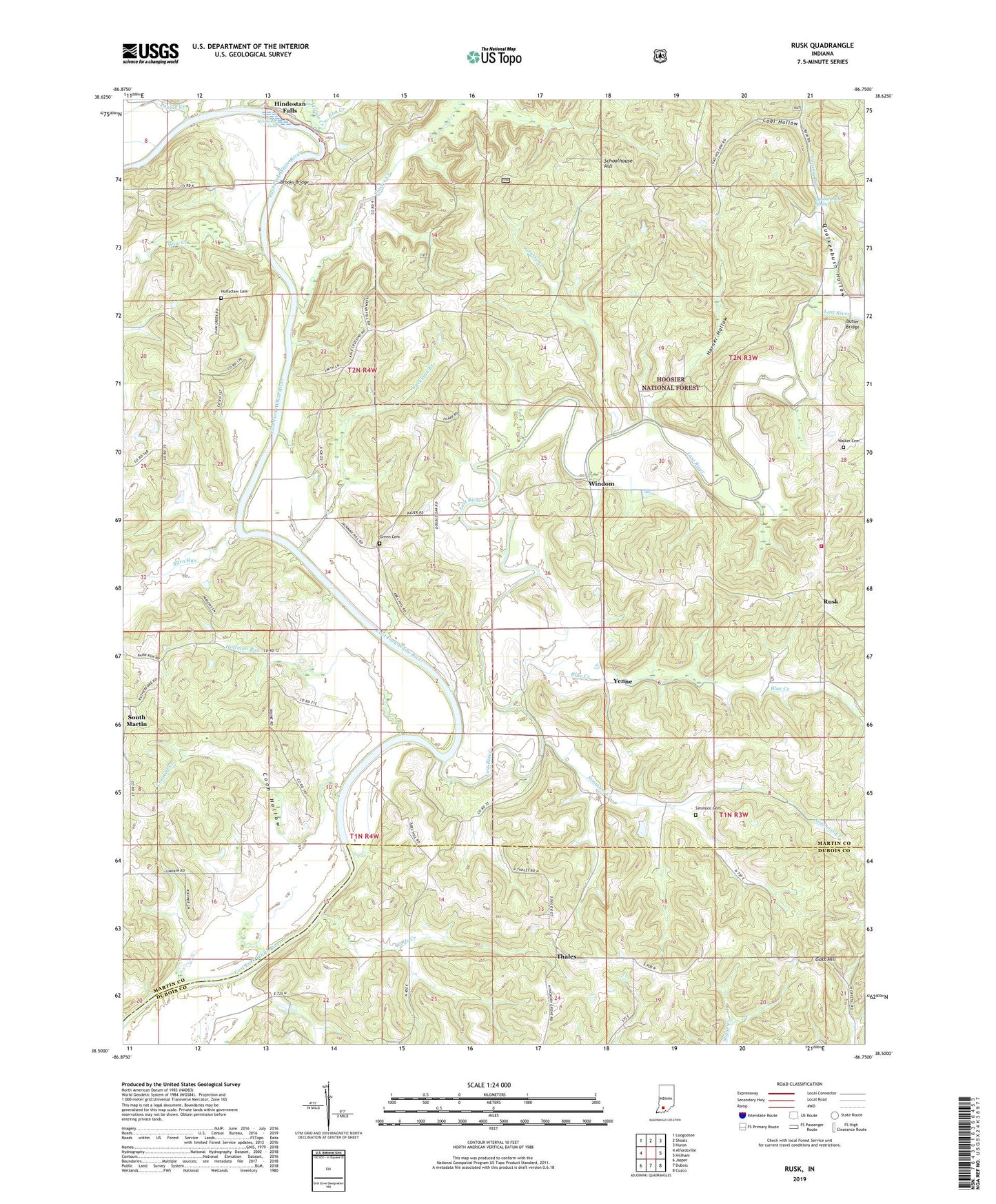
Rusk Indiana US Topo Map
Couldn't load pickup availability
Also explore the Rusk Forest Service Topo of this same quad for updated USFS data
2022 topographic map quadrangle Rusk in the state of Indiana. Scale: 1:24000. Based on the newly updated USGS 7.5' US Topo map series, this map is in the following counties: Martin, Dubois. The map contains contour data, water features, and other items you are used to seeing on USGS maps, but also has updated roads and other features. This is the next generation of topographic maps. Printed on high-quality waterproof paper with UV fade-resistant inks.
Quads adjacent to this one:
West: Alfordsville
Northwest: Loogootee
North: Shoals
Northeast: Huron
East: Hillham
Southeast: Cuzco
South: Dubois
Southwest: Jasper
This map covers the same area as the classic USGS quad with code o38086e7.
Contains the following named places: Barn Run, Bateman School, Blue Creek, Brooks Bridge, Butler Bridge, Coal Hollow, Coon Hollow, Crooked Creek, Elm Creek, Fairview Church, Goss Hill, Grassy Creek, Green Cemetery, Harner Hollow, Haw Creek, Hickory Grove Church, Hindostan Falls, Hoffman Run, Holtsclaw Cemetery, Jackman Branch, Lost River, Lost River Volunteer Fire Department, Miller Fork, Plaster Creek, Poplar Creek, Qualkenbush Hollow, Qualkenbush Spring, Rusk, Schoolhouse Hill, Simmons Cemetery, Simmons Creek, South Martin, South Martin Church, Thales, Township of Lost River, Virginia Rill, Waggoner Chapel, Walker Cemetery, Willow Creek, Windom, Wolfe Creek, Yenne