MyTopo
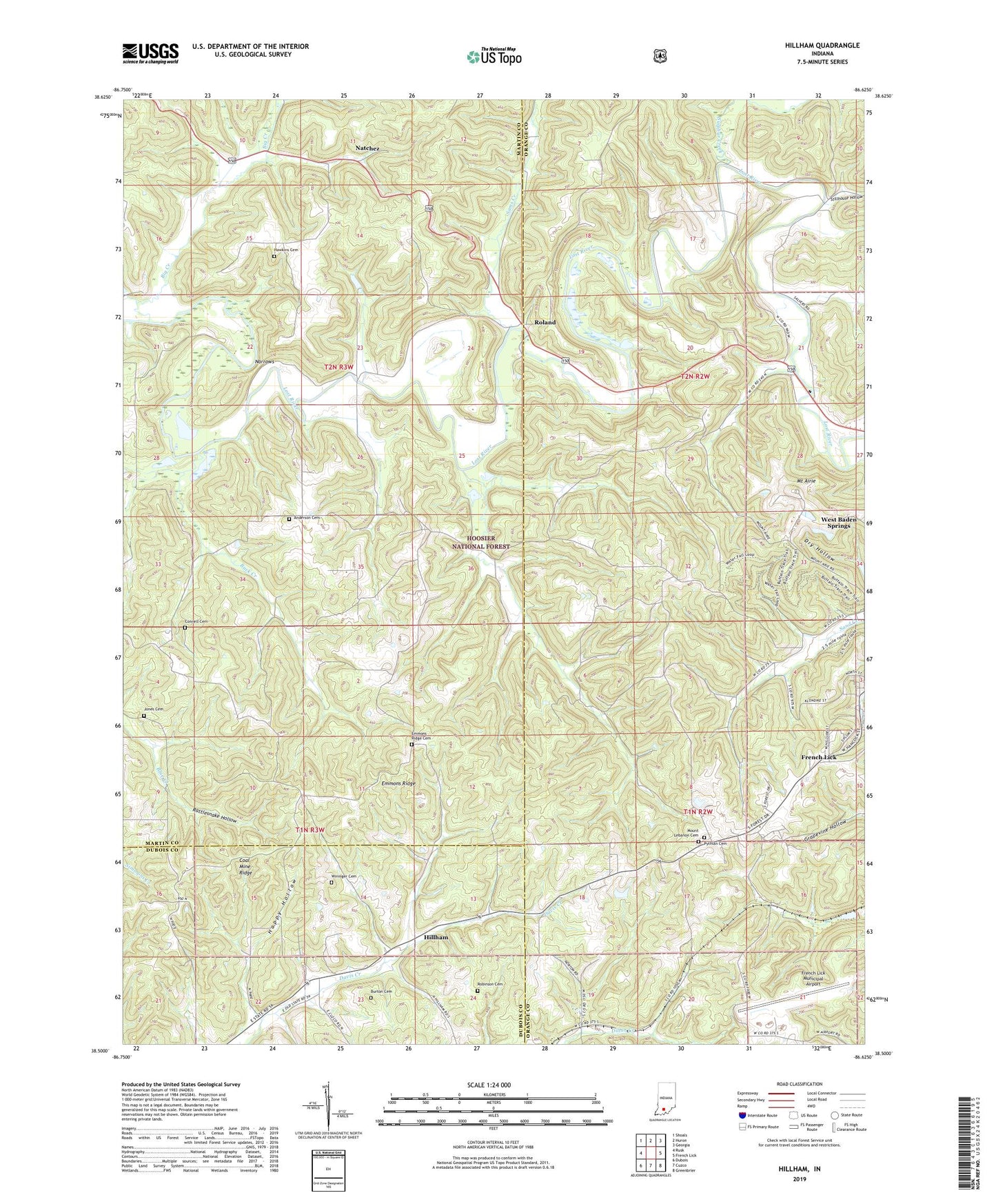
Hillham Indiana US Topo Map
Couldn't load pickup availability
Also explore the Hillham Forest Service Topo of this same quad for updated USFS data
2022 topographic map quadrangle Hillham in the state of Indiana. Scale: 1:24000. Based on the newly updated USGS 7.5' US Topo map series, this map is in the following counties: Orange, Martin, Dubois. The map contains contour data, water features, and other items you are used to seeing on USGS maps, but also has updated roads and other features. This is the next generation of topographic maps. Printed on high-quality waterproof paper with UV fade-resistant inks.
Quads adjacent to this one:
West: Rusk
Northwest: Shoals
North: Huron
Northeast: Georgia
East: French Lick
Southeast: Greenbrier
South: Cuzco
Southwest: Dubois
This map covers the same area as the classic USGS quad with code o38086e6.
Contains the following named places: Anderson Cemetery, Big Creek, Buck Creek, Burton Cemetery, Coal Mine Ridge, Connell Cemetery, Emmons Ridge, Emmons Ridge Cemetery, French Lick Dam Number F-2, French Lick Municipal Airport, Happy Hollow, Hawkins Cemetery, Highland Church, Hillham, Jones Cemetery, Mount Airie, Mount Lebanon Cemetery, Mount Lebanon Church, Narrows, Natchez, New Antioch Church, Nicholson Valley Church, Powell Valley Church, Pythian Cemetery, Rattlesnake Hollow, Red Quarry Church, Robinson Cemetery, Roland, Sams Creek, Stillhouse Hollow, Sulphur Creek, Wininger Cemetery