MyTopo
Dugger Indiana US Topo Map
Couldn't load pickup availability
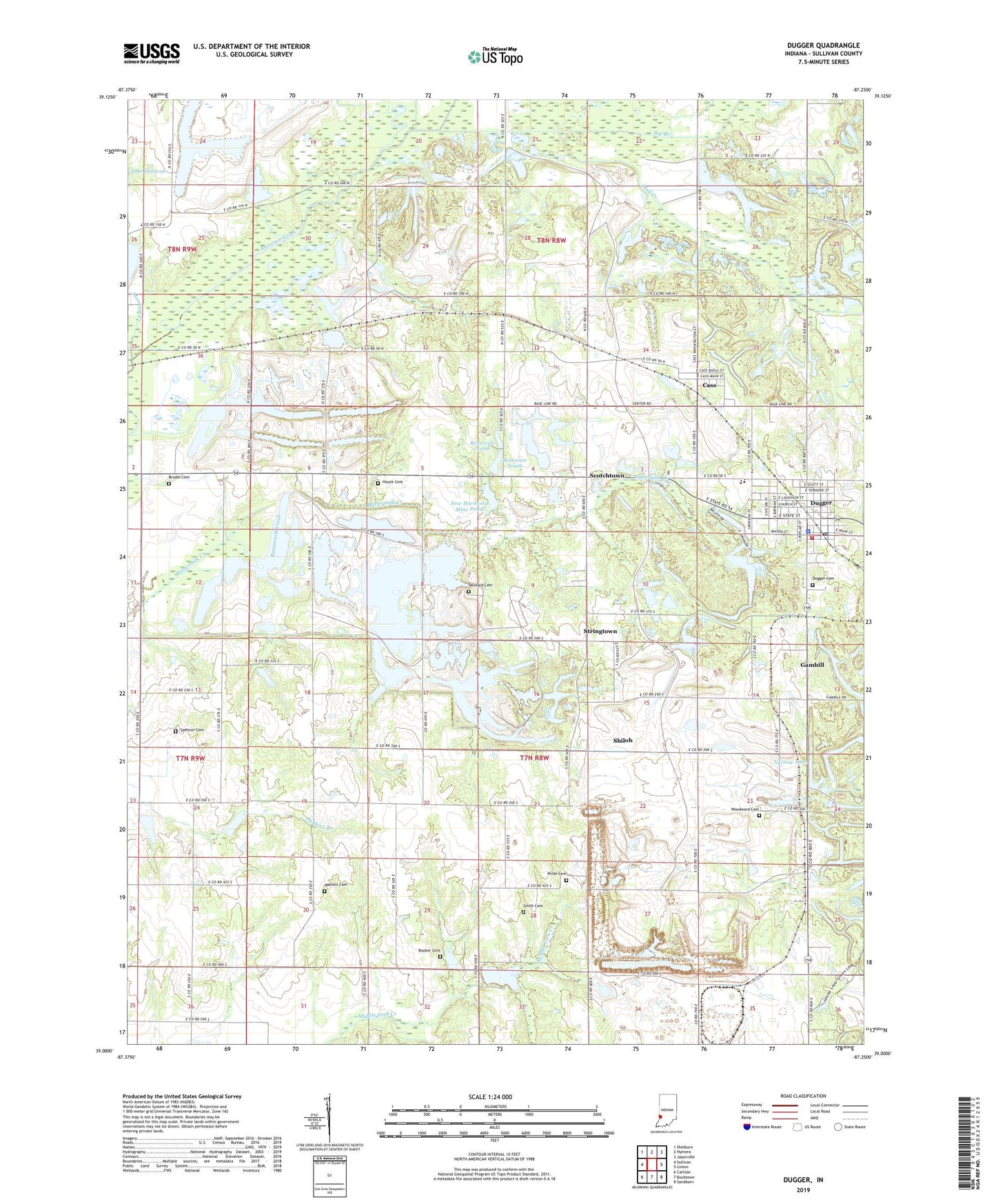
2022 topographic map quadrangle Dugger in the state of Indiana. Scale: 1:24000. Based on the newly updated USGS 7.5' US Topo map series, this map is in the following counties: Sullivan. The map contains contour data, water features, and other items you are used to seeing on USGS maps, but also has updated roads and other features. This is the next generation of topographic maps. Printed on high-quality waterproof paper with UV fade-resistant inks.
Quads adjacent to this one:
West: Sullivan
Northwest: Shelburn
North: Hymera
Northeast: Jasonville
East: Linton
Southeast: Sandborn
South: Bucktown
Southwest: Carlisle
This map covers the same area as the classic USGS quad with code o39087a3.
Contains the following named places: Berea Church, Big Branch, Booker Cemetery, Brodie Cemetery, Busseron Dam Number B-2, Caledonia, Cass, Clayton Cemeteries, Deckard Cemetery, Dugger, Dugger Cemetery, Dugger Elementary School, Dugger Police Department, Dugger Post Office, Farnsworth, Gambill, Hickory Church, Houck Cemetery, Jericho, Kettle Creek, Long Chapel, Morrison Creek, Mount Calvary Church, Mud Creek, Narrow Lake, New Harmony Mine Pond, Pirtle Cemetery, Reservoir North, Reservoir South, Scotchtown, Shiloh, Shiloh Church, Smith Cemetery, Spencer Cemetery, Stringtown, Sullivan County Park, T Lake, Town of Dugger, Township of Cass, Union Fire Territory, Union High School, Walters Cemetery, Woodward Cemetery, ZIP Code: 47848