MyTopo
Linton Indiana US Topo Map
Couldn't load pickup availability
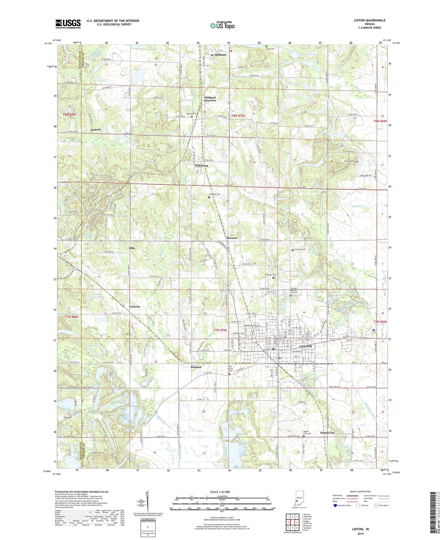
2022 topographic map quadrangle Linton in the state of Indiana. Scale: 1:24000. Based on the newly updated USGS 7.5' US Topo map series, this map is in the following counties: Greene, Sullivan. The map contains contour data, water features, and other items you are used to seeing on USGS maps, but also has updated roads and other features. This is the next generation of topographic maps. Printed on high-quality waterproof paper with UV fade-resistant inks.
Quads adjacent to this one:
West: Dugger
Northwest: Hymera
North: Jasonville
Northeast: Coal City
East: Switz City
Southeast: Lyons
South: Sandborn
Southwest: Bucktown
This map covers the same area as the classic USGS quad with code o39087a2.
Contains the following named places: Antioch, Antioch Church, Bethel Cemetery, Boy Scout Pond, City of Linton, Clayton Cemetery, County Line Lake, Ellis, Ellis Church, Embury Church, Fairview Cemetery, Frye Cemetery, German Memory Hill Cemetery, Greene County General Hospital, Hale Cemetery, Harmons Lake, Historical Marker USA Center of Population, Hoosier, Humphrey Park, Island City, Island City Cemetery, Linton, Linton Fire Department, Linton Police Department, Linton Post Office, Linton-Stockton High School, Linton-Stockton Junior High School, Midland, Midland Junction, Midland Post Office, Morris Chapel, Old Linton Cemetery, Olive Branch Church, Reservoir Number Twenty-nine, Reservoir Number Twenty-six, Richards Cemetery, Salem Church, Samaria Church, Sponsler, Summersville Church, Summit, Sunflower Pond, Terhune Cemetery, Township of Stockton, Vicksburg, Victoria, WBTO-AM (Linton), White Rose, Willow Slough, WQTY-FM (Linton), Wright Township Volunteer Fire Department, ZIP Code: 47441