MyTopo
Deerfield Indiana US Topo Map
Couldn't load pickup availability
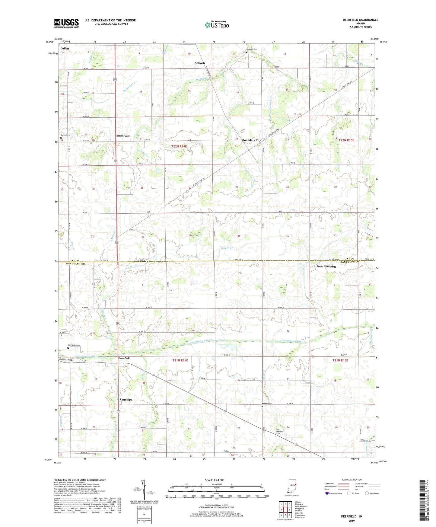
2022 topographic map quadrangle Deerfield in the state of Indiana. Scale: 1:24000. Based on the newly updated USGS 7.5' US Topo map series, this map is in the following counties: Randolph, Jay. The map contains contour data, water features, and other items you are used to seeing on USGS maps, but also has updated roads and other features. This is the next generation of topographic maps. Printed on high-quality waterproof paper with UV fade-resistant inks.
Quads adjacent to this one:
West: Ridgeville
Northwest: Blaine
North: Portland
Northeast: Fort Recovery
East: Cosmos
Southeast: Union City
South: Winchester
Southwest: Maxville
This map covers the same area as the classic USGS quad with code o40084c8.
Contains the following named places: Antioch, Bluff Point, Boundary City, Buckeye Creek, Clear Creek, Deerfield, Flyin S Ranch, Goshen Creek, Harshman Creek, Hawkins Cemetery, Kunce Cemetery, Lawndale Cemetery, Miller Creek, Mud Creek, New Pittsburg, O'Brien Creek, Old Prospect Cemetery, Porter Creek, R and R Hog Farms, Randolph, Reitenour Cemetery, Township of Pike, Township of Ward, Weimer Cemetery, Woodbury Farms, Zoar Church