MyTopo
Wyatt Indiana US Topo Map
Couldn't load pickup availability
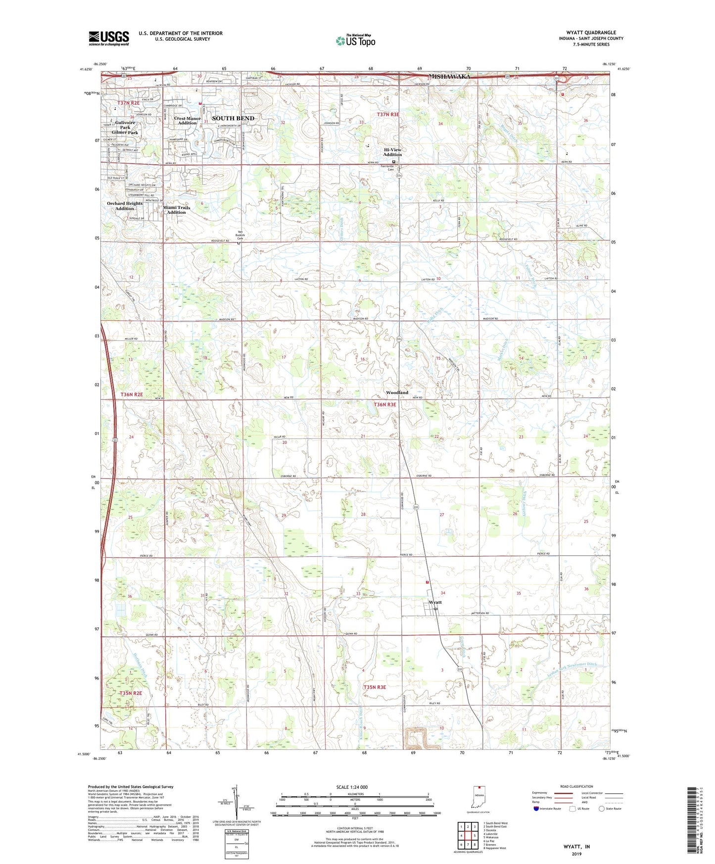
2022 topographic map quadrangle Wyatt in the state of Indiana. Scale: 1:24000. Based on the newly updated USGS 7.5' US Topo map series, this map is in the following counties: St. Joseph. The map contains contour data, water features, and other items you are used to seeing on USGS maps, but also has updated roads and other features. This is the next generation of topographic maps. Printed on high-quality waterproof paper with UV fade-resistant inks.
Quads adjacent to this one:
West: Lakeville
Northwest: South Bend West
North: South Bend East
Northeast: Osceola
East: Wakarusa
Southeast: Nappanee West
South: Bremen
Southwest: La Paz
This map covers the same area as the classic USGS quad with code o41086e2.
Contains the following named places: Anthony Ditch, Clearview Farms, Coalbush Church, Crest Manor Addition, Ferrisville Cemetery, Forest G Hay Elementary School, Freehauf Farm, Fulmer Ditch, Good Brothers Farm, Grimes Ditch, Gross Ditch, Gulivoire Park, Gulivoire Park Census Designated Place, Hi-View Addition, Hoffman Ditch, J and J Dairy Farm, Kline-Rouch Ditch, Ladig Ditch, Lateral Number Five Ditch, Leman Birk Newcomer Ditch, Madison Township Volunteer Fire Department, Marker Ditch, Miami Trails Addition, Midway Corners, Orchard Heights Addition, Penn Township Fire Department Station 14, Saint Johns Church, Saint Pauls Church, Schlarb Farm, Schmidt Farms, Sha - Ron Farm, South Bend Fire Department Station 10, Stoller Nursery, Tamarack Grange, Township of Madison, Union Church, Van Buskirk Cemetery, West York Post Office, WNDU-TV (South Bend), Woodland, WSBT-AM (South Bend), WSBT-TV (South Bend), WSJV-TV (Elkhart), WVPE-FM (Elkhart), Wyatt, Wyatt Post Office, ZIP Codes: 46544, 46595