MyTopo
Wakarusa Indiana US Topo Map
Couldn't load pickup availability
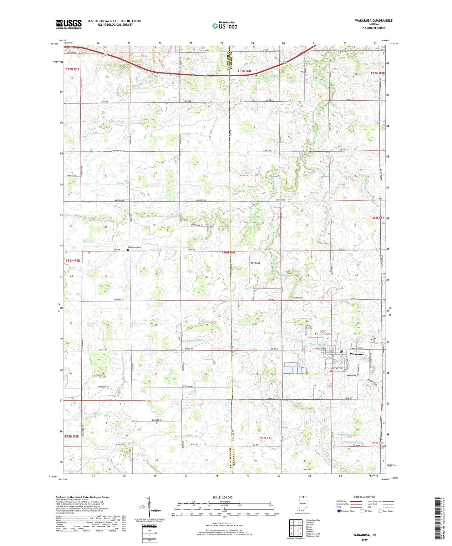
2022 topographic map quadrangle Wakarusa in the state of Indiana. Scale: 1:24000. Based on the newly updated USGS 7.5' US Topo map series, this map is in the following counties: Elkhart, St. Joseph. The map contains contour data, water features, and other items you are used to seeing on USGS maps, but also has updated roads and other features. This is the next generation of topographic maps. Printed on high-quality waterproof paper with UV fade-resistant inks.
Quads adjacent to this one:
West: Wyatt
Northwest: South Bend East
North: Osceola
Northeast: Elkhart
East: Foraker
Southeast: Nappanee East
South: Nappanee West
Southwest: Bremen
This map covers the same area as the classic USGS quad with code o41086e1.
Contains the following named places: Barkey Ditch, Billman Ditch, Christophel Ditch, Eby Field, Holdeman Church, Holderman Ditch, Lateral Number Fifteen Ditch, Lateral Number Five, Little Bingo Creek, Louck Ditch, Madison Union Church, Miller Ditch, North Union Church, Nunemaker Ditch, Olive Church, Phelps Farms, Pittman Gordon Ditch, Pletcher Cemetery, Resthaven Cemetery, Rogers Ditch, Roner School, Shutts Cemetery, Tamarack Church, Town of Wakarusa, Township Ditch, Township of Olive, Wakarusa, Wakarusa Ambulance Department, Wakarusa Elementary and Middle School, Wakarusa Fire Department, Wakarusa Police Department, Wakarusa Post Office, Werntz Ditch, Zion Church, ZIP Code: 46573