MyTopo
Clarinda South Iowa US Topo Map
Couldn't load pickup availability
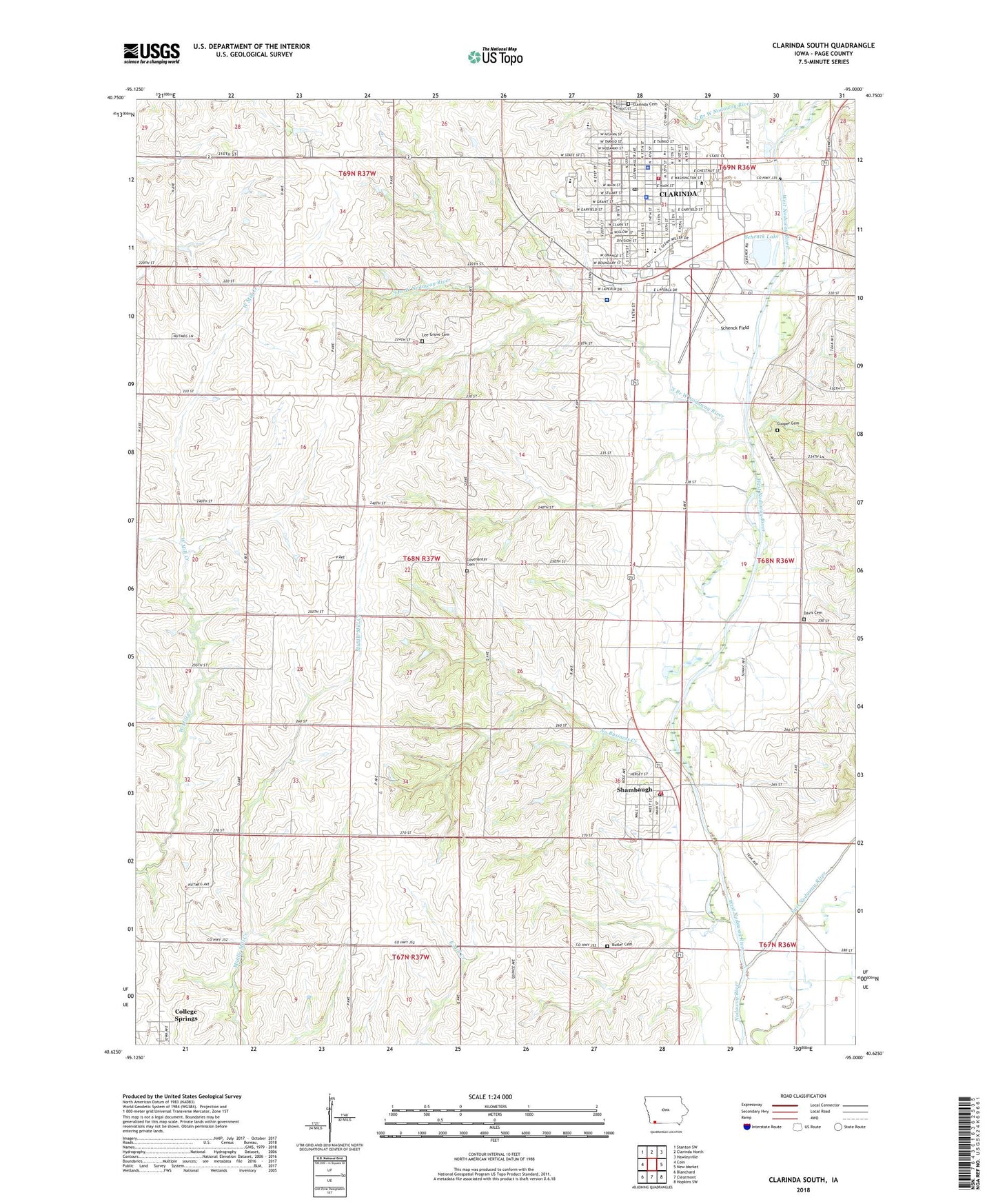
2022 topographic map quadrangle Clarinda South in the state of Iowa. Scale: 1:24000. Based on the newly updated USGS 7.5' US Topo map series, this map is in the following counties: Page. The map contains contour data, water features, and other items you are used to seeing on USGS maps, but also has updated roads and other features. This is the next generation of topographic maps. Printed on high-quality waterproof paper with UV fade-resistant inks.
Quads adjacent to this one:
West: Coin
Northwest: Stanton SW
North: Clarinda North
Northeast: Hawleyville
East: New Market
Southeast: Hopkins SW
South: Clearmont
Southwest: Blanchard
This map covers the same area as the classic USGS quad with code o40095f1.
Contains the following named places: Alternative High School Clarinda Community School, Butler Cemetery, Calvary Baptist Church, Church of Christ, Church of God, Church of the Nazarene, City of Clarinda, City of Shambaugh, Clarinda, Clarinda Cemetery, Clarinda City Hall, Clarinda City Park, Clarinda Family Practice Clinic, Clarinda Fire Department, Clarinda Free Methodist Church, Clarinda High School, Clarinda Lutheran School, Clarinda Middle School, Clarinda Police Department, Clarinda Post Office, Clarinda Public Library, Clarinda Regional Health Center, Clarinda Water Filter Plant, Cooper Cemetery, Covenanter Cemetery, Covenanter Church, Davis Cemetery, East Nodaway River, Edith Lisle Library, Fairview Church of Christ, First Assembly of God Church, First Baptist Church, First Christian Church, First United Methodist Church, Foster Park, Garfield Elementary School, Glenn Miller Birthplace Home, Goldenrod Manor Nursing Home, Goldenrod School, Harvest Fellowship Church, Hillside Missionary Church, Iowa Western Community College - Clarinda Center, Jessie Field Shambaugh State Historical Marker, Lee Grove Cemetery, No Business Creek, Nodaway Mills Post Office, Nodaway Valley Historical Museum, North Branch West Nodaway River, Page County 4-H Fairgrounds, Page County Care Facility, Page County Courthouse, Page County Jail, Page County Sheriff's Office, Saint Clare Catholic Church, Saint Johns Lutheran Church, Saint Josephs Catholic Church, Saint Pauls Lutheran Church, Schenck Field, Schenck Lake, Schenck Landing Strip, Shambaugh, Shambaugh Church of God, Shambaugh Post Office, Shambaugh Volunteer Fire Department, Site of First School Building in Clarinda Historical Marker, South Branch West Nodaway River, Thomas Ditch, Township of Harlan, Tribute to Glenn Miller Historical Marker, Trinity Presbyterian Church, Washington East Chiropractic Center, West Nodaway River, Westminster Presbyterian Church, ZIP Code: 51632