MyTopo
Loring Iowa US Topo Map
Couldn't load pickup availability
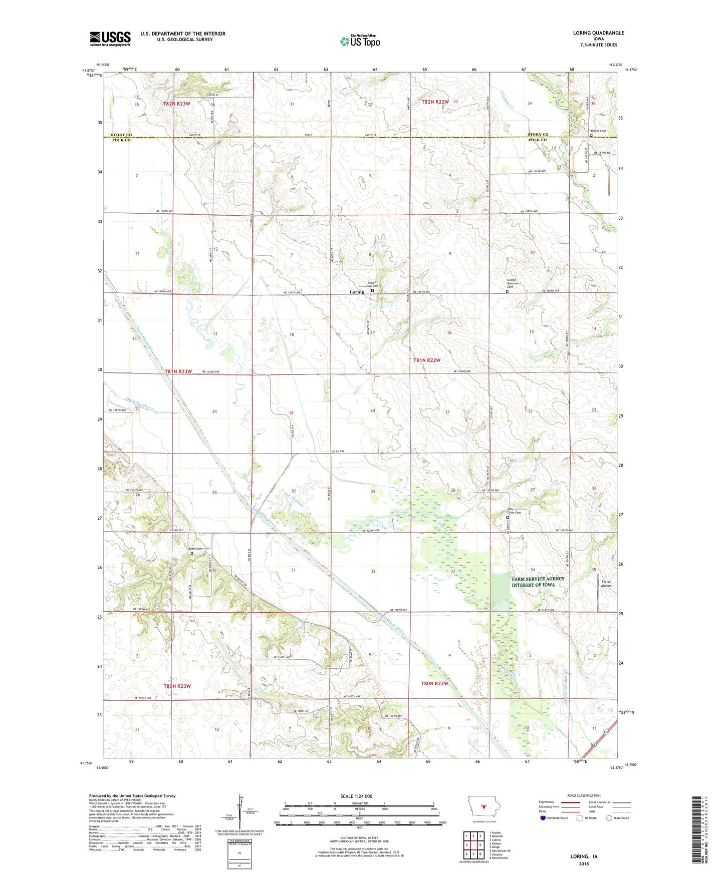
2022 topographic map quadrangle Loring in the state of Iowa. Scale: 1:24000. Based on the newly updated USGS 7.5' US Topo map series, this map is in the following counties: Polk, Story. The map contains contour data, water features, and other items you are used to seeing on USGS maps, but also has updated roads and other features. This is the next generation of topographic maps. Printed on high-quality waterproof paper with UV fade-resistant inks.
Quads adjacent to this one:
West: Elkhart
Northwest: Huxley
North: Maxwell
Northeast: Collins
East: Mingo
Southeast: Mitchellville
South: Altoona
Southwest: Des Moines NE
This map covers the same area as the classic USGS quad with code o41093g4.
Contains the following named places: Byers Cemetery, Calamus Creek, Chichaqua Wildlife Habitat Park, Church of the Brethren Cemetery, Cory Grove Church, Ditch Number 11, Ditch Number 4, Farrar Airport, Holy Cross Cemetery, Holy Cross Church, Loring, Loring Post Office, Mount Zion Cemetery, North Polk Landing Strip, Old Channel, Oldfield, Oldfield Post Office, Peoria Cemetery, Tibbitt Post Office, Township of Washington, Woodland Lake, Woodland Lake Dam, ZIP Code: 50161