MyTopo
Maxwell Iowa US Topo Map
Couldn't load pickup availability
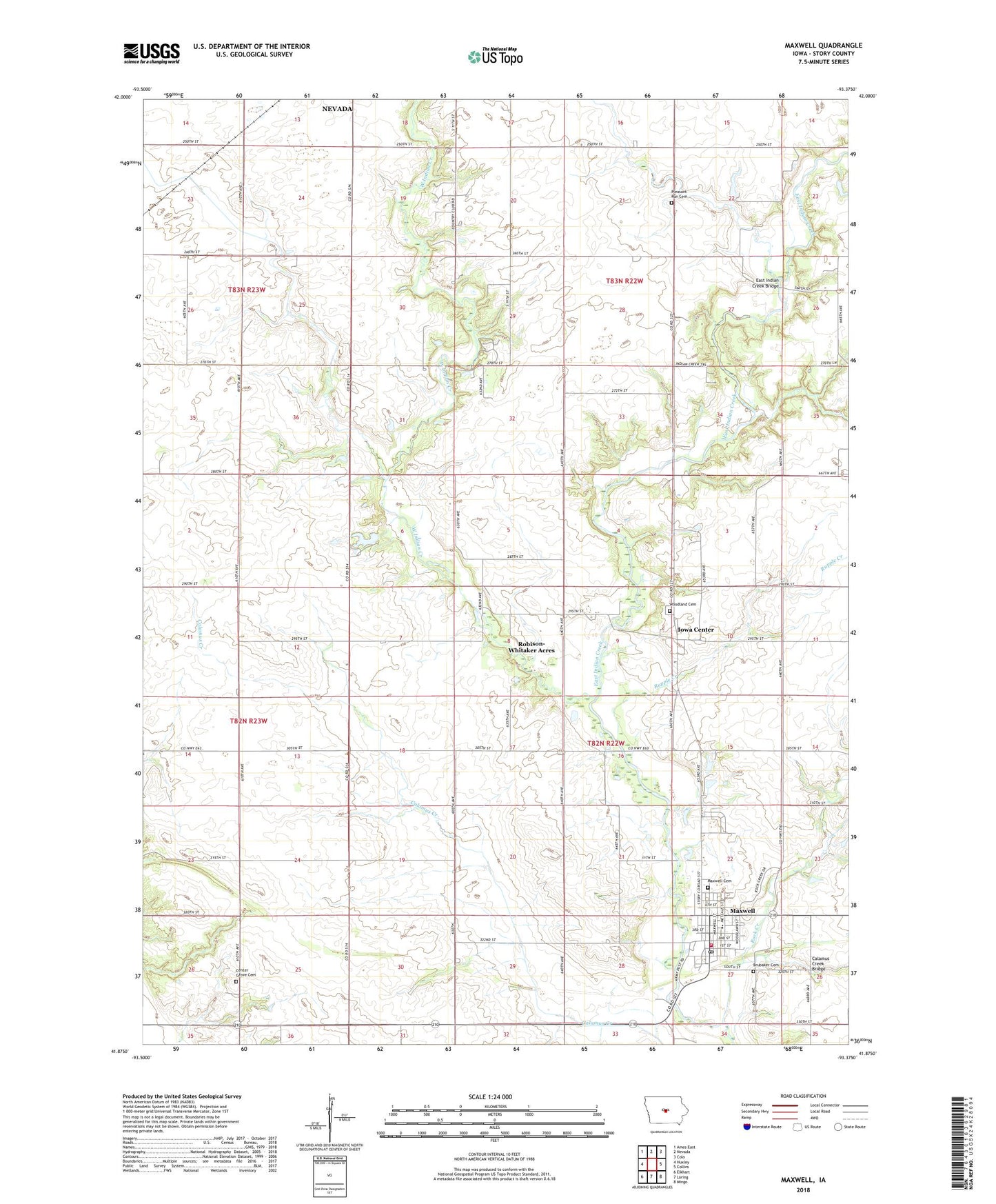
2022 topographic map quadrangle Maxwell in the state of Iowa. Scale: 1:24000. Based on the newly updated USGS 7.5' US Topo map series, this map is in the following counties: Story. The map contains contour data, water features, and other items you are used to seeing on USGS maps, but also has updated roads and other features. This is the next generation of topographic maps. Printed on high-quality waterproof paper with UV fade-resistant inks.
Quads adjacent to this one:
West: Huxley
Northwest: Ames East
North: Nevada
Northeast: Colo
East: Collins
Southeast: Mingo
South: Loring
Southwest: Elkhart
This map covers the same area as the classic USGS quad with code o41093h4.
Contains the following named places: Brethren Church, Brubaker Cemetery, Calamus Creek Bridge, Center Grove Cemetery, Christian Church, City of Maxwell, Collins - Maxwell Middle / High School, Community Historical Society Museum, East Indian Creek, East Indian Creek Bridge, Elwell, Elwell Post Office, Farmers Elevator Company Elevator, First Presbyterian Church, Indian Creek Country Club, Iowa Center, Iowa Center Post Office, Maxwell, Maxwell Cemetery, Maxwell City Hall, Maxwell City Park, Maxwell First Responders, Maxwell Medical Clinic, Maxwell Post Office, Maxwell Public Library, Maxwell Volunteer Fire Department, Pleasant Run Cemetery, Robison-Whitaker Acres, Rock Creek, Rolling Hills Mobile Home Park, Rupple Creek, Township of Indian Creek, Township of Nevada, United Methodist Church, West Indian Creek, Woodland Cemetery