MyTopo
Harpers Ferry Iowa US Topo Map
Couldn't load pickup availability
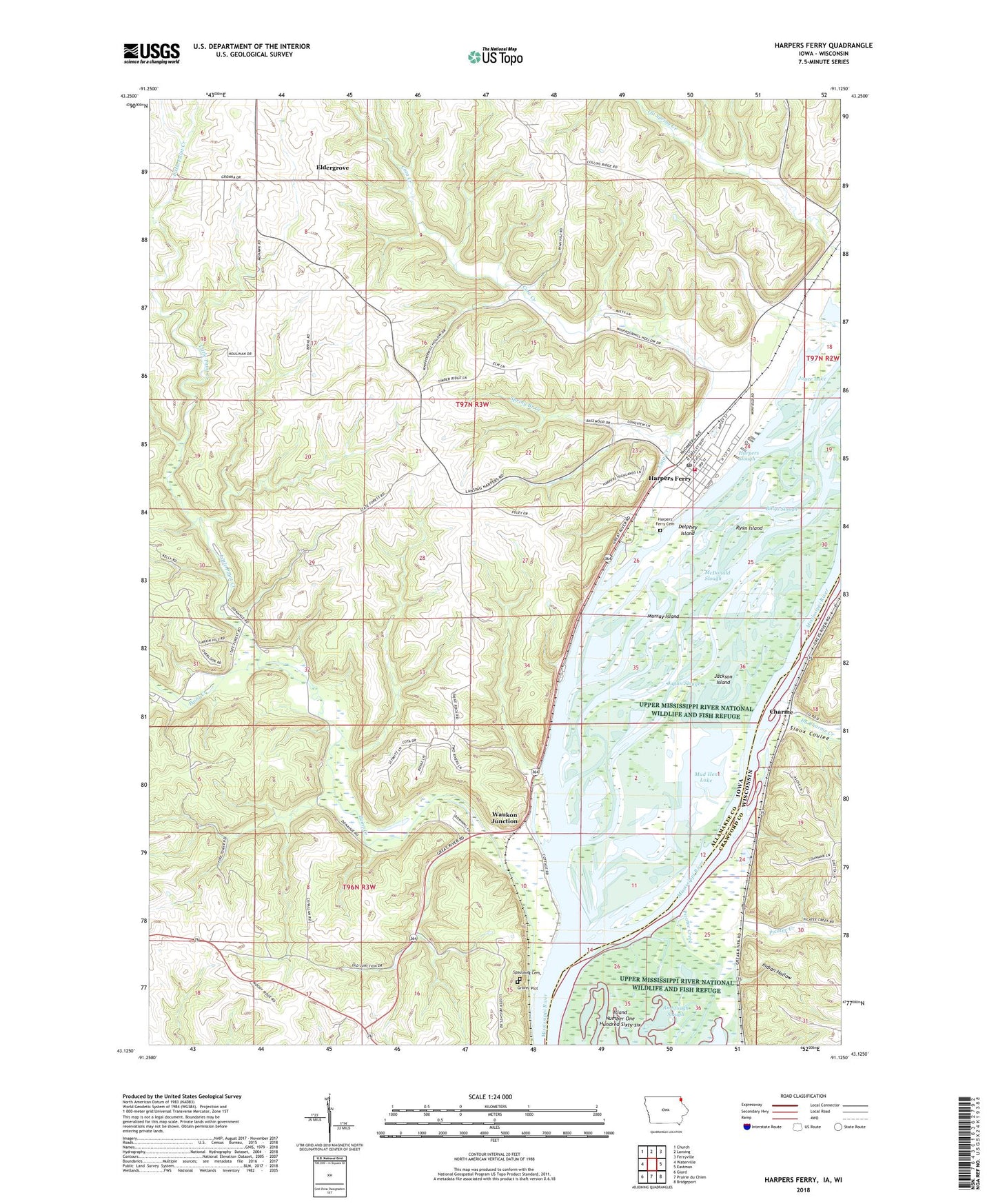
2022 topographic map quadrangle Harpers Ferry in the states of Iowa, Wisconsin. Scale: 1:24000. Based on the newly updated USGS 7.5' US Topo map series, this map is in the following counties: Allamakee, Crawford. The map contains contour data, water features, and other items you are used to seeing on USGS maps, but also has updated roads and other features. This is the next generation of topographic maps. Printed on high-quality waterproof paper with UV fade-resistant inks.
Quads adjacent to this one:
West: Waterville
Northwest: Church
North: Lansing
Northeast: Ferryville
East: Eastman
Southeast: Bridgeport
South: Prairie du Chien
Southwest: Giard
Contains the following named places: Allamakee Post Office, Andy Mountain Campground, Big Missouri Lake, Billys Slough, Charme, City of Harpers Ferry, Cota Creek, Delphey Island, Du Charme Creek, Eldergrove, Eldergrove Post Office, Grover Plot, Gun Lake, Harpers Ferry, Harpers Ferry Bluffview, Harpers Ferry City Library, Harpers Ferry City Park, Harpers Ferry Post Office, Harpers Ferry Rescue Squad, Harpers Ferry Volunteer Fire Department, Harpers Slough, Indian Hollow, Jackson Island, Japan Slough, Johnsons Port, Joyce Lake, Lark Post Office, Little Paint Creek, Little Paint Creek Public Hunting Area, Luster Heights Work Camp, Martelle Lake, McDonald Slough, Mud Hen Lake, Mud Hen Lake Wildlife Management Area, Murray Island, Nobles Island, Off Slough, Paint Creek, Picatee Creek, Ryan Island, Sandy Point Cemetery, Sioux Coulee, Springs Branch Creek, Taylor Lakes, Township of Taylor, Waukon Junction, Waukon Junction Post Office, Waukon Junction Wildlife Management Area, Willsons Ford Post Office, Yellow River State Forest, Yellow River State Forest Trail, ZIP Code: 52146