MyTopo
Clarinda North Iowa US Topo Map
Couldn't load pickup availability
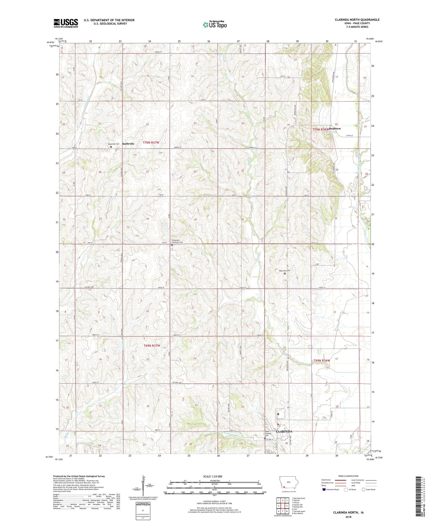
2022 topographic map quadrangle Clarinda North in the state of Iowa. Scale: 1:24000. Based on the newly updated USGS 7.5' US Topo map series, this map is in the following counties: Page. The map contains contour data, water features, and other items you are used to seeing on USGS maps, but also has updated roads and other features. This is the next generation of topographic maps. Printed on high-quality waterproof paper with UV fade-resistant inks.
Quads adjacent to this one:
West: Stanton SW
Northwest: Red Oak South
North: Stanton
Northeast: Villisca
East: Hawleyville
Southeast: New Market
South: Clarinda South
Southwest: Coin
This map covers the same area as the classic USGS quad with code o40095g1.
Contains the following named places: Bethesda, Bethesda Cemetery, Bethesda Lutheran Church, Bethesda Post Office, City of Hepburn, Clarinda Academy, Clarinda Correctional Facility, Clarinda Country Club, Clarinda Mental Health Institute, Clarinda Mental Health Institute Cemetery, Clarinda Treatment Complex Fire Department, Clarinda Treatment Complex Museum, Ditch Number 10, Hepburn, Hepburn Post Office, Immanual Lutheran Cemetery, Immanuel Lutheran Church, Immanuel School, KQIS-FM (Clarinda), Meade Post Office, Rose Hill Cemetery, Rose Hill Church, Stephens Tract Wildlife Area, Township of Douglas, Township of Nodaway, Wolf Run