MyTopo
Stanton Iowa US Topo Map
Couldn't load pickup availability
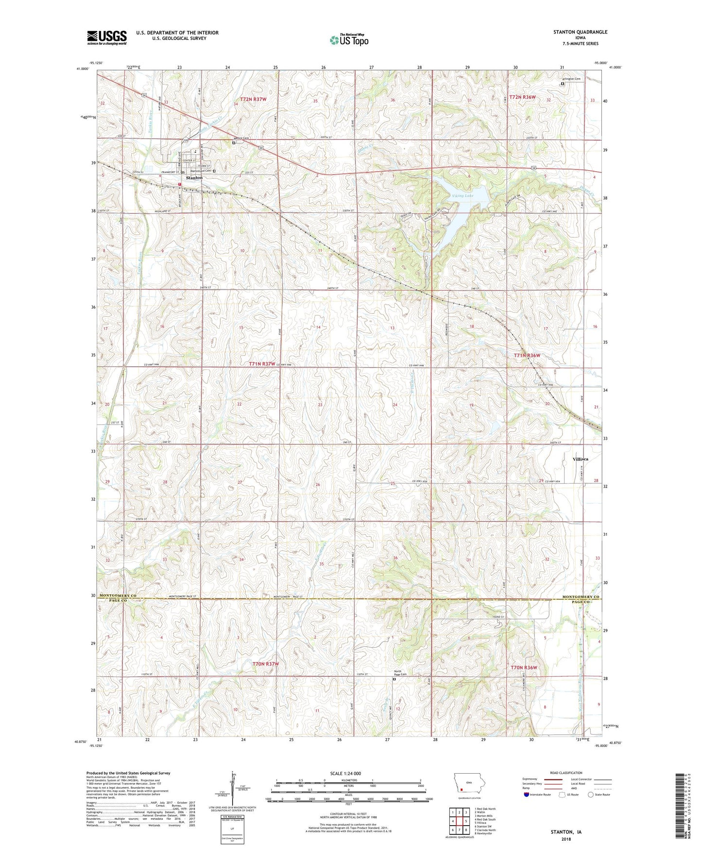
2022 topographic map quadrangle Stanton in the state of Iowa. Scale: 1:24000. Based on the newly updated USGS 7.5' US Topo map series, this map is in the following counties: Montgomery, Page. The map contains contour data, water features, and other items you are used to seeing on USGS maps, but also has updated roads and other features. This is the next generation of topographic maps. Printed on high-quality waterproof paper with UV fade-resistant inks.
Quads adjacent to this one:
West: Red Oak South
Northwest: Red Oak North
North: Wallin
Northeast: Morton Mills
East: Villisca
Southeast: Hawleyville
South: Clarinda North
Southwest: Stanton SW
This map covers the same area as the classic USGS quad with code o40095h1.
Contains the following named places: Anderson Park, Arlington Cemetery, City of Stanton, Clarinda Junction, Erickson Prairie, Evangelical Covenant Church, Little Tarkio Creek, Mamre Cemetery, Mamrelund Cemetery, Mamrelund Lutheran Church, North Page Cemetery, Stanton, Stanton Care Center, Stanton Community Library, Stanton Elementary School, Stanton Fire Department, Stanton Middle / High School, Stanton Post Office, Swedish Heritage and Cultural Center, Township of Scott, United Farmers Mercantile Coop Elevator, Viking Lake, Viking Lake State Park, ZIP Code: 51573