MyTopo
Colo Iowa US Topo Map
Couldn't load pickup availability
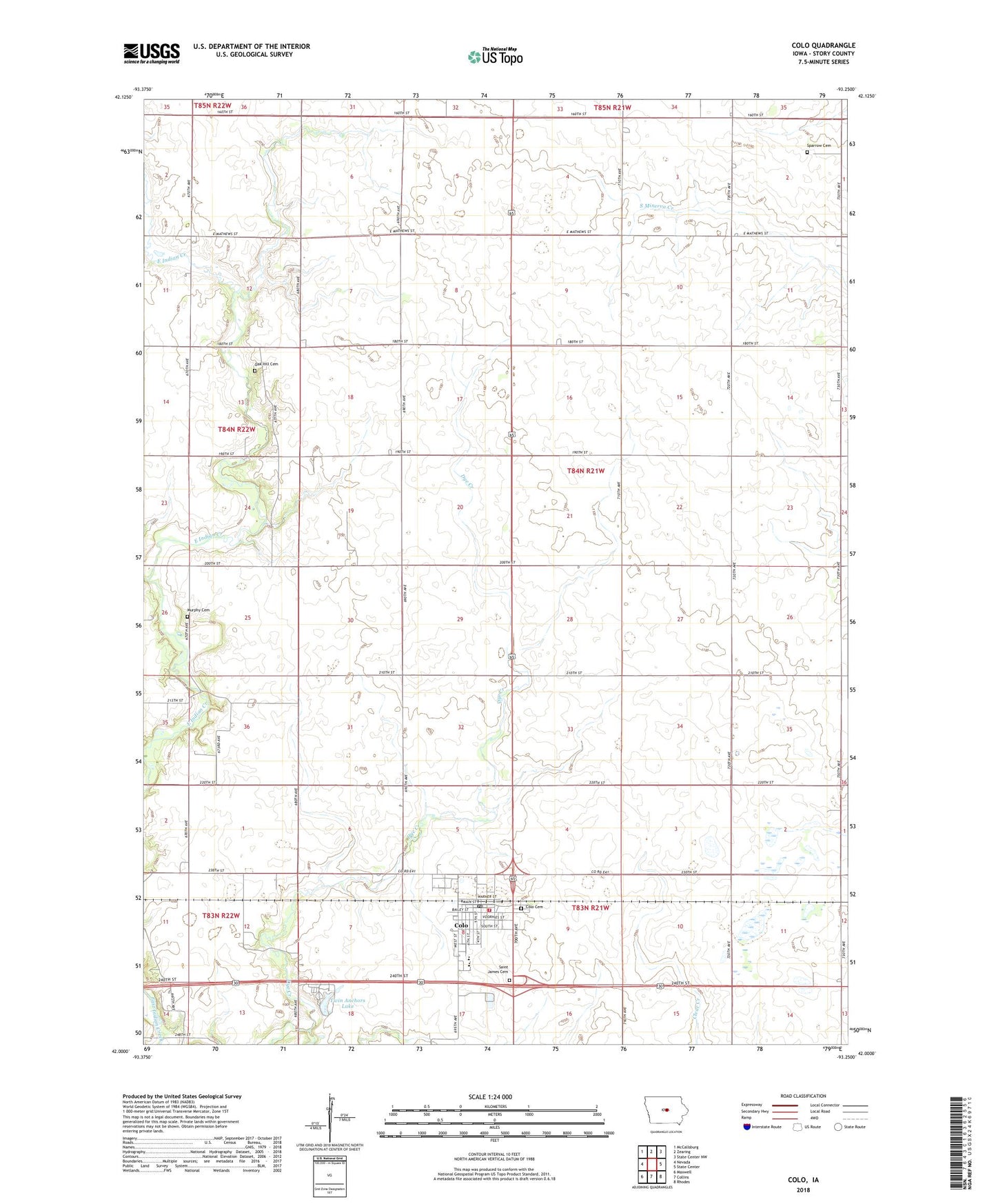
2022 topographic map quadrangle Colo in the state of Iowa. Scale: 1:24000. Based on the newly updated USGS 7.5' US Topo map series, this map is in the following counties: Story. The map contains contour data, water features, and other items you are used to seeing on USGS maps, but also has updated roads and other features. This is the next generation of topographic maps. Printed on high-quality waterproof paper with UV fade-resistant inks.
Quads adjacent to this one:
West: Nevada
Northwest: McCallsburg
North: Zearing
Northeast: State Center NW
East: State Center
Southeast: Rhodes
South: Collins
Southwest: Maxwell
This map covers the same area as the classic USGS quad with code o42093a3.
Contains the following named places: City of Colo, Colo, Colo - NESCO Junior / Senior High School, Colo - NESCO South Learning Center, Colo Cemetery, Colo Fire and Rescue, Colo Post Office, Johnsons Grove Post Office, Murphy Cemetery, Oak Hill Cemetery, Saint James Cemetery, Sherman Townhall, Sparrow Cemetery, Township of Sherman, Twin Acres Lake Dam, Twin Anchors Campground, Twin Anchors Lake, ZIP Code: 50056