MyTopo
Nevada Iowa US Topo Map
Couldn't load pickup availability
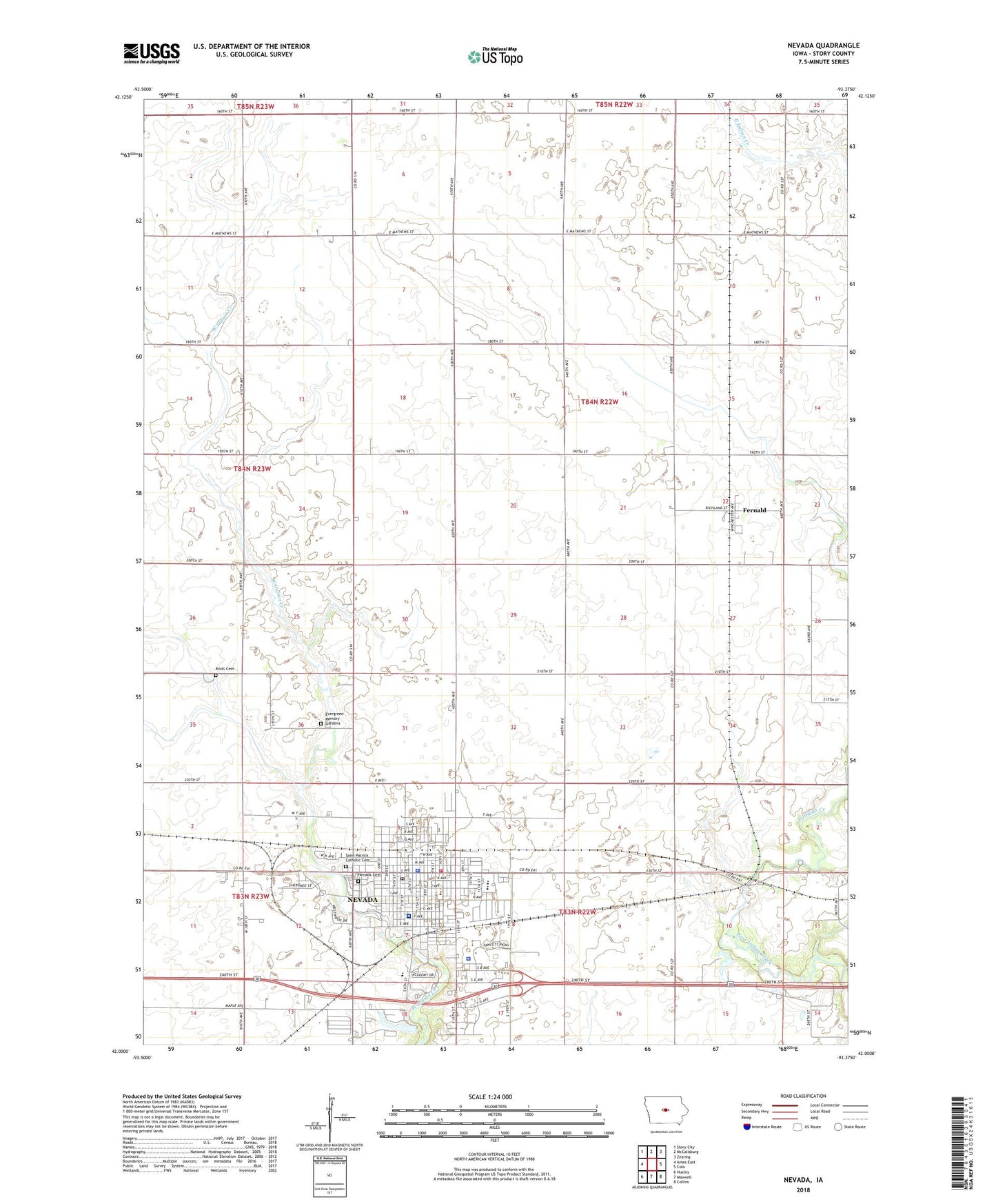
2022 topographic map quadrangle Nevada in the state of Iowa. Scale: 1:24000. Based on the newly updated USGS 7.5' US Topo map series, this map is in the following counties: Story. The map contains contour data, water features, and other items you are used to seeing on USGS maps, but also has updated roads and other features. This is the next generation of topographic maps. Printed on high-quality waterproof paper with UV fade-resistant inks.
Quads adjacent to this one:
West: Ames East
Northwest: Story City
North: McCallsburg
Northeast: Zearing
East: Colo
Southeast: Collins
South: Maxwell
Southwest: Huxley
This map covers the same area as the classic USGS quad with code o42093a4.
Contains the following named places: 4-H Park, 50201, Assembly of God Church, Bonthala Clinic, Central Elementary School, Central Presbyterian Church, Christian Church, City of Nevada, Community Evangelical Free Church, Evergreen Memory Gardens Cemetery, Fernald, Fernald Post Office, Harrington Park, Hattery Park, Kiwanis Park, Knoll Cemetery, Mardean Park, McFarland Clinic, Memorial Lutheran Church, Nevada, Nevada Back and Neck Care Center, Nevada Baptist Church, Nevada Cemetery, Nevada Fire Department, Nevada First Responders, Nevada High School, Nevada Middle School, Nevada Municipal Airport, Nevada Police Department, Nevada Post Office, Nevada Public Library, Nevada Seventh-day Adventist School, North Park, Oak Park Academy, Paul Landing Strip, Saint Patrick's Catholic Church, Saint Patricks Cemetery, Sch Heliport, Seventh Day Adventist Church, Story County, Story County Courthouse, Story County Home, Story County Medical Center, Story County Sheriff's Office, Swanson Elevator, Township of Richland, United Methodist Church