MyTopo
Lafontaine Kansas US Topo Map
Couldn't load pickup availability
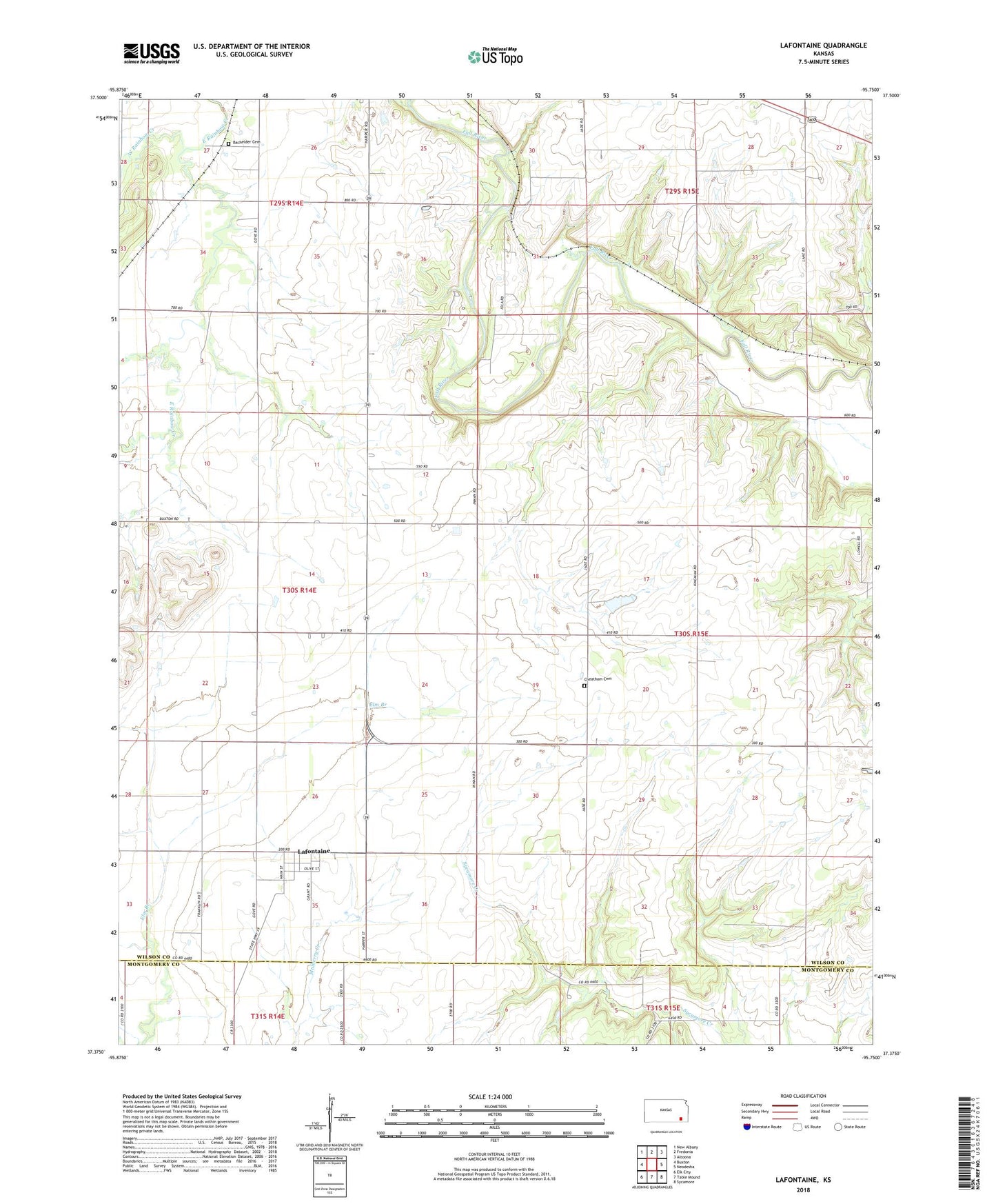
2022 topographic map quadrangle Lafontaine in the state of Kansas. Scale: 1:24000. Based on the newly updated USGS 7.5' US Topo map series, this map is in the following counties: Wilson, Montgomery. The map contains contour data, water features, and other items you are used to seeing on USGS maps, but also has updated roads and other features. This is the next generation of topographic maps. Printed on high-quality waterproof paper with UV fade-resistant inks.
Quads adjacent to this one:
West: Buxton
Northwest: New Albany
North: Fredonia
Northeast: Altoona
East: Neodesha
Southeast: Sycamore
South: Table Mound
Southwest: Elk City
This map covers the same area as the classic USGS quad with code o37095d7.
Contains the following named places: Bachelder Cemetery, Bell School, Camp Crawford, Cheatham Cemetery, Emmanuel Church of God in Christ Mennonite Church, Lafontaine, Lafontaine Census Designated Place, Lone Elm School, Township of Talleyrand, West Rainbow Creek