MyTopo
Fredonia Kansas US Topo Map
Couldn't load pickup availability
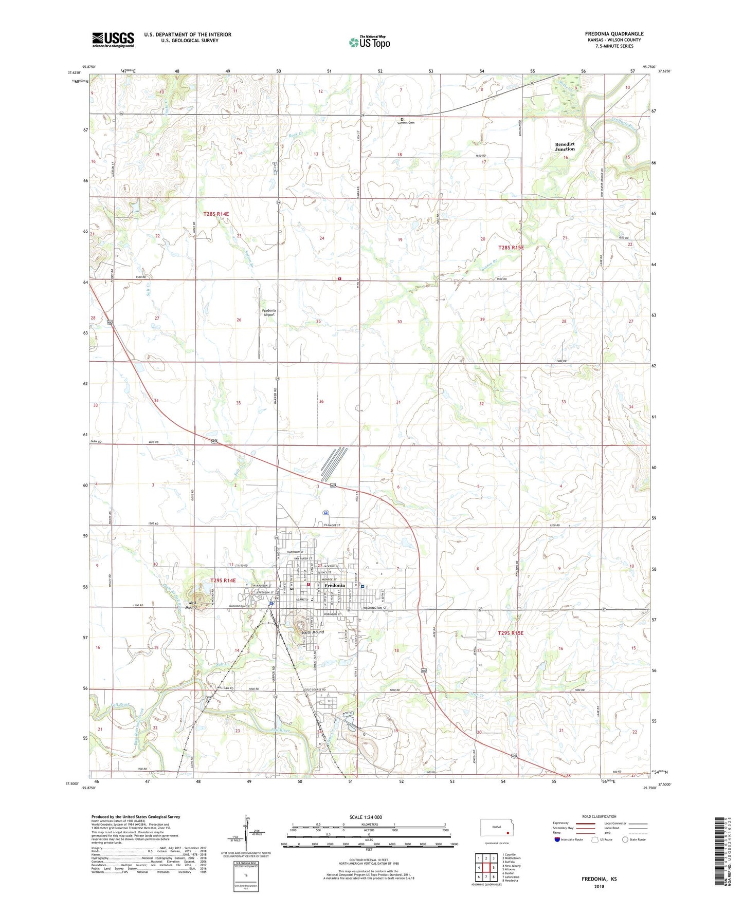
2022 topographic map quadrangle Fredonia in the state of Kansas. Scale: 1:24000. Based on the newly updated USGS 7.5' US Topo map series, this map is in the following counties: Wilson. The map contains contour data, water features, and other items you are used to seeing on USGS maps, but also has updated roads and other features. This is the next generation of topographic maps. Printed on high-quality waterproof paper with UV fade-resistant inks.
Quads adjacent to this one:
West: New Albany
Northwest: Coyville
North: Middletown
Northeast: Buffalo
East: Altoona
Southeast: Neodesha
South: Lafontaine
Southwest: Buxton
This map covers the same area as the classic USGS quad with code o37095e7.
Contains the following named places: Ben S Paulen Elementary School, Benedict Junction, Bible Baptist Church, Brown School, Butts School, Cairo School, Calvary Wesleyan Church, Centralia School, City of Fredonia, Clark School, Clear Creek, Covenant Promise Church of Fredonia, Derby Grade School, East Rainbow Creek, First Christian Church, First Southern Baptist Church, Fredonia, Fredonia Airport, Fredonia Church of Christ, Fredonia Church of God, Fredonia City Hall, Fredonia Co - Operative Association Grain Elevator Number 1, Fredonia Country Club, Fredonia Emergency Medical Services, Fredonia Fire Department, Fredonia First Assembly of God Church, Fredonia High School, Fredonia Middle School, Fredonia Police Department, Fredonia Post Office, Fredonia Public Library, Fredonia Public Works, Fredonia Regional Hospital, Fredonia Seventh Day Adventist Church, Fredonia United Methodist Church, Fredonia Wastewater Treatment Plant, Grand Valley School, Kansas Highway Patrol Troop H Wilson, Kingdom Hall of Jehovah's Witnesses, Lincoln Elementary School, Maple Grove School, New Beginnings Worship Center, Plum Branch Fall River, Rock Creek School, Sacred Heart Catholic Church, Salt Creek, Sexton, Snake Creek, South Mound, Summit Cemetery, Sutton Branch, Township of Center, Township of Prairie, West Mound, Wilson County Courthouse, Wilson County Fairgrounds, Wilson County Farm, Wilson County Health Department, Wilson County Jail, Wilson County Museum, Wilson County Rural Fire District Station 13, Wilson County Sheriff's Office, ZIP Code: 66736