MyTopo
Xenia Kansas US Topo Map
Couldn't load pickup availability
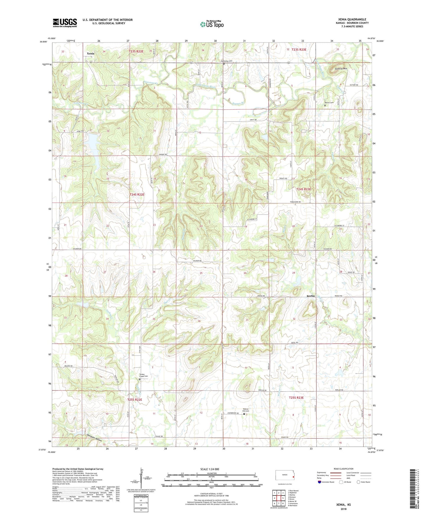
2022 topographic map quadrangle Xenia in the state of Kansas. Scale: 1:24000. Based on the newly updated USGS 7.5' US Topo map series, this map is in the following counties: Bourbon. The map contains contour data, water features, and other items you are used to seeing on USGS maps, but also has updated roads and other features. This is the next generation of topographic maps. Printed on high-quality waterproof paper with UV fade-resistant inks.
Quads adjacent to this one:
West: Bronson
Northwest: Blue Mound
North: Mapleton
Northeast: Mantey
East: Devon
Southeast: Marmaton
South: Uniontown
Southwest: Moran SE
This map covers the same area as the classic USGS quad with code o37094h8.
Contains the following named places: Baker School, Berlin, Berlin School, Dry Ridge Church, Dry Ridge School, Dyer Creek, Guthrie Mountain, Harmony School, Limestone Creek, Morris Cemetery, Northway Cemetery, Oakdale School, Opossum Creek, Pleasant Valley School, Poplar Grove School, Reagan Branch, Tippie Creek, Township of Timberhill, Turkey Creek Cemetery, Turkey Creek School, Walnut Hill Cemetery, Walnut Hill School, Xenia, Xenia Baptist Church