MyTopo
Mapleton Kansas US Topo Map
Couldn't load pickup availability
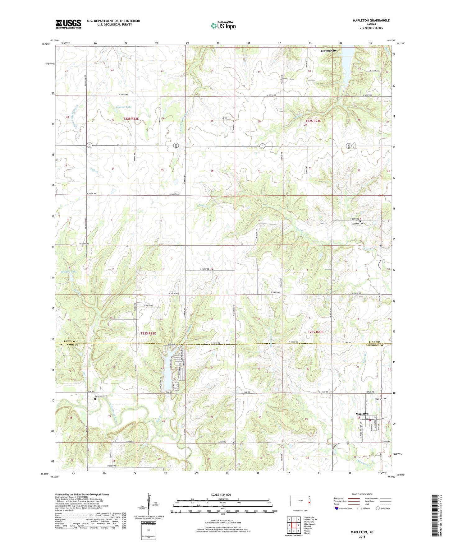
2022 topographic map quadrangle Mapleton in the state of Kansas. Scale: 1:24000. Based on the newly updated USGS 7.5' US Topo map series, this map is in the following counties: Linn, Bourbon. The map contains contour data, water features, and other items you are used to seeing on USGS maps, but also has updated roads and other features. This is the next generation of topographic maps. Printed on high-quality waterproof paper with UV fade-resistant inks.
Quads adjacent to this one:
West: Blue Mound
Northwest: Centerville
North: Mound City NW
Northeast: Mound City
East: Mantey
Southeast: Devon
South: Xenia
Southwest: Bronson
This map covers the same area as the classic USGS quad with code o38094a8.
Contains the following named places: Baker Branch, Bell Branch, Bourbon County Fire District 3 Station 4, Bradley Lake, Campbell Cemetery, City of Mapleton, City of Mound City, Hidden Valley Lake Dam, Johnson Lake, Mapleton, Mapleton Cemetery, Mapleton Christian Church, Mapleton Post Office, Osage Valley School, Owl Creek, Rock Ridge School, Stevenson Cemetery, ZIP Codes: 66010, 66754