MyTopo
Boicourt Kansas US Topo Map
Couldn't load pickup availability
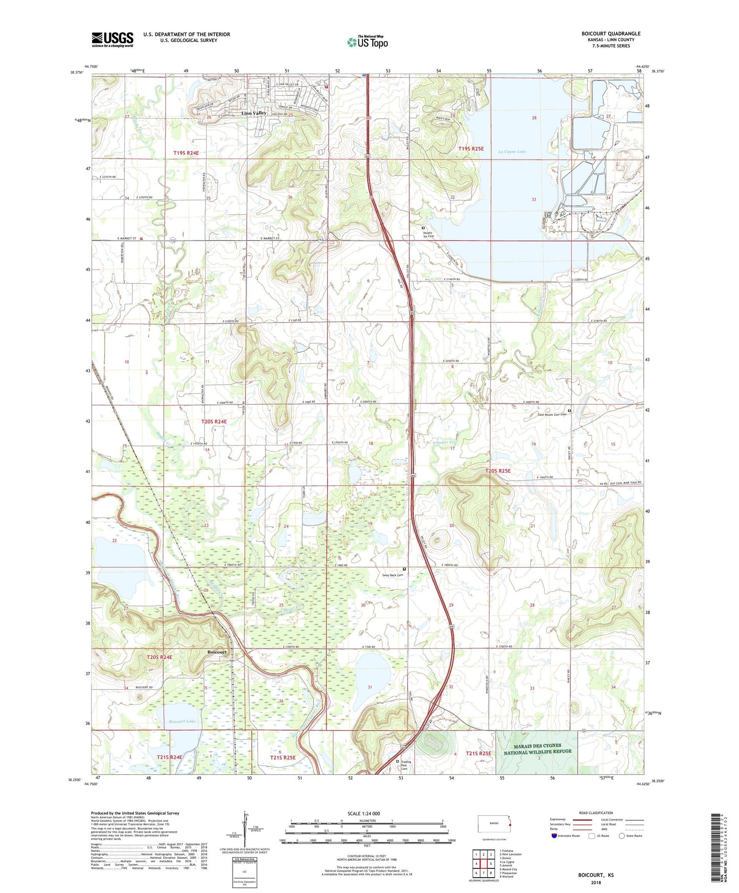
2022 topographic map quadrangle Boicourt in the state of Kansas. Scale: 1:24000. Based on the newly updated USGS 7.5' US Topo map series, this map is in the following counties: Linn. The map contains contour data, water features, and other items you are used to seeing on USGS maps, but also has updated roads and other features. This is the next generation of topographic maps. Printed on high-quality waterproof paper with UV fade-resistant inks.
Quads adjacent to this one:
West: La Cygne
Northwest: Fontana
North: New Lancaster
Northeast: Drexel
East: Amoret
Southeast: Worland
South: Pleasanton
Southwest: Mound City
This map covers the same area as the classic USGS quad with code o38094c6.
Contains the following named places: Boicourt, Boicourt Lake, Deer Trace Golf Course, East Mount Zion Cemetery, Excelsior School, La Cygne Corner, La Cygne Lake, La Cygne State Fishing Lake and Wildlife Area, Linn County Park Campground, Linn County Park Marina, Linn County Park Wastewater Treatment Plant, Linn County Rural Fire District 1 Station 950, Linn Valley Community Church, Linn Valley Police Department, Linn Valley Volunteer Fire Department Substation, Marais des Cygnes Waterfowl Area, Middle Creek, New Home School, Ninety Six Cemetery, North Sugar Creek, Orchard, Star Valley School, Sway Back Cemetery, Township of Lincoln, Township of Valley, Trading Post Cemetery, Trading Post Museum, ZIP Code: 66040