MyTopo
Drexel Missouri US Topo Map
Couldn't load pickup availability
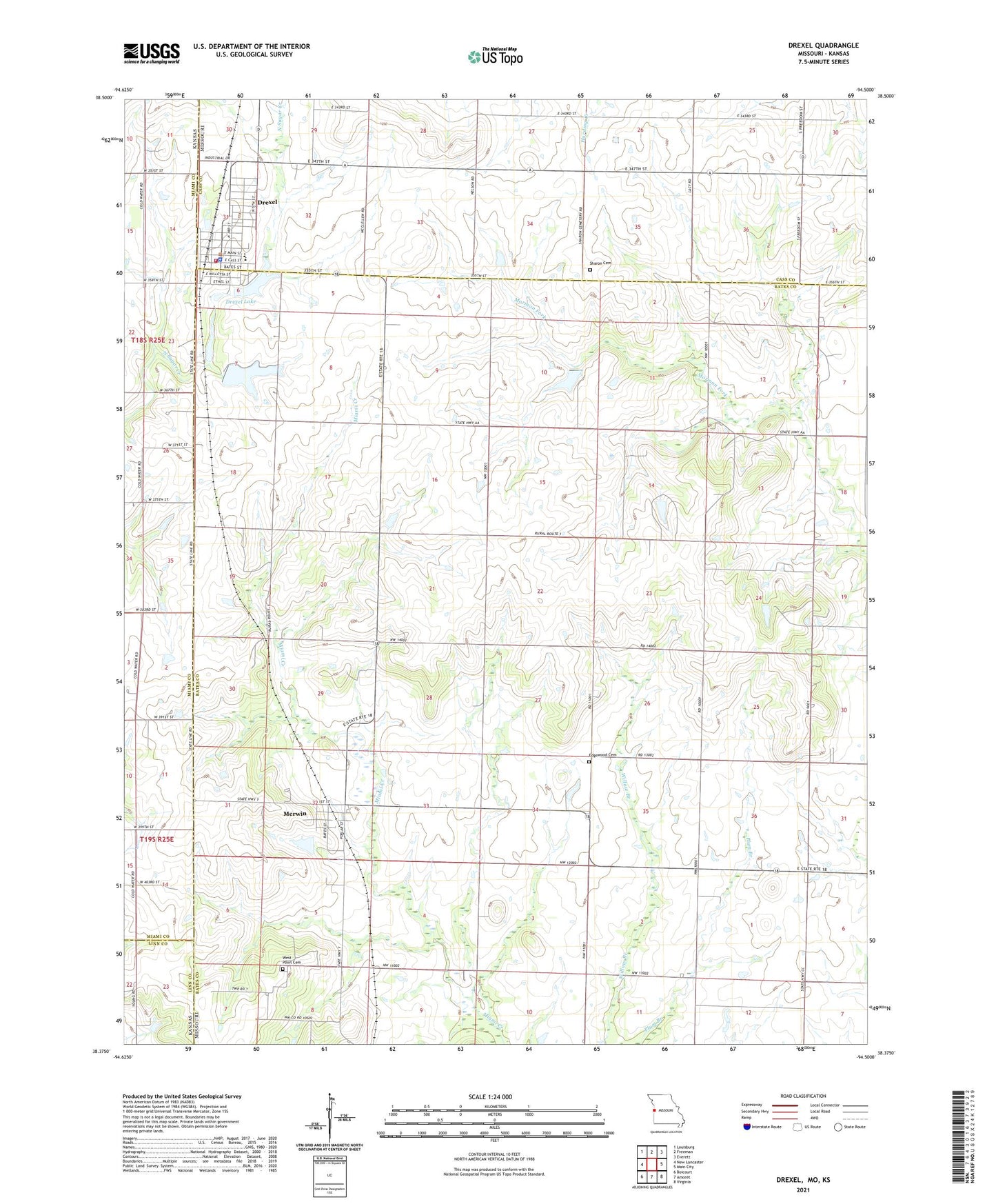
2021 topographic map quadrangle Drexel in the state of Missouri. Scale: 1:24000. Based on the newly updated USGS 7.5' US Topo map series, this map is in the following counties: Bates, Cass, Miami, Linn. The map contains contour data, water features, and other items you are used to seeing on USGS maps, but also has updated roads and other features. This is the next generation of topographic maps. Printed on high-quality waterproof paper with UV fade-resistant inks.
Quads adjacent to this one:
West: New Lancaster
Northwest: Louisburg
North: Freeman
Northeast: Everett
East: Main City
Southeast: Virginia
South: Amoret
Southwest: Boicourt
This map covers the same area as the classic USGS quad with code o38094d5.
Contains the following named places: Arvin Ranch Airport, Boone Lake Dam, Drexel, Drexel City Reservoir South, Drexel City Reservoir South Dam, Drexel Community Fire Protection Association, Drexel Elementary School, Drexel High School, Drexel Lake, Drexel Lake Dam, Drexel North Wastewater Treatment Facility, Drexel Post Office, Drexel South Wastewater Treatment Facility, Edgewood Cemetery, Edgewood School, Hodges Lake Dam, Maple Grove School, May Airport, May Lake, May Lake Dam, Merwin, Rocking Chair Ranch Lake Dam, Shannon Circle S Ranch Lake Dam, Sharon Cemetery, South Drexel, Township of West Boone, Village of Merwin, West Point Cemetery, Woodland School