MyTopo
New Lancaster Kansas US Topo Map
Couldn't load pickup availability
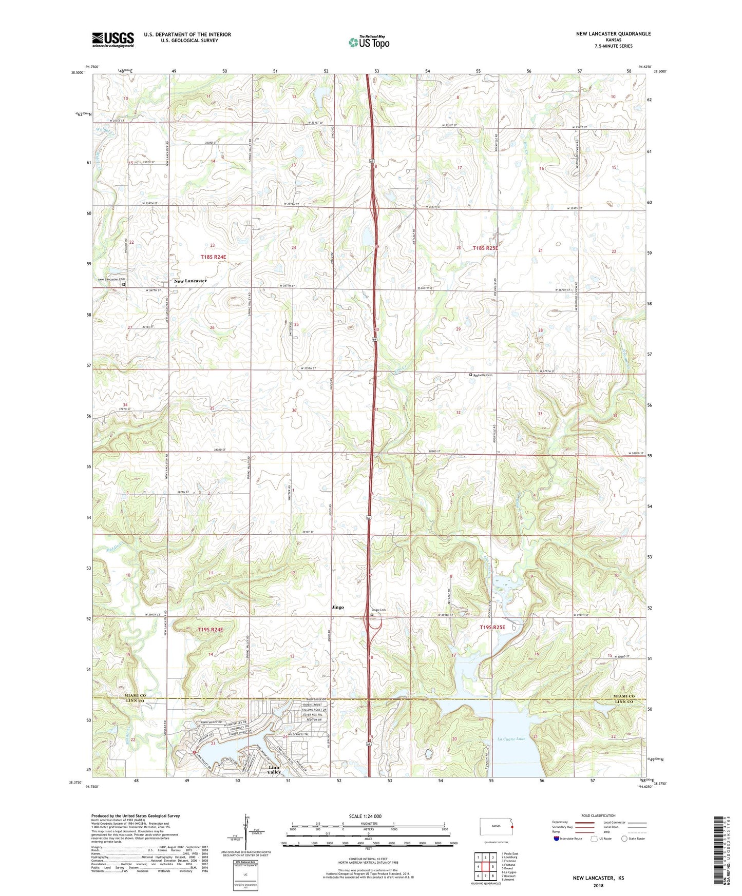
2022 topographic map quadrangle New Lancaster in the state of Kansas. Scale: 1:24000. Based on the newly updated USGS 7.5' US Topo map series, this map is in the following counties: Miami, Linn. The map contains contour data, water features, and other items you are used to seeing on USGS maps, but also has updated roads and other features. This is the next generation of topographic maps. Printed on high-quality waterproof paper with UV fade-resistant inks.
Quads adjacent to this one:
West: Fontana
Northwest: Paola East
North: Louisburg
Northeast: Freeman
East: Drexel
Southeast: Amoret
South: Boicourt
Southwest: La Cygne
This map covers the same area as the classic USGS quad with code o38094d6.
Contains the following named places: City of Linn Valley, Drexel Corner, Elm Creek, Hurt Airport, Jeserick Airport, Jingo, Jingo Cemetery, Linn Valley, Linn Valley Volunteer Fire Department, New Lancaster, New Lancaster Cemetery, Rockville, Rockville Cemetery, Sugar, Township of Miami, Township of Sugar Creek, Wade Quarries, Walnut Creek