MyTopo
Westphalia Kansas US Topo Map
Couldn't load pickup availability
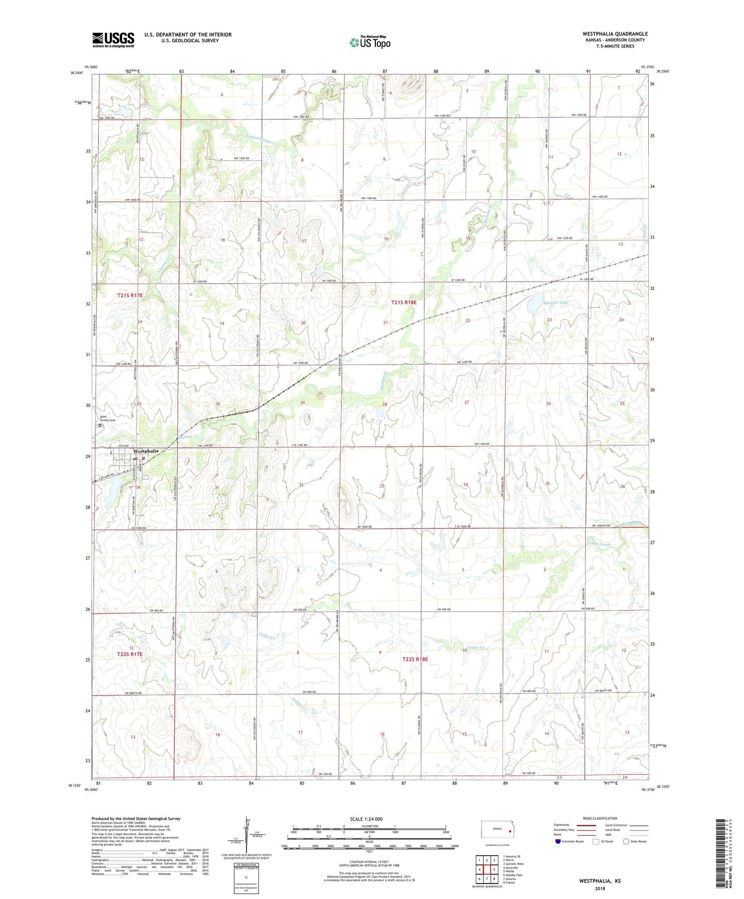
2022 topographic map quadrangle Westphalia in the state of Kansas. Scale: 1:24000. Based on the newly updated USGS 7.5' US Topo map series, this map is in the following counties: Anderson. The map contains contour data, water features, and other items you are used to seeing on USGS maps, but also has updated roads and other features. This is the next generation of topographic maps. Printed on high-quality waterproof paper with UV fade-resistant inks.
Quads adjacent to this one:
West: Aliceville
Northwest: Waverly SE
North: Harris
Northeast: Garnett West
East: Welda
Southeast: Colony
South: Geneva
Southwest: Neosho Falls
This map covers the same area as the classic USGS quad with code o38095b4.
Contains the following named places: Cherry Creek, Cherry Mound Church, City of Westphalia, Le Roy Co - Operative Association Grain Elevator Number 3, Mont Ida Elementary School, Saint Teresa Catholic Church, Saint Teresa's Cemetery, Spencer Lake, Township of Westphalia, Westphalia, Westphalia Fire Station, Westphalia Post Office, Westphalia Town Hall, ZIP Code: 66093