MyTopo
Hepler Kansas US Topo Map
Couldn't load pickup availability
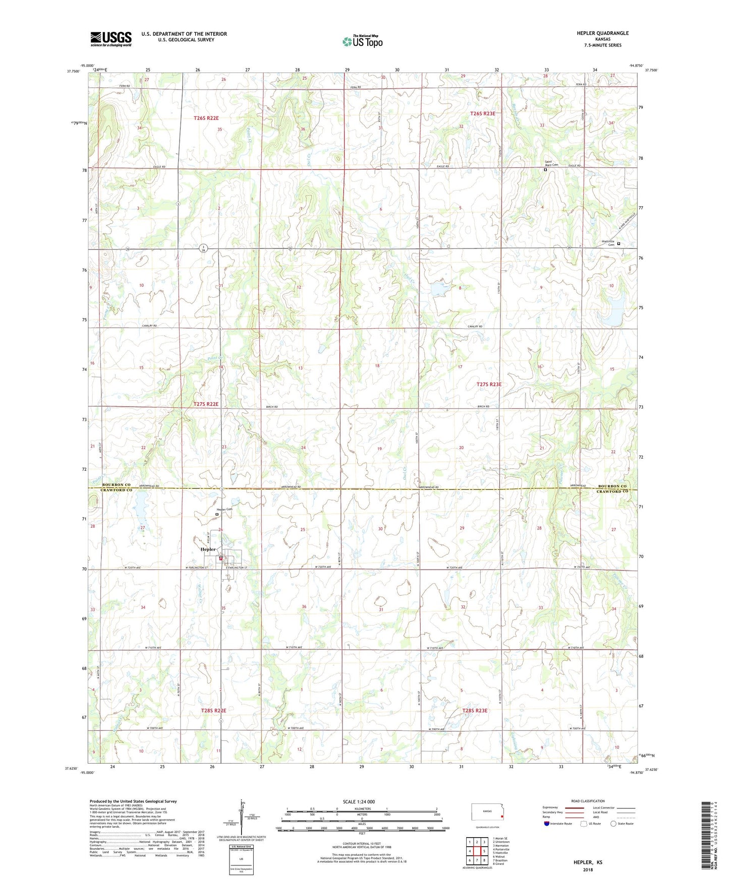
2022 topographic map quadrangle Hepler in the state of Kansas. Scale: 1:24000. Based on the newly updated USGS 7.5' US Topo map series, this map is in the following counties: Bourbon, Crawford. The map contains contour data, water features, and other items you are used to seeing on USGS maps, but also has updated roads and other features. This is the next generation of topographic maps. Printed on high-quality waterproof paper with UV fade-resistant inks.
Quads adjacent to this one:
West: Porterville
Northwest: Moran SE
North: Uniontown
Northeast: Marmaton
East: Hiattville
Southeast: Girard
South: Brazilton
Southwest: Walnut
This map covers the same area as the classic USGS quad with code o37094f8.
Contains the following named places: Arlington School, City of Hepler, Cleveland School, Gibson School, Green Valley School, Hepler, Hepler Cemetery, Hepler City and Rural Fire Department, Hepler City Hall, Hepler City Library, Hepler Post Office, Hepler Seventh Day Adventist Church, Hepler Sewer Treatment Plant, Hiattville Cemetery, Lone Elm School, Maple Grove School, Mount Hope School, Owl Creek, Pleasant Valley School, Prong Creek, Saint Mary Cemetery, Star of Hope School, Township of Walnut, Victory School, ZIP Code: 66746