MyTopo
Waverly NW Kansas US Topo Map
Couldn't load pickup availability
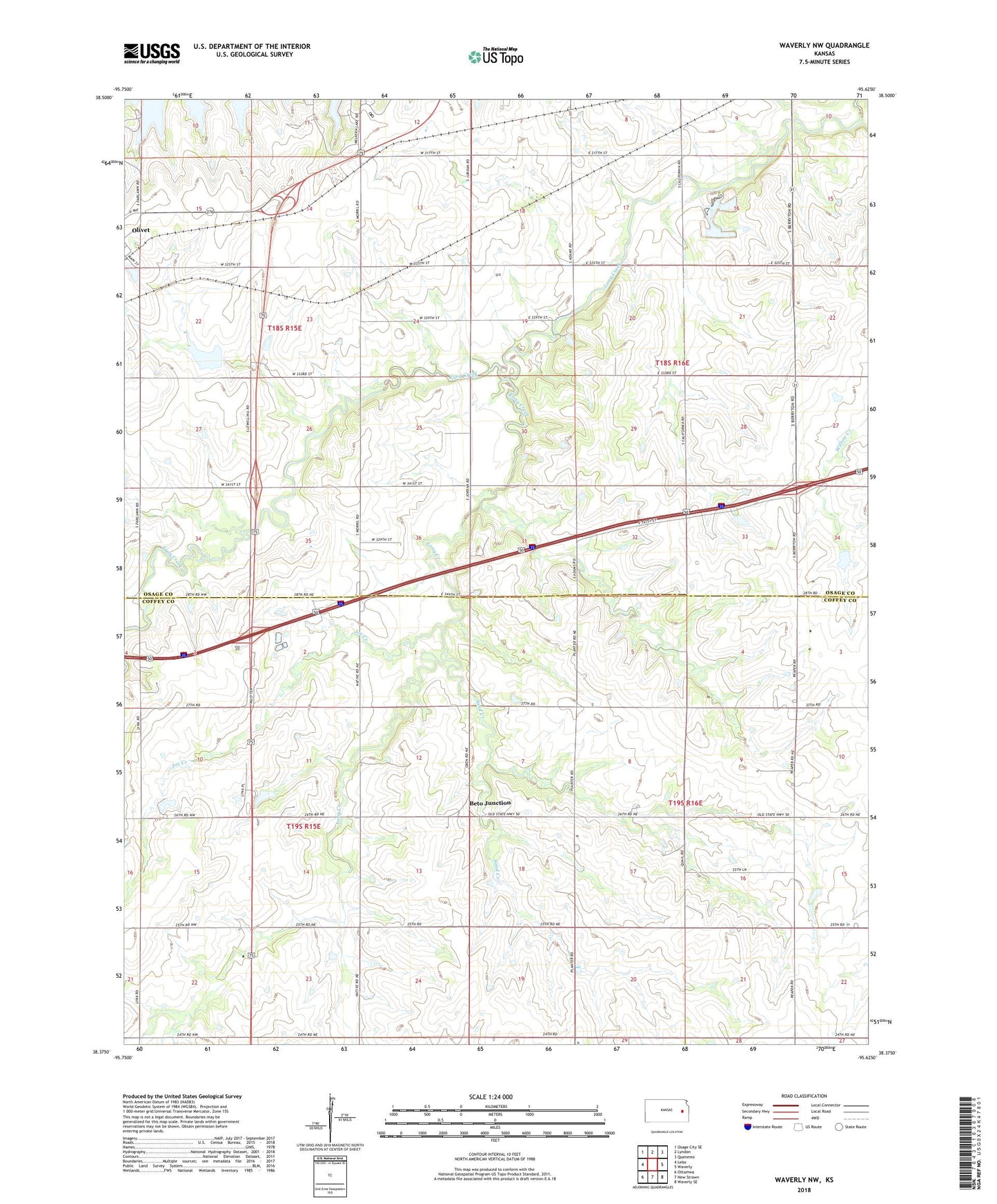
2022 topographic map quadrangle Waverly NW in the state of Kansas. Scale: 1:24000. Based on the newly updated USGS 7.5' US Topo map series, this map is in the following counties: Osage, Coffey. The map contains contour data, water features, and other items you are used to seeing on USGS maps, but also has updated roads and other features. This is the next generation of topographic maps. Printed on high-quality waterproof paper with UV fade-resistant inks.
Quads adjacent to this one:
West: Lebo
Northwest: Osage City SE
North: Lyndon
Northeast: Quenemo
East: Waverly
Southeast: Waverly SE
South: New Strawn
Southwest: Ottumwa
This map covers the same area as the classic USGS quad with code o38095d6.
Contains the following named places: Beto Junction, Frog Creek, Joe Creek, Kedron, Sand Creek, Township of Key West, Township of Melvern