MyTopo
Uniontown Kansas US Topo Map
Couldn't load pickup availability
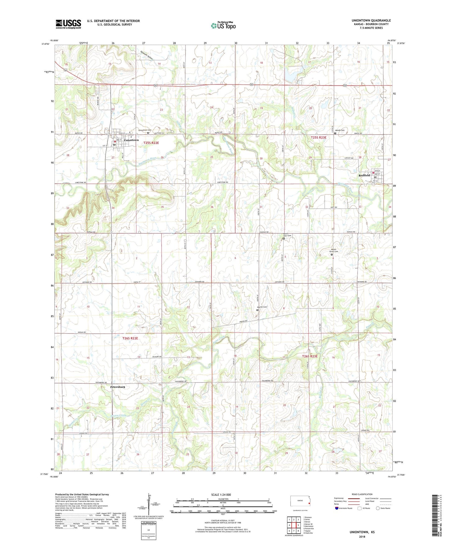
2022 topographic map quadrangle Uniontown in the state of Kansas. Scale: 1:24000. Based on the newly updated USGS 7.5' US Topo map series, this map is in the following counties: Bourbon. The map contains contour data, water features, and other items you are used to seeing on USGS maps, but also has updated roads and other features. This is the next generation of topographic maps. Printed on high-quality waterproof paper with UV fade-resistant inks.
Quads adjacent to this one:
West: Moran SE
Northwest: Bronson
North: Xenia
Northeast: Devon
East: Marmaton
Southeast: Hiattville
South: Hepler
Southwest: Porterville
This map covers the same area as the classic USGS quad with code o37094g8.
Contains the following named places: Beachner Grain Elevator Number 16, Bourbon County Fire District 3 Station 1, Bourbon County Fire District 4 Redfield Station, Bunion Creek, City of Redfield, City of Uniontown, East Fairview School, First Missionary Baptist Church, Goff School, Harrison School, Hinton Creek, Lake Side, Marion Cemetery, Marion School, Mount Orum Cemetery, Mount Orum Church, Mount Zion Cemetery, Opossum Hollow, Orion School, Paint Creek Church of the Brethren, Petersburg, Redfield, Redfield Post Office, Redfield Wastewater Plant, Rolling Prairie School, Square Top School, Township of Marion, Turkey Creek, Union School, Uniontown, Uniontown Cemetery, Uniontown High School, Uniontown Post Office, Uniontown Sewer Treatment Plant, United Methodist Church of Redfield, United Methodist Church of Uniontown, Walnut Creek, West Bourbon Elementary School, Woods Cemetery, ZIP Codes: 66769, 66779