MyTopo
Walnut Kansas US Topo Map
Couldn't load pickup availability
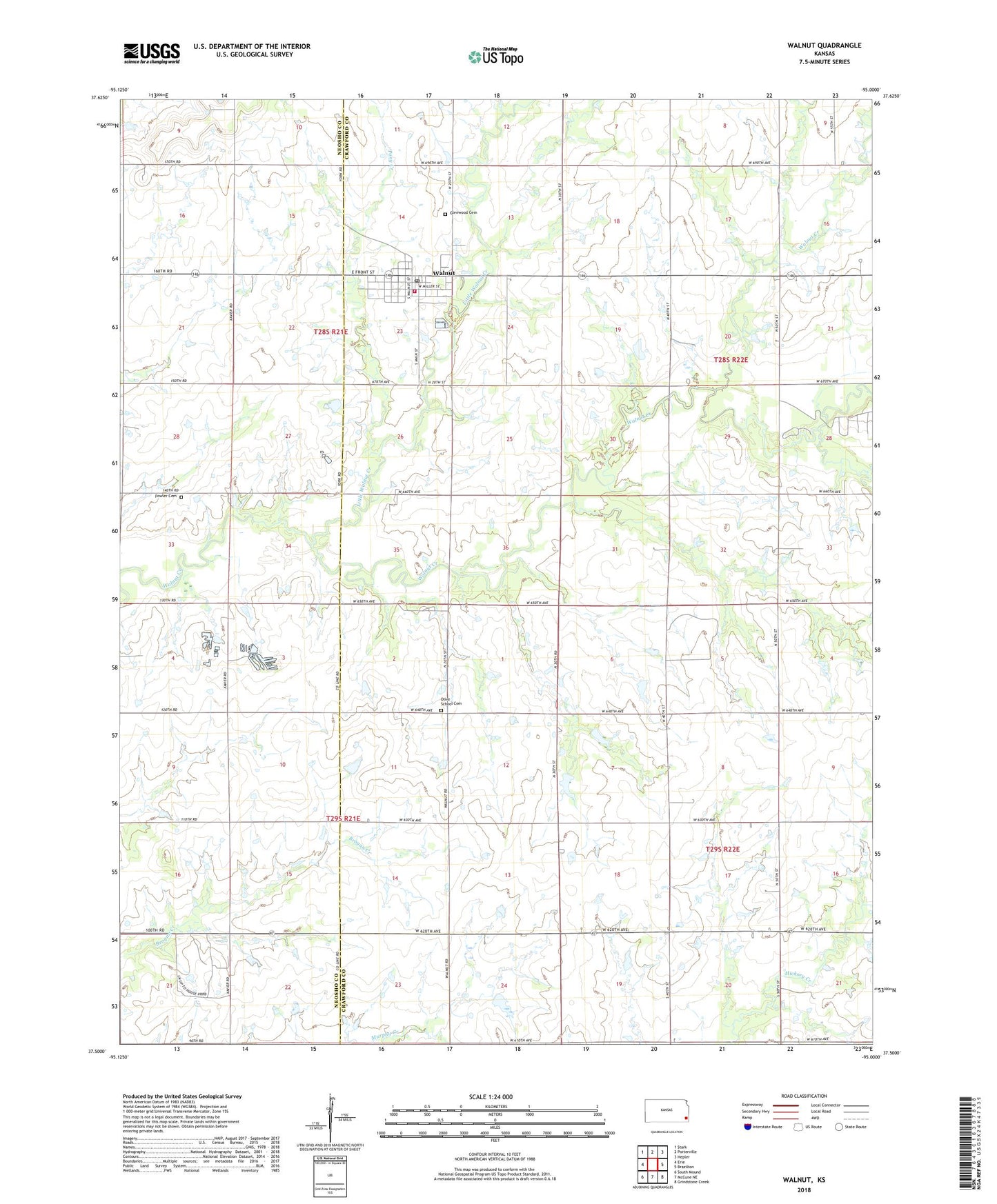
2022 topographic map quadrangle Walnut in the state of Kansas. Scale: 1:24000. Based on the newly updated USGS 7.5' US Topo map series, this map is in the following counties: Crawford, Neosho. The map contains contour data, water features, and other items you are used to seeing on USGS maps, but also has updated roads and other features. This is the next generation of topographic maps. Printed on high-quality waterproof paper with UV fade-resistant inks.
Quads adjacent to this one:
West: Erie
Northwest: Stark
North: Porterville
Northeast: Hepler
East: Brazilton
Southeast: Grindstone Creek
South: McCune NE
Southwest: South Mound
This map covers the same area as the classic USGS quad with code o37095e1.
Contains the following named places: Beachner Grain Elevator Number 17, Brogan School, City of Walnut, Cleveland School, Eureka School, Fowler Cemetery, Glenwood Cemetery, Kavanaugh School, Little Walnut Creek, Lone Elm School, Maple Grove School, Olive School, Olive School Cemetery, Osborn School, Pony Creek, Township of Grant, Township of Walnut, Walnut, Walnut City Hall, Walnut Fire Department, Walnut Grange Hall, Walnut Post Office, Walnut Public Library, Walnut Rural Fire Department, Walnut United Methodist Church, Walnut Wastewater Treatment Plant, ZIP Code: 66780