MyTopo
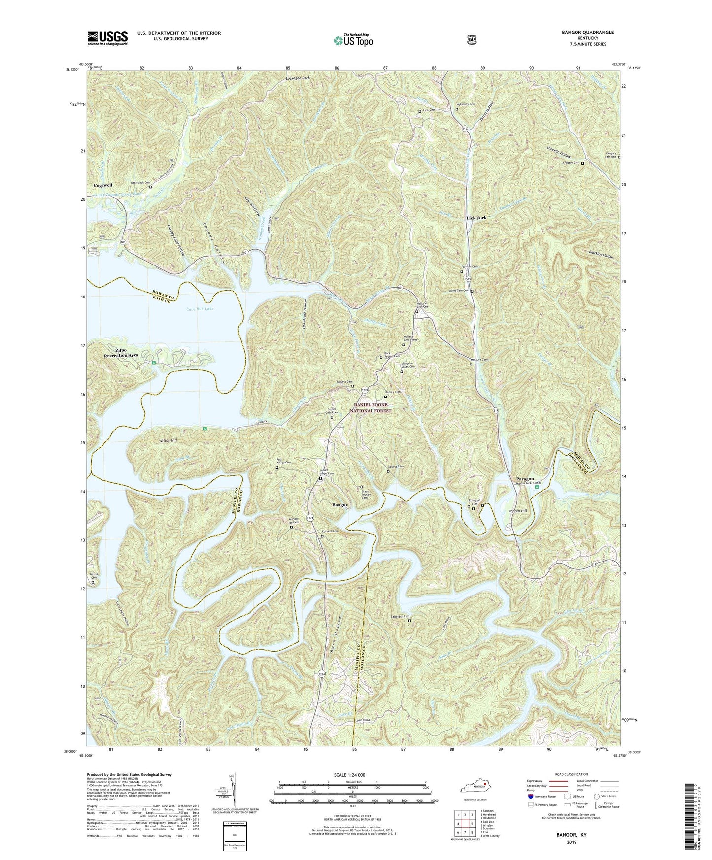
Bangor Kentucky US Topo Map
Couldn't load pickup availability
Also explore the Bangor Forest Service Topo of this same quad for updated USFS data
2022 topographic map quadrangle Bangor in the state of Kentucky. Scale: 1:24000. Based on the newly updated USGS 7.5' US Topo map series, this map is in the following counties: Rowan, Morgan, Menifee, Bath. The map contains contour data, water features, and other items you are used to seeing on USGS maps, but also has updated roads and other features. This is the next generation of topographic maps. Printed on high-quality waterproof paper with UV fade-resistant inks.
Quads adjacent to this one:
West: Salt Lick
Northwest: Farmers
North: Morehead
Northeast: Haldeman
East: Wrigley
Southeast: West Liberty
South: Ezel
Southwest: Scranton
This map covers the same area as the classic USGS quad with code o38083a4.
Contains the following named places: Abbott Cemetery, Alfrey Boat Ramp, Alfrey Church, Back - Peyton Cemetery, Baldridge Cemetery, Bangor, Bangor Boat Ramp, Bangor Post Office, Barber Branch, Barn Hollow, Bear Branch, Beaver Creek, Bertis Post Office, Biddle Hollow, Big Hollow, Boyd Branch, Brown Cemetery Four, Brush Hollow, Brushy Branch, Brushy Fork, Buck Creek, Carpenter Branch, Cassidy Ford Hollow, Cave Branch, Cave Branch School, Cave Run Lake, Charity Branch, Charity Freewill Baptist Church, Claylick Boat Ramp, Claylick Boat-in Campground, Claylick Branch, Cogswell, Cornett Cemetery, Coswell School, Don McKinsey Branch, Donahue School, Dry Branch, Ellington Cemetery, Ellington South Cemetery, Elm Log Branch, Forman Cemetery, Fuget Branch, Giant Canada Goose Pond, Ginter Cemetery, Ham Branch, Harlan Ellington Cemetery, Hickory Grove, Hill Branch, Horsely-Brown Cemetery, J Foster Cemetery, Jones Cemetery Number 1, Lakeview Vista, Laurel Branch, Lick Fork, Lick Fork Railroad Station, Licking River School, Licking Union Railroad Station, Limekiln Hollow, Link Cemetery, Little Laurel Branch, Lockegee Branch, Lockegee Rock, Long Branch, Lower Lick Fork, Lower Lick Fork Church, McClure Cemetery, Mckinney Cemetery, McKinsey School, Middle Fork, Mine Branch, Mount Hope, Mount Hope Cemetery, Mount Hope School, Muskie Bend Fishing Point, North Fork Licking River, Old House Hollow, Orchard Branch, Paragon, Paragon Railroad Station, Paragon School, Peter Everett Branch, Peyton - Igo Cemetery, Pickett Branch, Poppin Hill, Poppin Rock Boat Ramp, Poppin Rock Tunnel, Popping Post Office, Pound Branch, Ramey Cemetery, Ramey Creek, Ramey Creek Picnic Area, Roll Alfrey Cemetery, Salt Spring Branch, Scale Ladder Hollow, Shallow Flats Fishing Point, Shrout Hollow, Stacy-Peyton Cemetery, Stillhouse Branch, Sugar Camp Branch, Sugar Cane Branch, Tackett Cemetery, Thomas Cave Branch, Three Forks Branch, Twolick Branch, Upper Lick Fork School, Utterback Cemetery, Wallace Cemetery One, Wallace Cemetery Three, Warix Run, Warix Run Boat Ramp, Wellford Post Office, White Pine Branch, Wilson Hill, Windy Bay Fishing Point, Yale Post Office, Yocum Creek, Zilpo Post Office, Zilpo Recreation Area