MyTopo
Grand Rivers Kentucky US Topo Map
Couldn't load pickup availability
Also explore the Grand Rivers Forest Service Topo of this same quad for updated USFS data
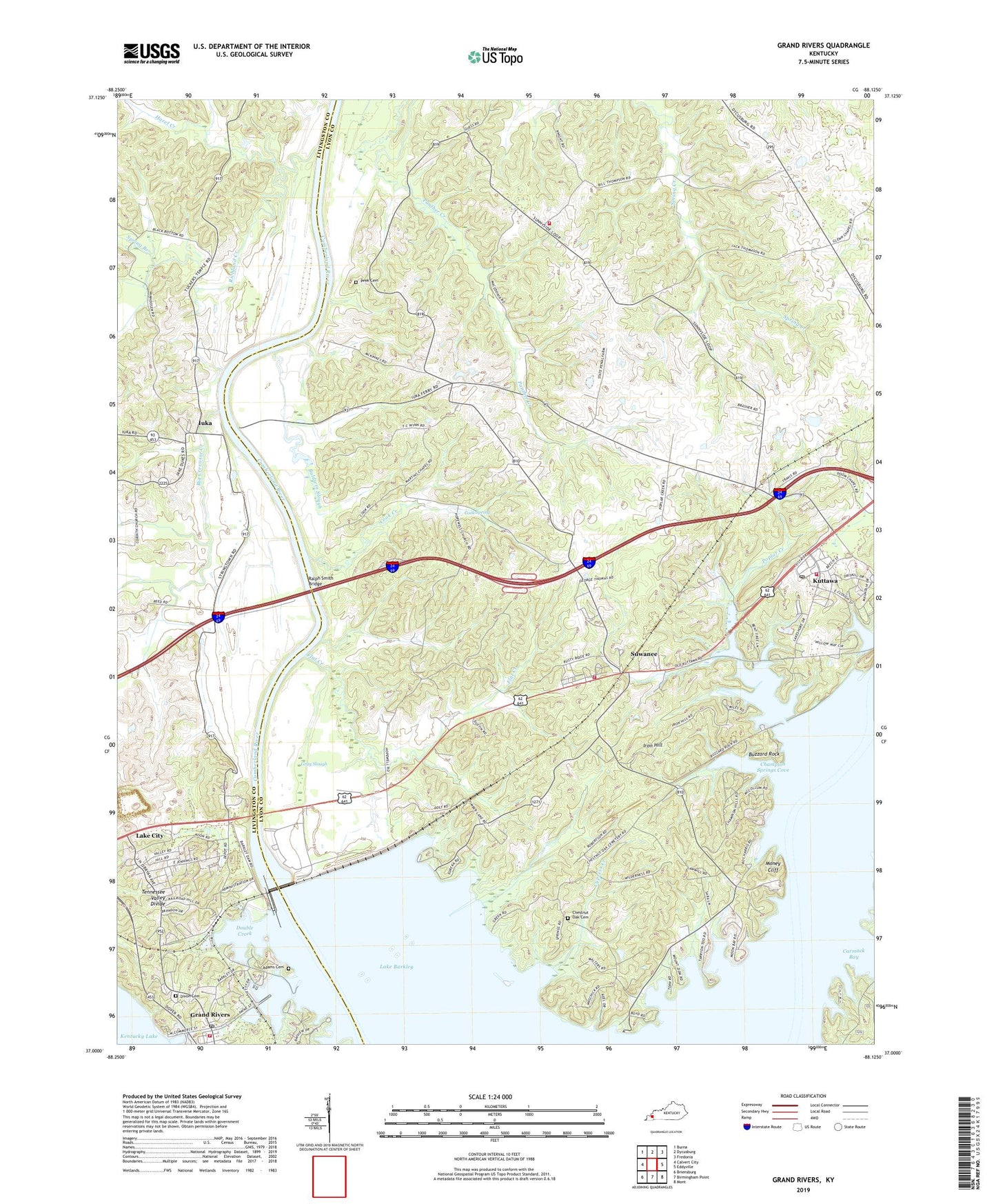
2022 topographic map quadrangle Grand Rivers in the state of Kentucky. Scale: 1:24000. Based on the newly updated USGS 7.5' US Topo map series, this map is in the following counties: Lyon, Livingston. The map contains contour data, water features, and other items you are used to seeing on USGS maps, but also has updated roads and other features. This is the next generation of topographic maps. Printed on high-quality waterproof paper with UV fade-resistant inks.
Quads adjacent to this one:
West: Calvert City
Northwest: Burna
North: Dycusburg
Northeast: Fredonia
East: Eddyville
Southeast: Mont
South: Birmingham Point
Southwest: Briensburg
This map covers the same area as the classic USGS quad with code o37088a2.
Contains the following named places: Adams Cemetery Number 2, Antioch, Baldwin Slough, Barkley Dam, Big Crevasse Creek, Buzzard Rock, Carmack Bay, Cave Pond, Champion Springs Cove, Chestnut Grove Church, Chestnut Oak Cemetery, City of Grand Rivers, Cook Creek, Cook Spring, Cypress Creek, Dixon Cemetery, Doom Chapel, Double Creek, Flat Creek, Grand Rivers, Grand Rivers Post Office, Gravel Switch, Gray Slough, Hazel Creek, Hopewell Church, Iron Hill, Iuka, Kelly Furnace Historical Marker, Kentucky State Penitentiary Farm, Kuttawa, Kuttawa Fire Department, Kuttawa Post Office, Lake City, Lyon County Fire District 1 Sunnyside, Lyon County Fire District 2 Suwannee, Macedonia Church, Missionary Church, Money Cliff, Mount Carmel Methodist Church, Mount Zion Church, Peek Cemetery, Pisgah Church, Poplar Creek, Ralph Smith Bridge, Richland Creek, Spring Branch, Suwanee, Suwanee Furnace Historical Marker, William Kellys Kettle Historical Marker, ZIP Code: 42055