MyTopo
Paris West Kentucky US Topo Map
Couldn't load pickup availability
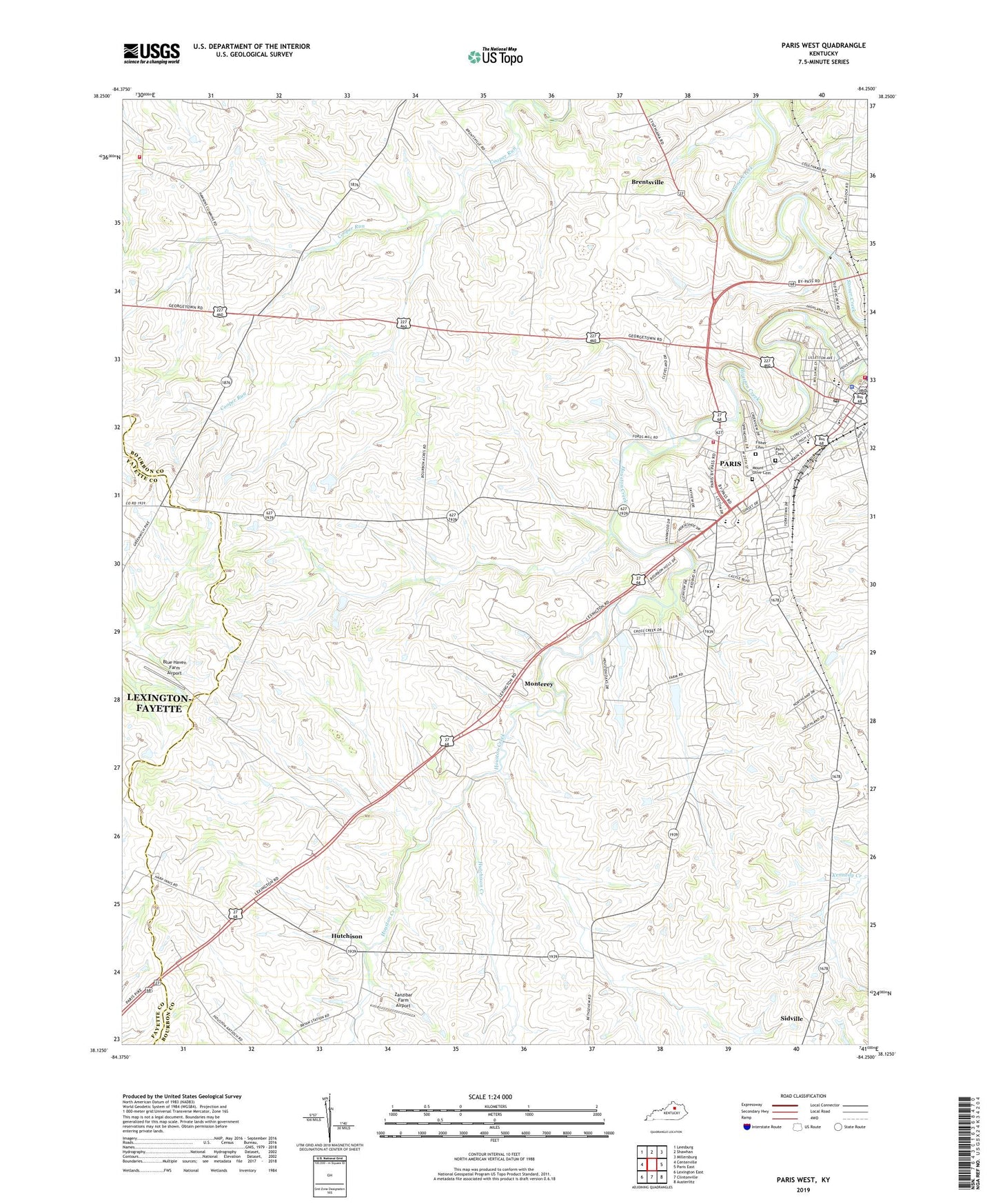
2022 topographic map quadrangle Paris West in the state of Kentucky. Scale: 1:24000. Based on the newly updated USGS 7.5' US Topo map series, this map is in the following counties: Bourbon, Fayette. The map contains contour data, water features, and other items you are used to seeing on USGS maps, but also has updated roads and other features. This is the next generation of topographic maps. Printed on high-quality waterproof paper with UV fade-resistant inks.
Quads adjacent to this one:
West: Centerville
Northwest: Leesburg
North: Shawhan
Northeast: Millersburg
East: Paris East
Southeast: Austerlitz
South: Clintonville
Southwest: Lexington East
This map covers the same area as the classic USGS quad with code o38084b3.
Contains the following named places: Antioch Church, Blue Haven Farm Airport, Brennan Farm Airport, Brentsville, Centerville Volunteer Fire Department, Chapel Church, City of Paris, Elizabeth Station, Fisher Cemetery, Hopewell Presbyterian Church, Hutchison, Hutchison Creek, Jimtown, Monterey, Mount Olive Cemetery, Paris, Paris Cemetery, Paris Division, Paris Fire Department Station 1, Paris Fire Department Station 2, Paris High School, Paris Police Department, Paris Post Office, Sidville, South Side School, WCOZ-FM (Paris), Western High School, Zanzibar Farm Airport