MyTopo
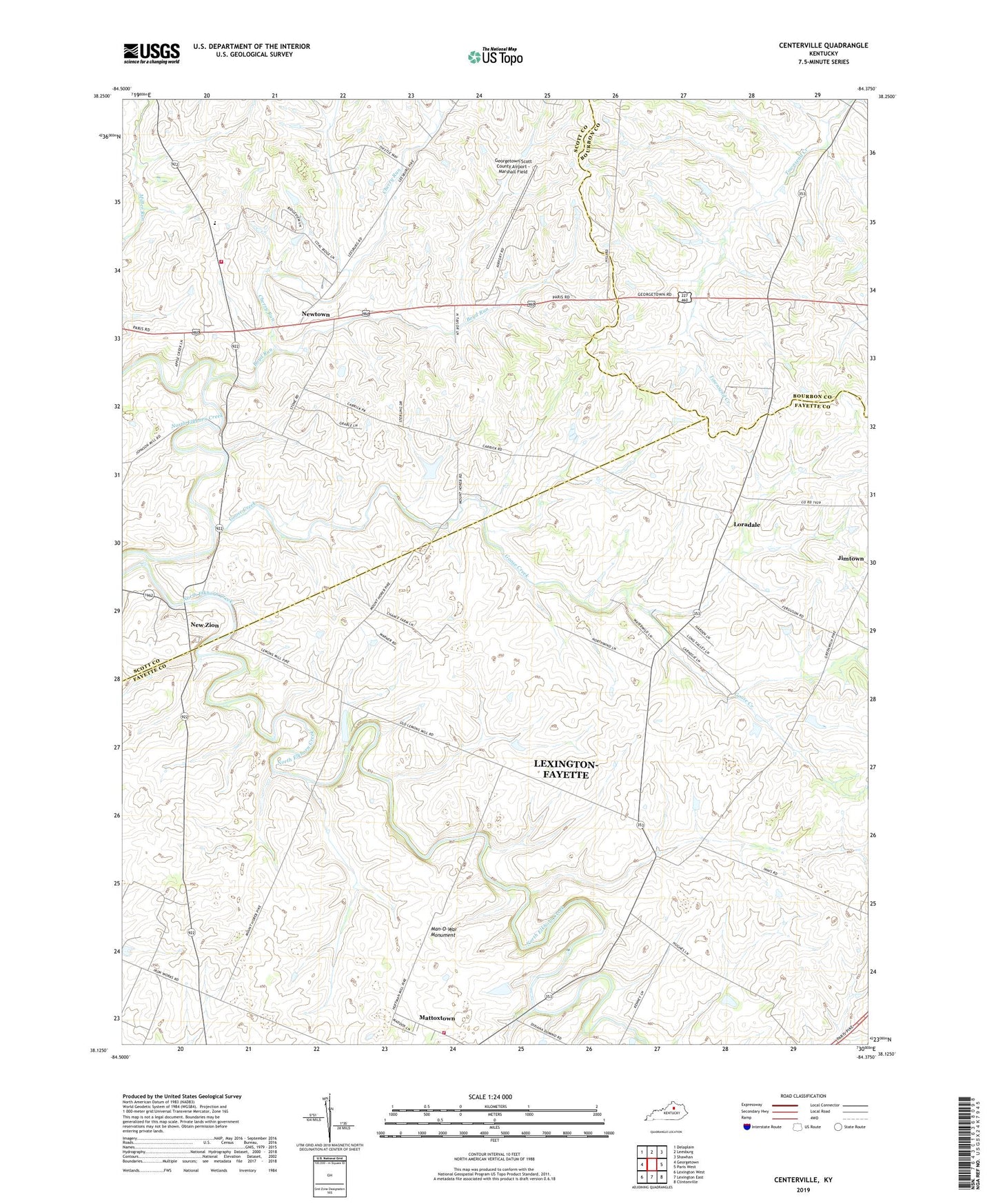
Centerville Kentucky US Topo Map
Couldn't load pickup availability
2022 topographic map quadrangle Centerville in the state of Kentucky. Scale: 1:24000. Based on the newly updated USGS 7.5' US Topo map series, this map is in the following counties: Fayette, Scott, Bourbon. The map contains contour data, water features, and other items you are used to seeing on USGS maps, but also has updated roads and other features. This is the next generation of topographic maps. Printed on high-quality waterproof paper with UV fade-resistant inks.
Quads adjacent to this one:
West: Georgetown
Northwest: Delaplain
North: Leesburg
Northeast: Shawhan
East: Paris West
Southeast: Clintonville
South: Lexington East
Southwest: Lexington West
This map covers the same area as the classic USGS quad with code o38084b4.
Contains the following named places: Beech Ridge, Boyd Run, Center Hill School, Centerville, Cherry Run, Georgetown Scott County Regional Airport, Goose Creek, Lexington Fire Department Station 19, Lexington-Fayette Northwest Division, Loradale, Man-O-War Monument, Mattoxtown, Mount Horeb Church, Mount Horeb Presbyterian Church Historical Marker, New Zion, Newtown, Scott County Fire Department Station 4, Wing Commander Historical Marker, ZIP Code: 40511