MyTopo
Nelsonville Kentucky US Topo Map
Couldn't load pickup availability
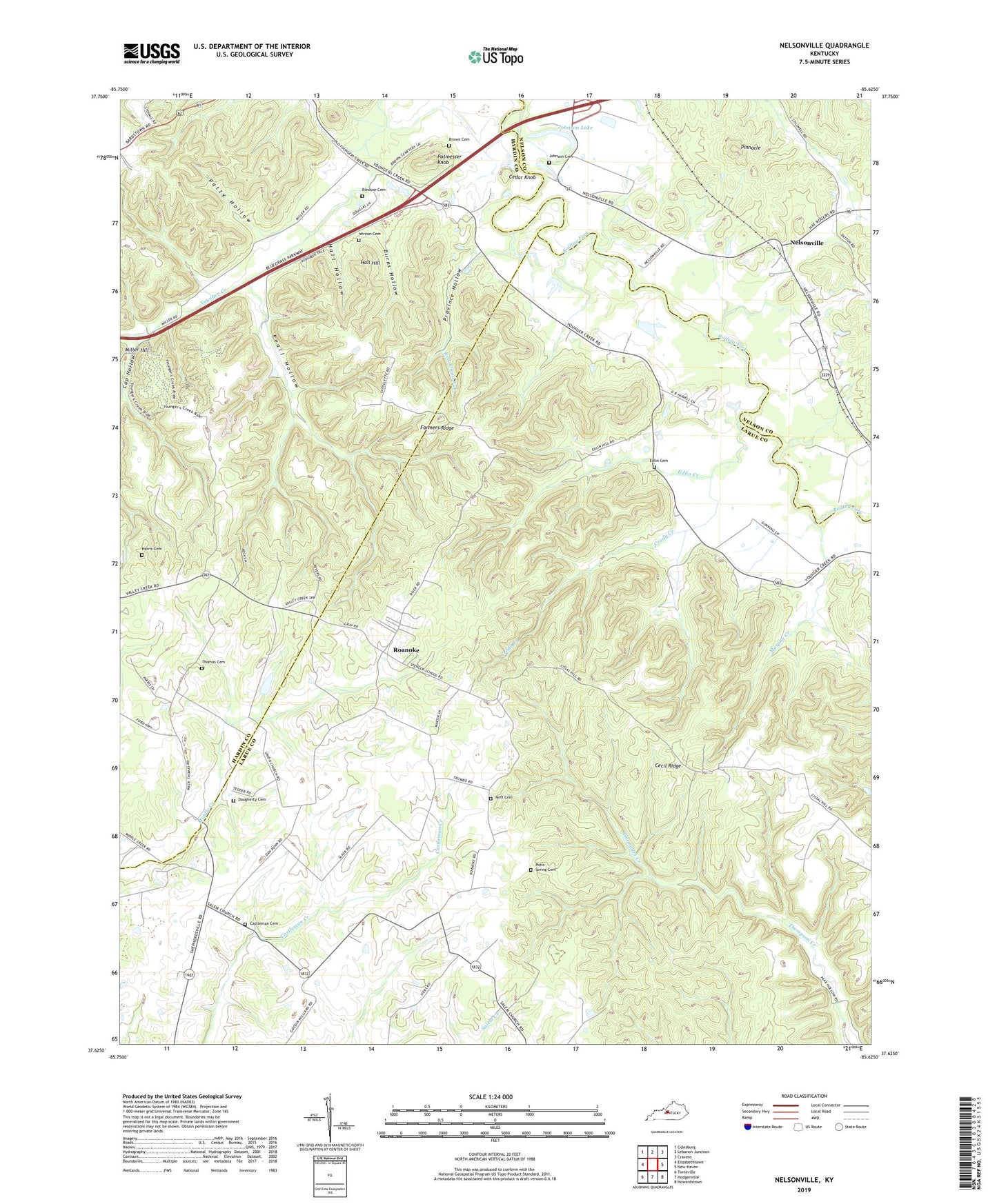
2022 topographic map quadrangle Nelsonville in the state of Kentucky. Scale: 1:24000. Based on the newly updated USGS 7.5' US Topo map series, this map is in the following counties: Larue, Hardin, Nelson. The map contains contour data, water features, and other items you are used to seeing on USGS maps, but also has updated roads and other features. This is the next generation of topographic maps. Printed on high-quality waterproof paper with UV fade-resistant inks.
Quads adjacent to this one:
West: Elizabethtown
Northwest: Colesburg
North: Lebanon Junction
Northeast: Cravens
East: New Haven
Southeast: Howardstown
South: Hodgenville
Southwest: Tonieville
This map covers the same area as the classic USGS quad with code o37085f6.
Contains the following named places: Bledsoe Cemetery, Broadhead Run, Brown Cemetery, Burns Hollow, Cap Hollow, Castleman Cemetery, Cecil Ridge, Cedar Knob, Crady Creek, Daugherty Cemetery, Edlin Cemetery, Edlin Creek, Farmers Ridge, Hall Hill, Hall Hollow, Harris Cemetery, Johnson Cemetery, Johnson Lake, Middle Creek Baptist Church, Murphy Creek, Neff Cemetery, Nelsonville, Patty Hollow, Pearl Hollow, Pinnacle, Potmesser Knob, Potts Spring Cemetery, Province Hollow, Roanoke, Salem Church, Thomas Family Cemetery, Union Christian Church, Vernon Cemetery, WKMO-FM (Hodgenville)